
CAT | Travel
14
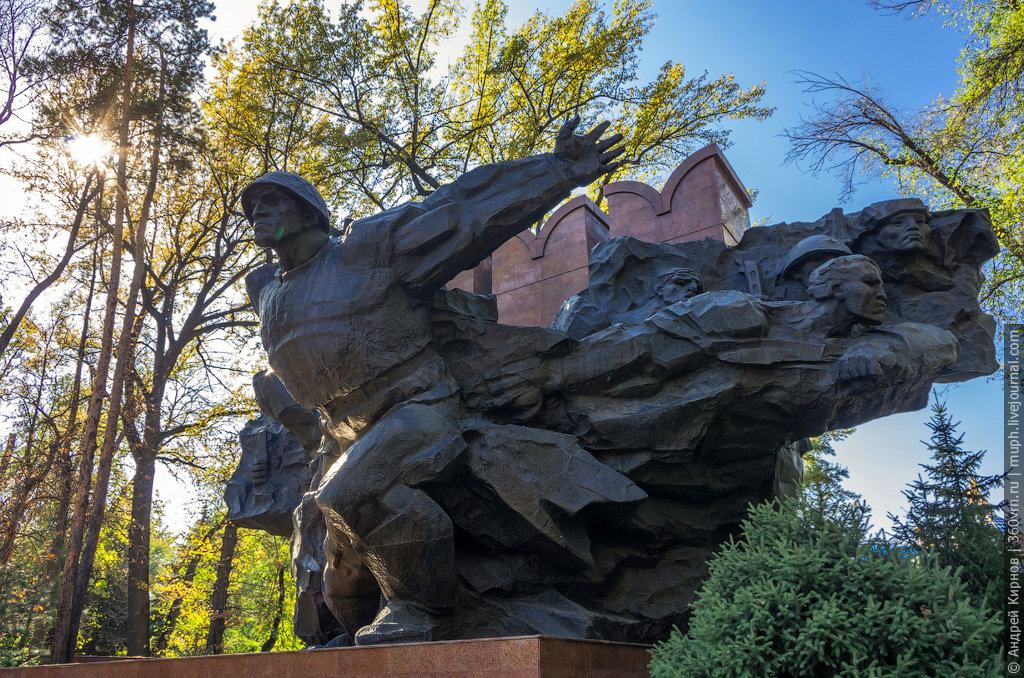
Park of 28 Panfilovtsev in Almaty
1 Comment · Posted by Sergei Rzhevsky in Cities, Entertainment, Travel
Park of 28 Panfilovtsev is a city park with an area of 18 hectares located in Medeu district of Almaty. Founded in the 1870s, this park in a complex with surrounding buildings is one of the most picturesque city-planning ensembles of Almaty.
The park is a monument of history, architecture and landscape art and is included in the Almaty State Historical, Architectural and Memorial Reserve. Park of 28 Panfilovtsev on Google Maps. Photos by: Andrey Kirnov.

Tags: Almaty city
22
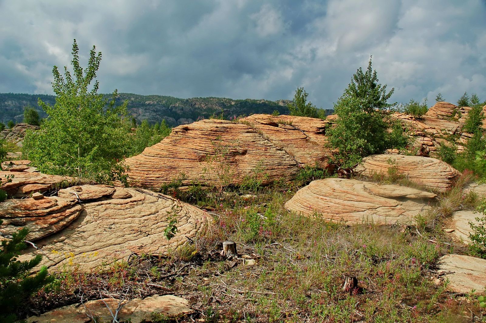
Picturesque Landscapes of the Karkaraly Mountains
No comments · Posted by Sergei Rzhevsky in Nature, Regions, Travel
Karkaraly Mountains are a mountain massif located in the Karaganda region of Kazakhstan, in the eastern part of the Kazakh Uplands. The Karkaraly massif consists of three mountain groups.
The mountains are relatively low and consist of granites, porphyrites, quartzites, and other rocks. The highest point of the massif is 1,403 meters. There are numerous lakes.
Tags: Karaganda oblast
2
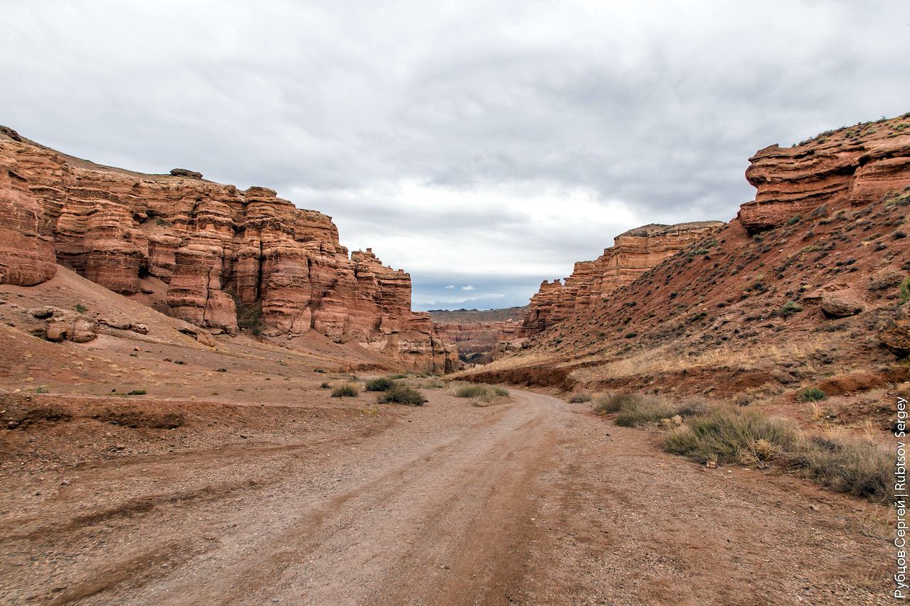
Charyn – the Grand Canyon of Kazakhstan
No comments · Posted by Sergei Rzhevsky in Nature, Photos, Travel
Charyn (Sharyn) Canyon, stretching for 154 km along the Charyn River, is located about 200 km east of Almaty, near the border with China, part of the Charyn National Park.
This picturesque natural monument consists of sedimentary rocks formed about 12 million years ago. The height of the rocks reaches 150-300 m. Charyn Canyon on Google Maps. Photos by: Sergey Rubtsov.
Tags: Almaty oblast
17
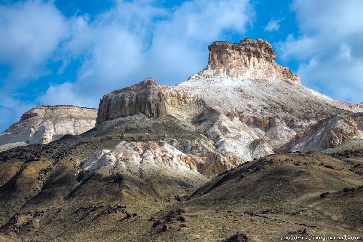
Picturesque Chalk Landscapes of Boszhira
No comments · Posted by Sergei Rzhevsky in Nature, Photos, Travel
The tract of Boszhira is located in the western part of the Ustyurt plateau on the Mangyshlak peninsula of the Mangistau region.
Boszhira occupies a large area, it takes more than one day to explore it. This place is gradually becoming more popular among tourists. There are no pre-laid routes, you can go wherever you want. Boszhira on Google Maps. Photos by: Vladimir Mulder.
amazing kingdom of chalk cliffs
Tags: Mangystau oblast
13
Late Autumn in the Southeast of Kazakhstan
No comments · Posted by Sergei Rzhevsky in Nature, Regions, Travel
The southeastern part of Kazakhstan, a vast area known as Semirechye (Zhetysu), belongs to the few regions of Kazakhstan with rich bioresources.
Seven large rivers flow into Lake Balkhash – hence the name to the region. The longest river is the Ili, which brings to Lake Balkhash about 70% of all incoming water. Semirechye on Google Maps. Photos by: Grigory Bedenko.
Lakes in the delta of the Ili River sometimes have a very bizarre shape.

Tags: Almaty oblast
16
Amazing Landscapes of Southern Kazakhstan
No comments · Posted by Sergei Rzhevsky in Nature, Regions, Travel
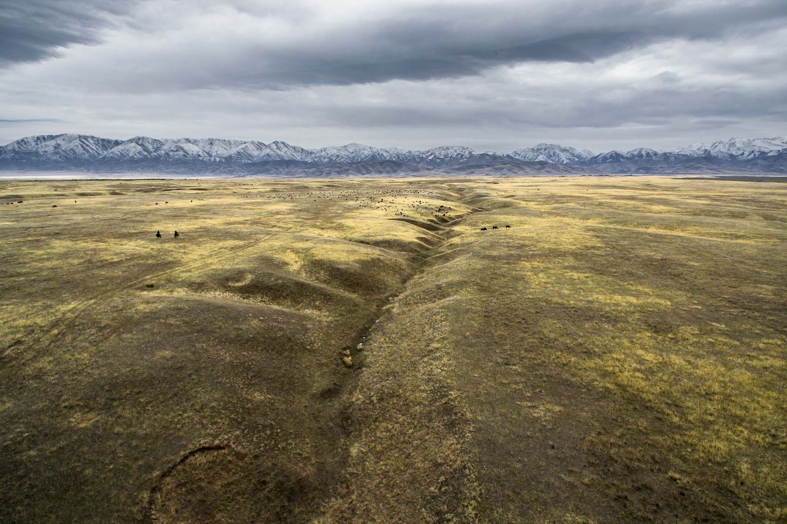
Southern Kazakhstan is the most densely populated part of the country. Here the largest cities of Kazakhstan, Almaty and Shymkent, are located.
The landscapes of Southern Kazakhstan are surprisingly diverse and represent a combination of arid, rather cold (in winter) and hot (in summer) sparsely populated steppes and deserts, snow-capped mountains, and densely populated foothills. Photos by: Dmitry Balakirev.
Famous boundless steppes of Kazakhstan – one of the symbols of the country.
Tags: Almaty oblast · South Kazakhstan oblast
24
Valley of Stone Balls on Mangyshlak Peninsula
No comments · Posted by Sergei Rzhevsky in Nature, Regions, Travel
Mangyshlak Peninsula is a peninsula on the eastern coast of the Caspian Sea in Kazakhstan. The Mangistau region is located on its territory.
One of the most interesting sights on the peninsula is the valley of stone balls called Torysh. There are several hypotheses of their origin, however the exact cause is still not known. The valley of balls on Google Maps. Photos by: Vladimir Mulder.
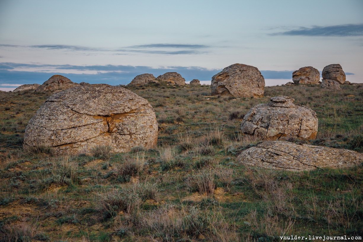
picturesque geological formations
Tags: Mangystau oblast
10
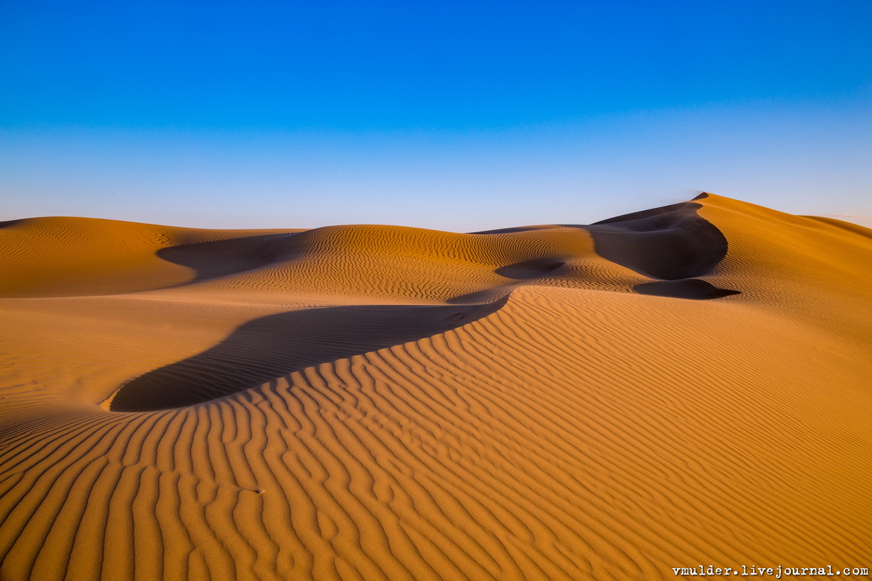
Senek Sands – a small desert in the Mangystau region
No comments · Posted by Sergei Rzhevsky in Nature, Regions, Travel
Senek is a village with a population of about 2,000 people located in the Karakiyansky district of the Mangystau region.
To the north-east of the village there is a sandy area named after the village – Senek Sands. Here you can see amazingly picturesque landscapes of a fairy tale desert. Senek Sands on Google Maps. Photos by: Vladimir Mulder.
Tags: Mangystau oblast
29
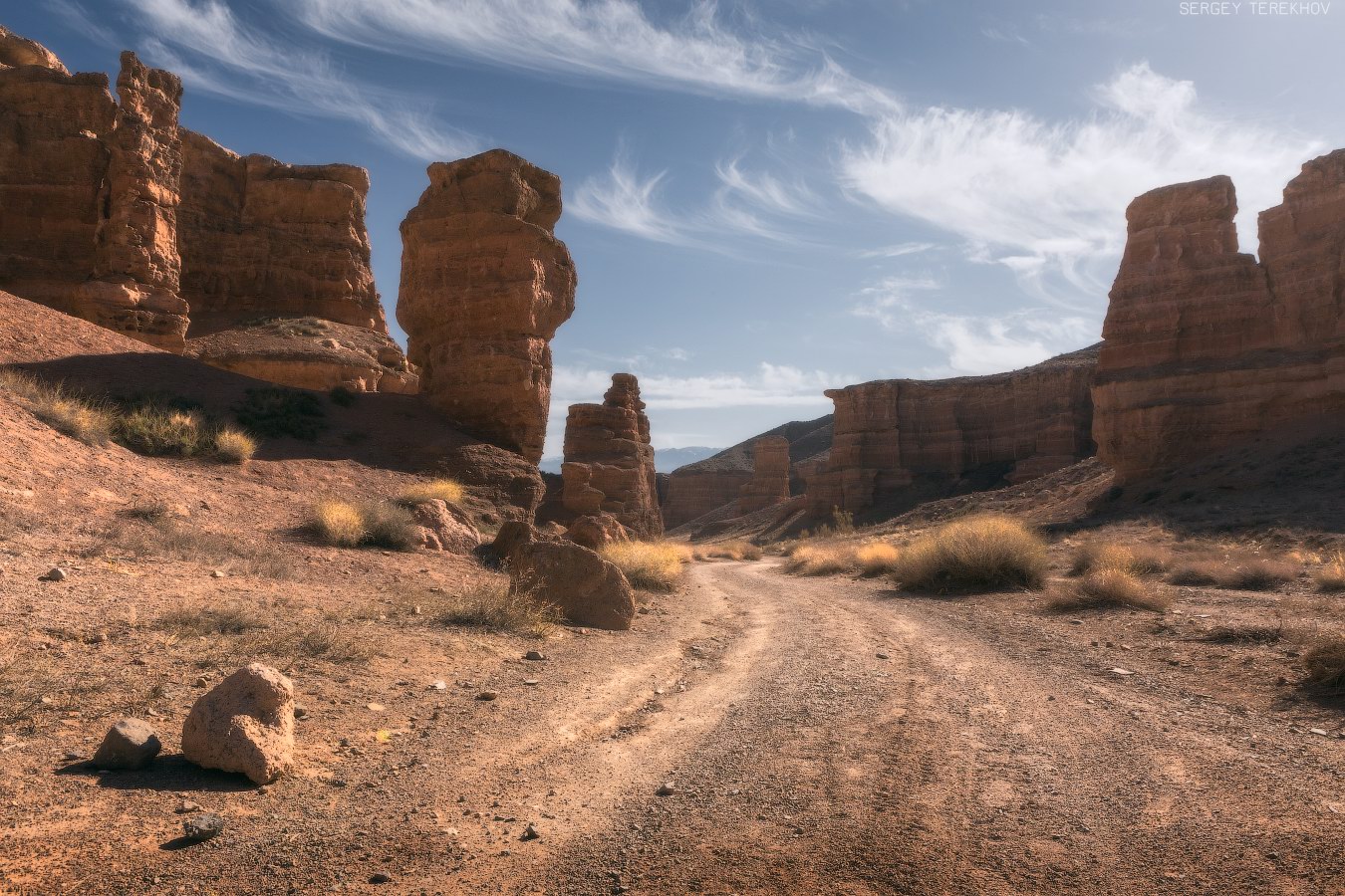
Valley of Castles in Charyn Canyon
No comments · Posted by Sergei Rzhevsky in Nature, Regions, Travel
Charyn Canyon (also known as Sharyn Canyon) stretches for 154 km along the Charyn River on the territory of the Charyn National Park, about 200 km east of Almaty, near the border with China.
It is a magnificent natural monument built of sedimentary rocks, which age is about 12 million years. The height of the steep slopes of the canyon reaches 150-300 m. Charyn Canyon on Google Maps. Photos by: Sergey Terekhov.
Tags: Almaty oblast
17
Picturesque landscapes of Bayanaul mountains
No comments · Posted by Sergei Rzhevsky in Nature, Regions, Travel
Bayanaul mountains are a mountain range located in the southwest of the Pavlodar region of Kazakhstan. The mountains stretch from west to east for 40-50 km, from north to south – for 20-25 km. The highest point, Mount Akbet, reaches 1,022 m above sea level.
Bayanaul State National Natural Park, one of the most protected natural areas of Kazakhstan, was created in this territory. Founded in 1985, it became the first national park in the country. Bayanaul mountains on Google Maps. Photos by: Zekkadrb.
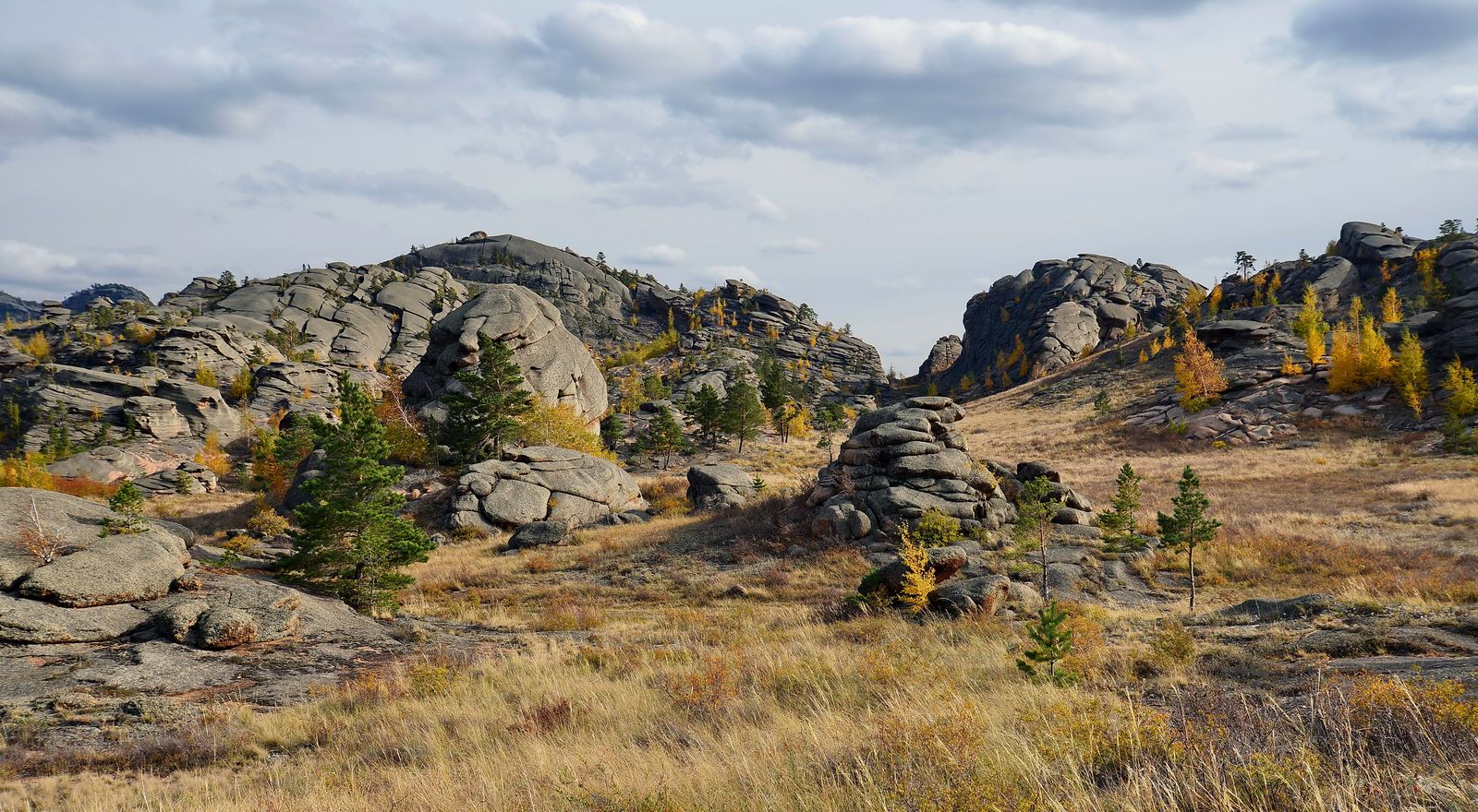
Tags: Pavlodar oblast
