
17
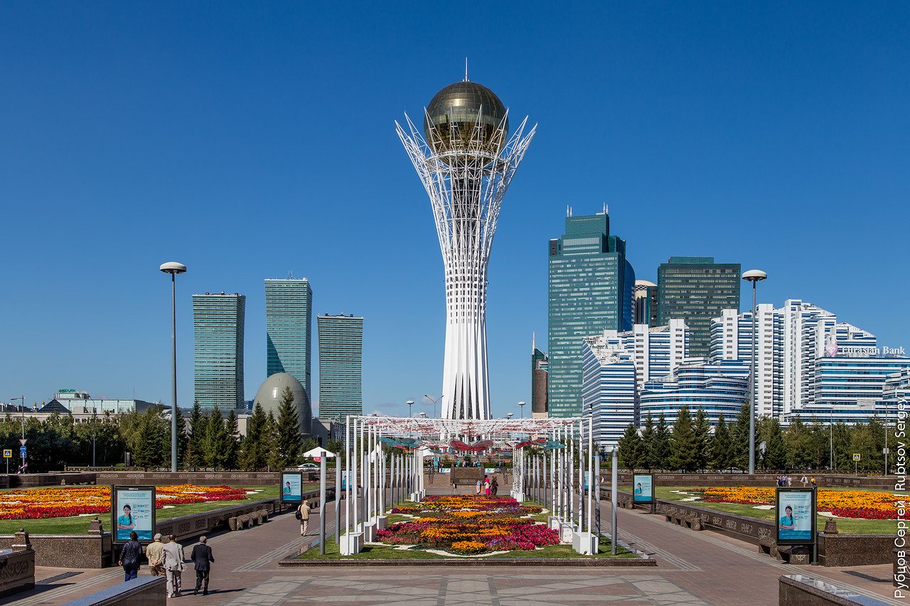
Walking through the center of Astana
No comments · Posted by Sergei Rzhevsky in Cities, Photos, Travel
Astana, meaning “capital” in Kazakh, is a city with a population of about 1 million people located in the north of Kazakhstan. It became the country’s capital in 1998.
Let’s take a walk in the city center during the days of Expo-2017 Astana – an international specialized exhibition held from June 10 to September 10, 2017. Photos by: Sergey Rubtsov.
Bayterek – a monument and observation tower crowned with a golden ball, one of the symbols of the new capital of Kazakhstan.
Tags: Astana city
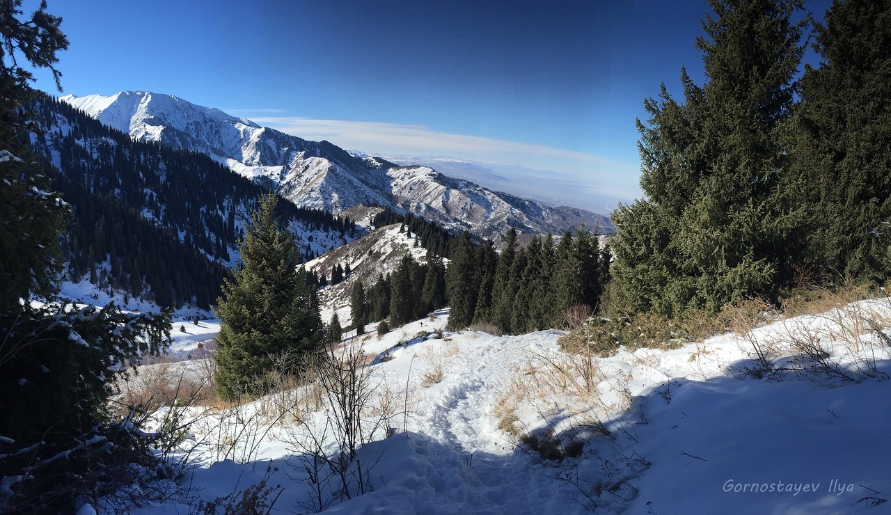
Trans-Ili Alatau is a mountain range in the northwest of the Tien Shan (on the border of Kazakhstan and Kyrgyzstan). Almaty, the former capital of Kazakhstan, is located in its northern foothills.
Due to this fact a range of various climbing trips is available even for amateurs of mountaineering. For example, let’s climb one of the most beautiful peaks of Trans-Ili Alatau – Peak Molodezhny (4,147 m). Peak Molodezhny on Google Maps. Photos by: Ilya Gornostayev.

Tags: Almaty oblast
27
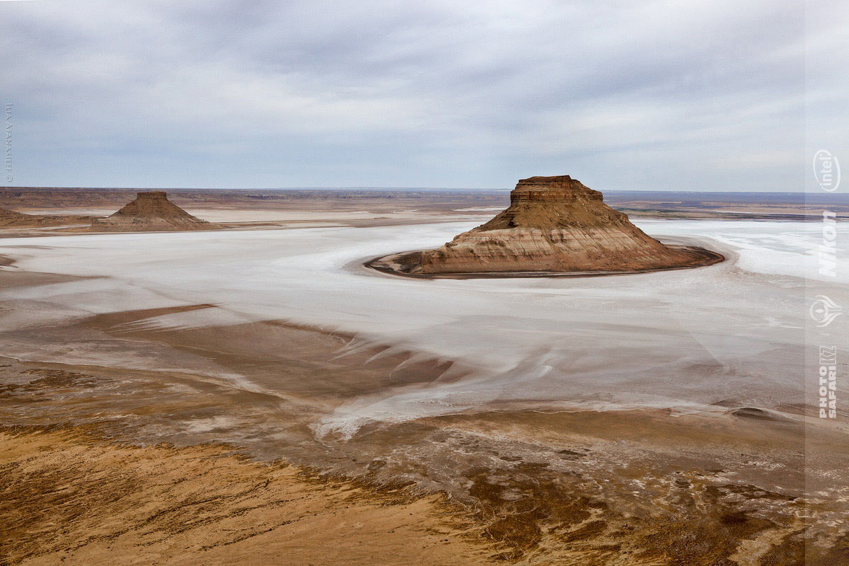
Karynzharyk Depression in the Mangystau Region
No comments · Posted by Sergei Rzhevsky in Nature, Regions, Travel
The Karynzharyk depression is located almost entirely in the territory of the Ustyurt State Nature Reserve in the southwestern part of the Mangystau region in Western Kazakhstan.
The distinctive feature of this area are the five remnant mountains, towering more than 150 meters in the midst of the salt plain. Three of them stand close to each other, locals call these mountains “Three Brothers”.
Tags: Mangystau oblast
27
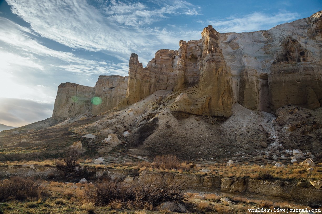
Picturesque Cliffs of Boszhira
No comments · Posted by Sergei Rzhevsky in Nature, Regions, Travel
Boszhira, a mountain range consisting of a variety of chalk cliffs, is located in the western part of the Ustyurt plateau on the Mangyshlak peninsula in the Mangystau region.
Boszhira, the former bottom of the sea, occupies a very large area and consists of cliffs of various bizarre forms, which appeared as a result of erosion. It takes more than one day to explore it. Boszhira on Google Maps. Photos by: Vladimir Mulder.
Tags: Mangystau oblast
Big Almaty Peak is a mountain 3,682 meters high located just 15 km from Almaty. The peak is perfectly visible in clear weather from almost anywhere in the city and looks like a huge pyramid. From the top of the mountain you can enjoy a beautiful view of Almaty.
East of the peak there is Big Almaty Lake. Big Almaty Peak on Google Maps. Photos by: Ilya Gornostayev.

Tags: Almaty city
30
Climbing Mount Furmanova near Almaty
No comments · Posted by Sergei Rzhevsky in Nature, Travel
Mount Furmanova is located in the vicinity of Almaty, at the end of the Kimasar Gorge. This is a popular place among the guests and residents of the city. Climbing it is available for beginners though it requires a certain level of physical fitness.
The height of the mountain is about 3,050 meters. If you walk from the Medeo rink, the distance to Mount Furmanova is 7.2 km. Mount Furmanova on Google Maps. Photos by: Ilya Gornostayev.
Tags: Almaty oblast
21
Amazing Landscapes of the Ustyurt Plateau
No comments · Posted by Sergei Rzhevsky in Nature, Regions, Travel
Ustyurt is a huge desert and a plateau with an area of more than 200,000 kilometers located in the west of Central Asia (in Kazakhstan (Mangystau oblast), Turkmenistan and Uzbekistan), between Mangyshlak and Kara-Bogaz-Gol in the west, the Aral Sea and the Amudarya delta in the east. Ustyurt National Preserve is located on this territory. The Ustyurt Plateau on Google Maps. Photos by: Vladimir Mulder.
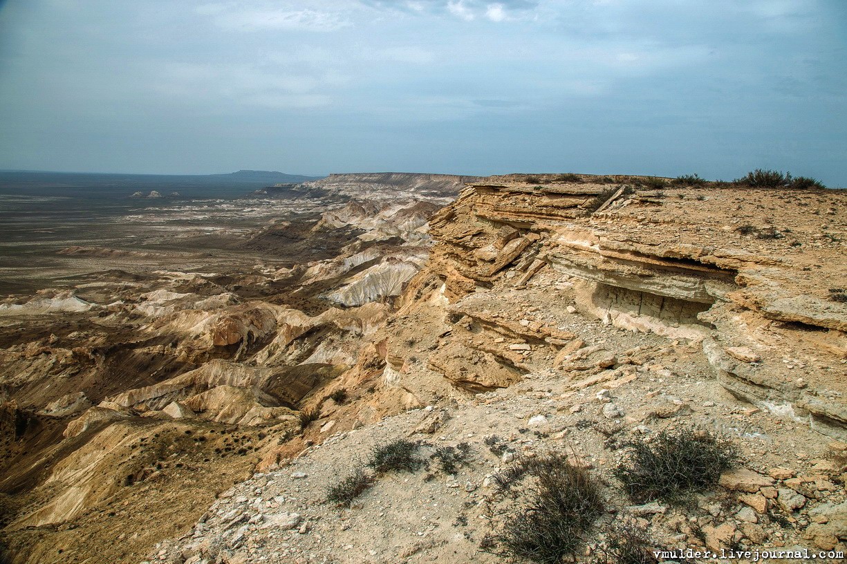
Tags: Mangystau oblast
11
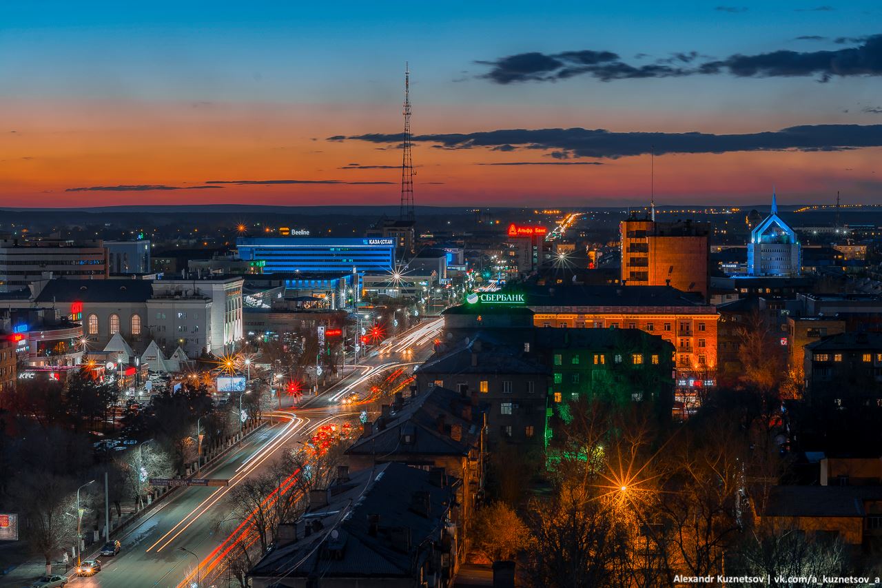
One Evening on the Roof in Karaganda
No comments · Posted by Sergei Rzhevsky in Cities, Photos, Travel
Karaganda is a city with a population of about half a million people, the capital of the Karaganda region of Kazakhstan.
Today, it is one of the largest industrial, economic, scientific, and cultural centers of the country. Let’s see how the center of Karaganda looks like in the evening. Photos by: Alexandr Kuznetsov.
Tags: Karaganda city
4
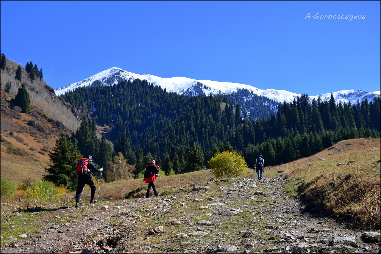
Hiking in Butakovskoe Gorge
No comments · Posted by Sergei Rzhevsky in Nature, Photos, Travel
The picturesque Butakovskoe gorge, located at an altitude of 1,700-2,900 meters above sea level in the mountains of Zailiysky Alatau, within the limits of Almaty, is a great place for hiking.
The total length of the gorge is 14 km. At the bottom of the gorge the Butakovka River flows, which is the right tributary of the Malaya Almatinka River. Butakovskoe gorge on Google Maps. Photos by: A. Gornostayeva and Ilya Gornostayev.
Tags: Almaty city
19
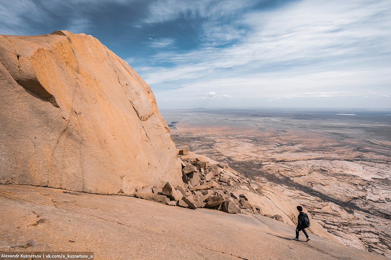
Climbing Mount Pik of Bektau-Ata
No comments · Posted by Sergei Rzhevsky in Nature, Regions, Travel
Bektau-Ata is a rock massif located 70 kilometers to the north of the town of Balkhash in the Karaganda region. This mountain area with an approximate height of 1,200 meters above sea level is known for numerous bizarre rocks, caves and small lakes.
Located in the middle of the Kazakh steppe, Bektau-Ata has its own unique flora. These photos were taken while climbing one of the peaks of Bektau-Ata – Mount Pik (1,214 meters). Bektau-Ata on Google Maps. Photos by: Alexandr Kuznetsov.
Tags: Karaganda oblast
