
TAG | Almaty oblast
17
Sunken Forest of Lake Kaindy
No comments · Posted by Sergei Rzhevsky in Nature, Regions, Travel
Kaindy is a 400 meters long lake located among coniferous forests at an altitude of 1,667 meters above sea level in the Almaty region of Kazakhstan, 284 km east of Almaty, a popular tourist destination.
Despite the low water temperature, Kaindy is very popular with diving enthusiasts. The main attraction of the lake is the remains of the spruce forest rising straight out of the water. Lake Kaindy on Google Maps. Photos by: Sergio.


Tags: Almaty oblast
2
Charyn – the Grand Canyon of Kazakhstan
No comments · Posted by Sergei Rzhevsky in Nature, Photos, Travel
Charyn (Sharyn) Canyon, stretching for 154 km along the Charyn River, is located about 200 km east of Almaty, near the border with China, part of the Charyn National Park.
This picturesque natural monument consists of sedimentary rocks formed about 12 million years ago. The height of the rocks reaches 150-300 m. Charyn Canyon on Google Maps. Photos by: Sergey Rubtsov.
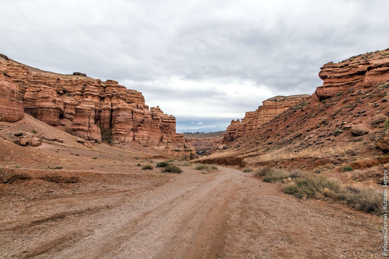
Tags: Almaty oblast
25
Tien-Shan Astronomical Observatory
No comments · Posted by Sergei Rzhevsky in Entertainment, Science, Technology
Tien-Shan Astronomical Observatory was founded in the mountains of Trans-Ili Alatau near Big Almay Lake, about 30 km south of Almaty, in 1957.
The height of the plateau on which this scientific object is located is 2,735 meters above sea level. Today, it is part of the National Center for Space Research and Technology of Kazakhstan.

Tags: Almaty oblast
13
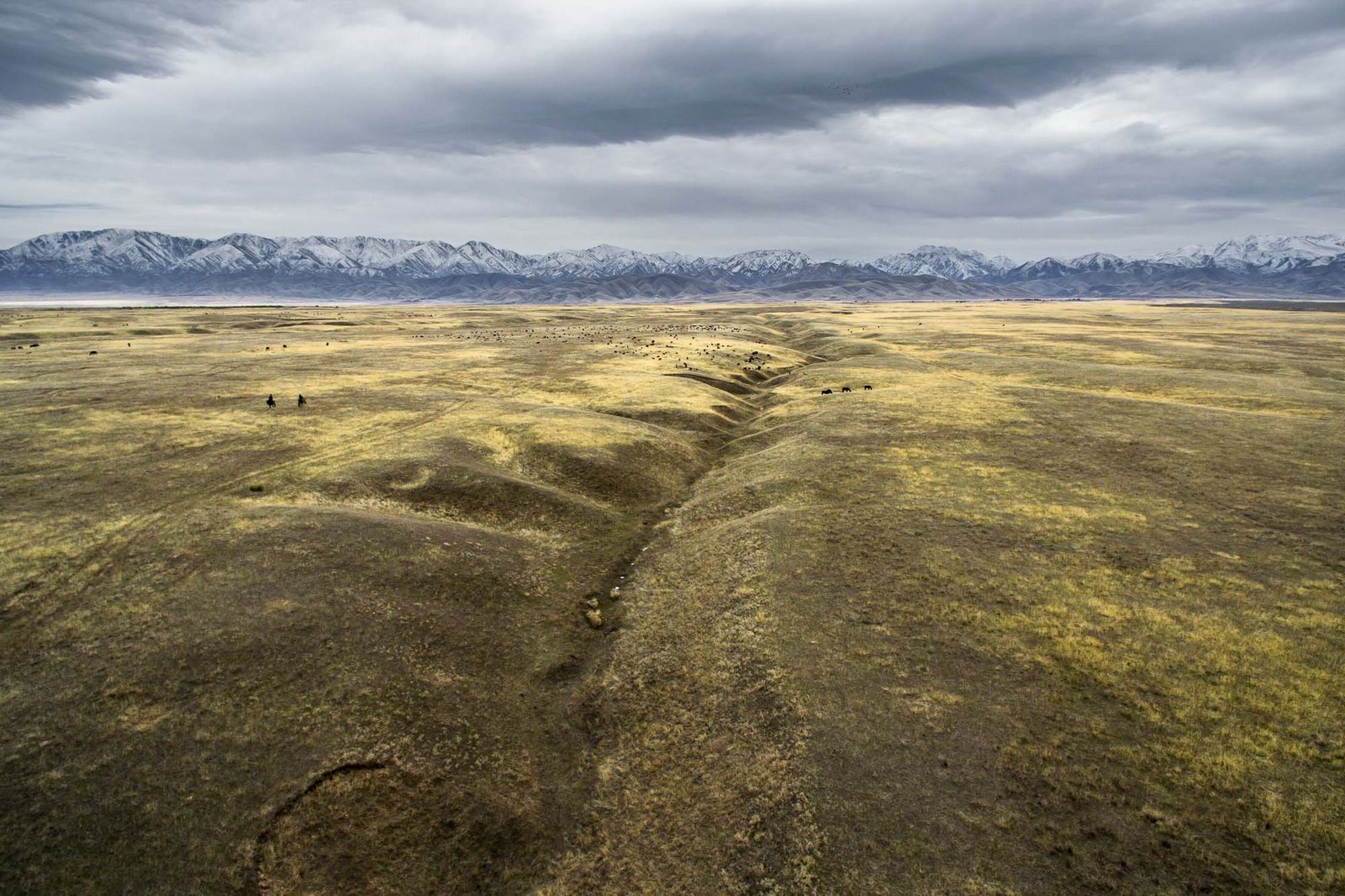
Late Autumn in the Southeast of Kazakhstan
No comments · Posted by Sergei Rzhevsky in Nature, Regions, Travel
The southeastern part of Kazakhstan, a vast area known as Semirechye (Zhetysu), belongs to the few regions of Kazakhstan with rich bioresources.
Seven large rivers flow into Lake Balkhash – hence the name to the region. The longest river is the Ili, which brings to Lake Balkhash about 70% of all incoming water. Semirechye on Google Maps. Photos by: Grigory Bedenko.
Lakes in the delta of the Ili River sometimes have a very bizarre shape.

Tags: Almaty oblast
16
Amazing Landscapes of Southern Kazakhstan
No comments · Posted by Sergei Rzhevsky in Nature, Regions, Travel
Southern Kazakhstan is the most densely populated part of the country. Here the largest cities of Kazakhstan, Almaty and Shymkent, are located.
The landscapes of Southern Kazakhstan are surprisingly diverse and represent a combination of arid, rather cold (in winter) and hot (in summer) sparsely populated steppes and deserts, snow-capped mountains, and densely populated foothills. Photos by: Dmitry Balakirev.
Famous boundless steppes of Kazakhstan – one of the symbols of the country.
Tags: Almaty oblast · South Kazakhstan oblast
29
Valley of Castles in Charyn Canyon
No comments · Posted by Sergei Rzhevsky in Nature, Regions, Travel
Charyn Canyon (also known as Sharyn Canyon) stretches for 154 km along the Charyn River on the territory of the Charyn National Park, about 200 km east of Almaty, near the border with China.
It is a magnificent natural monument built of sedimentary rocks, which age is about 12 million years. The height of the steep slopes of the canyon reaches 150-300 m. Charyn Canyon on Google Maps. Photos by: Sergey Terekhov.
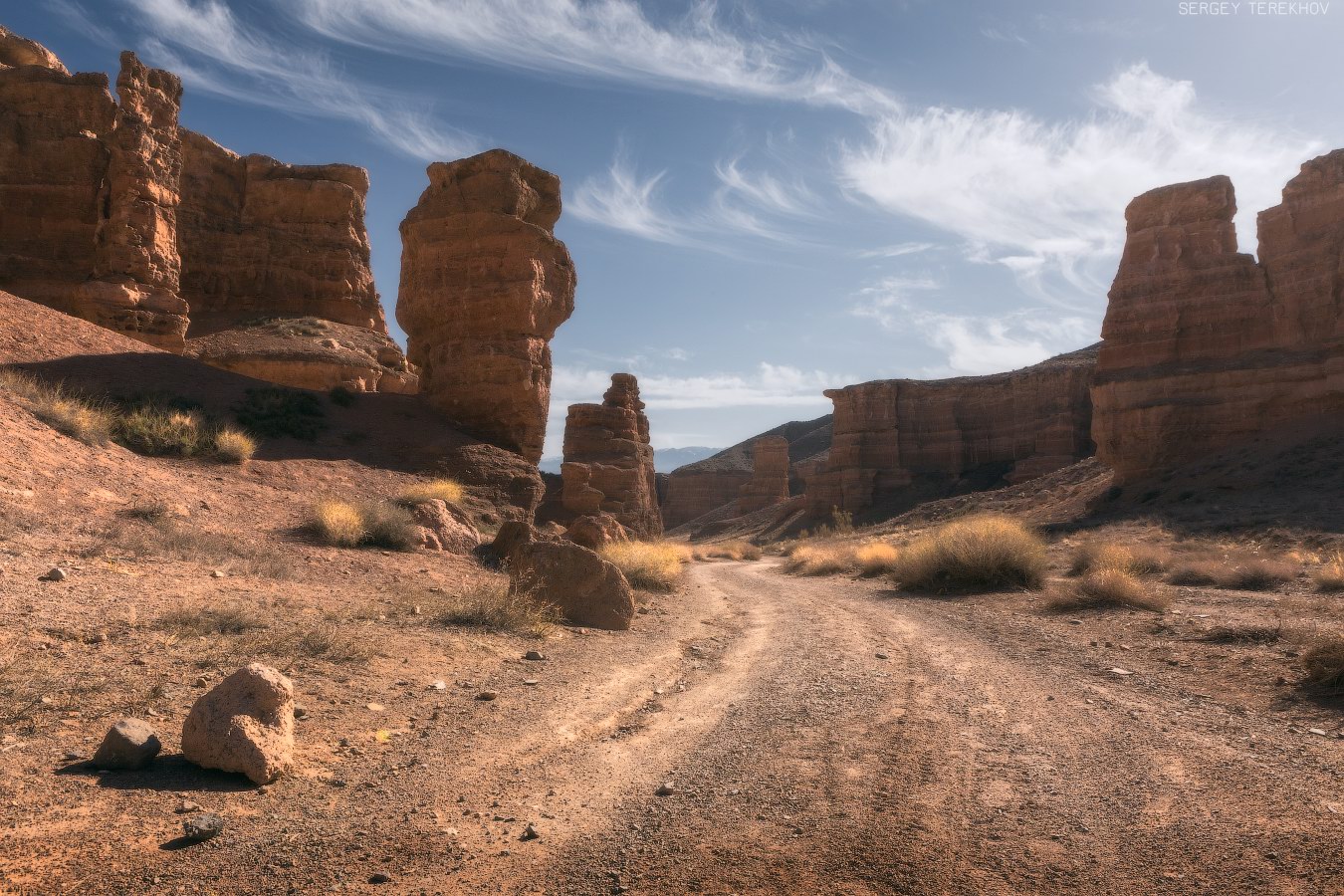
Tags: Almaty oblast
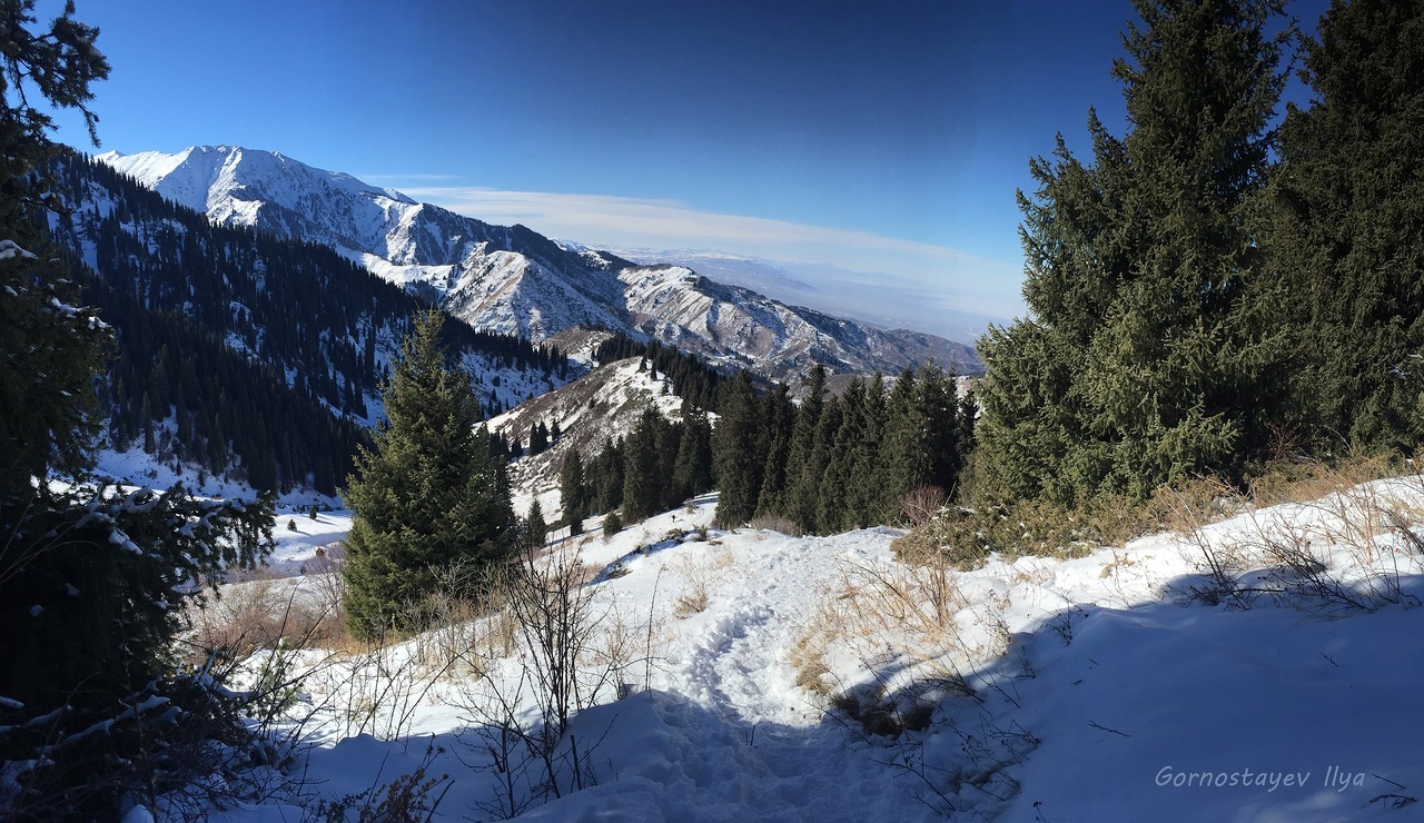
Trans-Ili Alatau is a mountain range in the northwest of the Tien Shan (on the border of Kazakhstan and Kyrgyzstan). Almaty, the former capital of Kazakhstan, is located in its northern foothills.
Due to this fact a range of various climbing trips is available even for amateurs of mountaineering. For example, let’s climb one of the most beautiful peaks of Trans-Ili Alatau – Peak Molodezhny (4,147 m). Peak Molodezhny on Google Maps. Photos by: Ilya Gornostayev.

Tags: Almaty oblast
30
Climbing Mount Furmanova near Almaty
No comments · Posted by Sergei Rzhevsky in Nature, Travel
Mount Furmanova is located in the vicinity of Almaty, at the end of the Kimasar Gorge. This is a popular place among the guests and residents of the city. Climbing it is available for beginners though it requires a certain level of physical fitness.
The height of the mountain is about 3,050 meters. If you walk from the Medeo rink, the distance to Mount Furmanova is 7.2 km. Mount Furmanova on Google Maps. Photos by: Ilya Gornostayev.
Tags: Almaty oblast
11
Singing Barkhan in the Altyn-Emel National Park
No comments · Posted by Sergei Rzhevsky in Nature, Regions, Travel
The so-called “singing barkhan”, consisting of sand of light tones, has a length of up to 3 km and a height of 150 m. It is located in the Altyn-Emel National Park in the Almaty region, 182 km north-east of Almaty.
This monument of nature is famous for the fact that in dry weather the sands emit sounds similar to the melody of the organ. Singing Barkhan on Google Maps. Photos by: Sergey Terekhov.
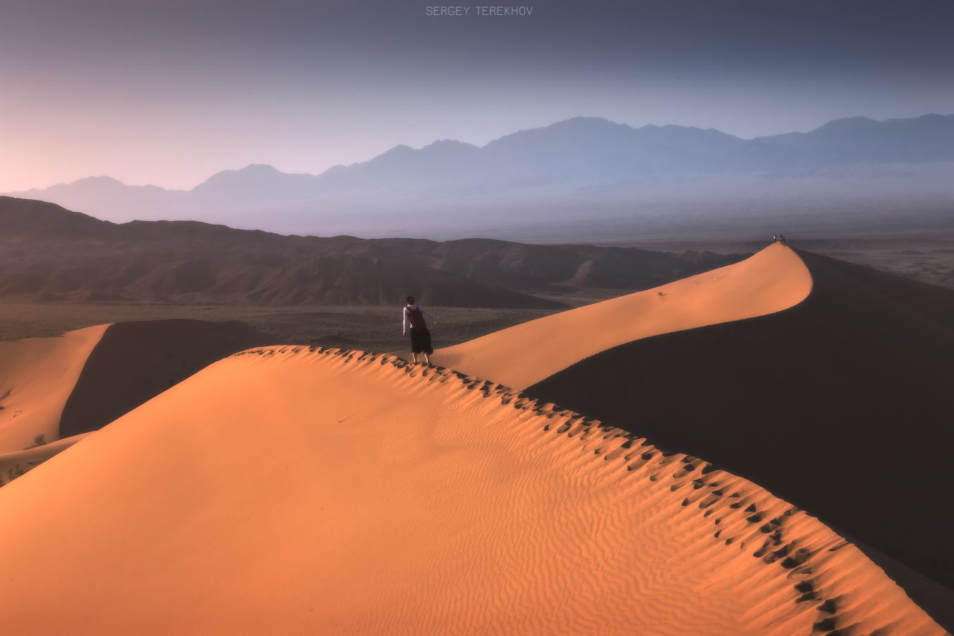
Tags: Almaty oblast
12
Ancient Petroglyphs of Bayan-Zhurek
No comments · Posted by Sergei Rzhevsky in Art, History
Between the ridges of Bayan-Zhurek and the Dzungarian Alatau, in the Almaty region, there is a wide valley of Kaskarau. Its beginning lies at the foot of the Dzungarian Alatau, at an altitude of 1,800-1,900 meters above sea level.
In the valley, a significant number of monuments of archeology of different epochs have been found, including ancient petroglyphs – carved or painted images on stones. Photos by: Sergey Terekhov.

Tags: Almaty oblast
