Pavlodar oblast overview
Pavlodar oblast (also spelled Pavlodarskaya) of northern Kazakhstan is situated along the middle course of Irtysh River on the southern edge of West Siberian Plain. Pavlodar region lands consist mainly of flat steppe, which turns into semi desert in the southwest.
The capital city of the region is Pavlodar. The region origin of name: Russian “For gift of Paul”.
Pavlodar oblast population is about 748,000 (2009); land area - 124,800 sq. km.
Pavlodar oblast history
First expeditions to current Pavlodar oblast territory close to Irtysh River were made immediately after Russian state power established in Siberia and Tobolskaya gubernia was formed. First there was a military post Koryakovsky - it was constructed on the Irtysh bank in 1720.
In 1861 the settlement was reformed into the town of Pavlodar. In the second half of 19th century coal was extracted in Ekibastuz as well as salt at the lakes Koryakovskoye and Bolshoi Kalmakan.
In the second half of 20th century the railway was built and navigation started on the Irtysh. Pavlodar became an oblast center in 1938, and being located at the crossroads of navigable Irtysh and the railway it received reliable connection with Ekibastuz, Ural and Siberia. This fact favored further development of the city and the oblast.
Since 1956 Pavlodar became one of the centers of virgin lands cultivating. As a result arable lands grew dozens much. Coal extraction and cultivated lands greatly promoted development of Pavlodarskaya oblast. Power engineering base was formed on the basis of cheap coal from Ekibastuz and new branches of industry began developing, such as ferrous and non-ferrous metallurgy, machine-building, aluminum, oil-processing and chemical industries.
Pavlodar oblast views

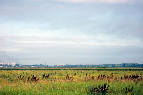
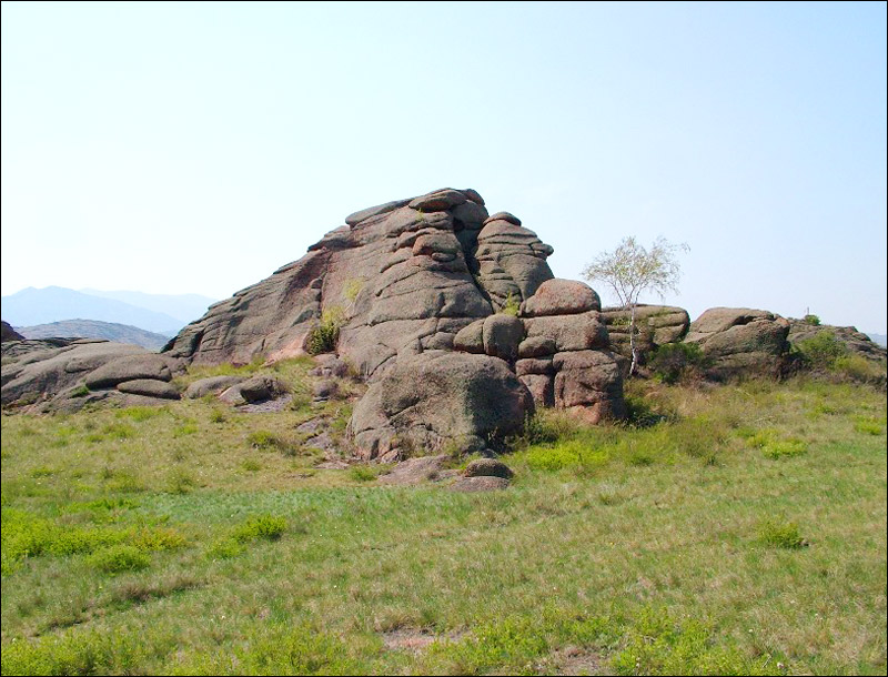
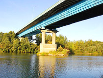
Pavlodar oblast nature view
Author: Sergey Sharpilo
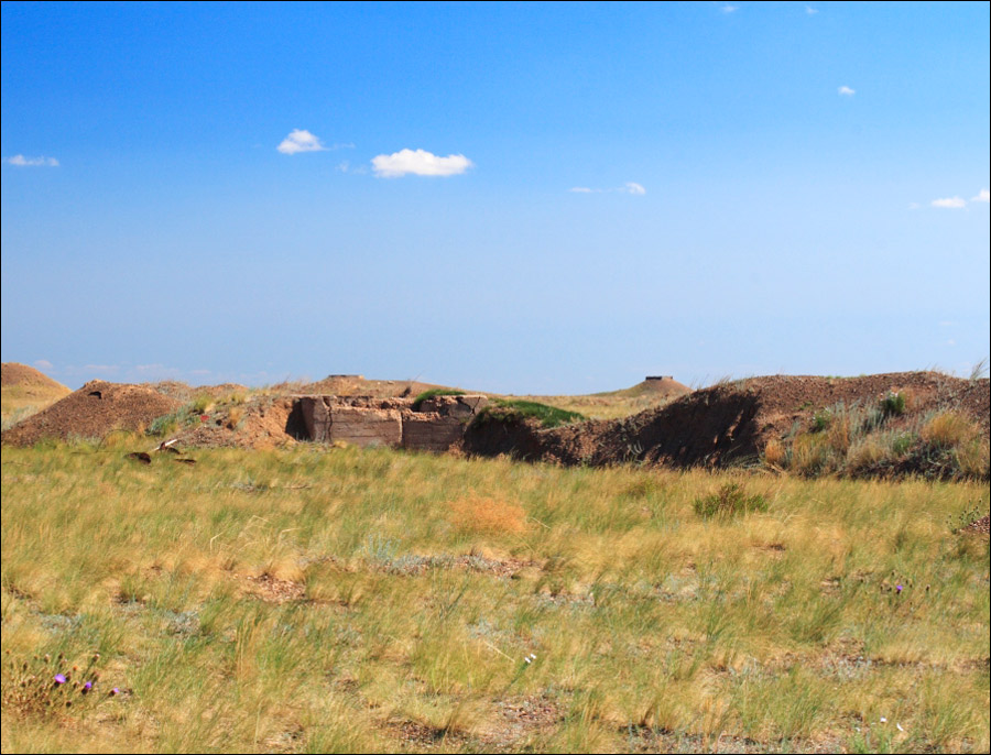
Pavlodar oblast, Kazakhstan view
Author: Filileev S.V.
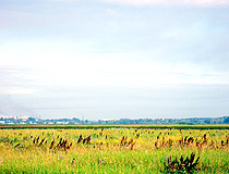
Pavlodar oblast view
Author: D.Filushin
Pavlodar oblast features
Most part of Pavlodar oblast is occupied with steppe plains. One of the most beautiful places in Kazakhstan Republic - Bayanaul - is located on the territory of the oblast. Mountainous regions, pine tree forests, lakes Zhasybai, Toraigyr, Sabyndykol are among main tourist sites. In the north of the oblast there is the largest recreation area visited by tourists from all over Kazakhstan and Russia.
The climate in Pavlodar oblast is of sharp continental type characterized by long cold winters (5,5 months) and short hot summers (3 months).
In 2001 nearly 70 percent of the population of Pavlodar oblast was urban. The most numerous nationalities of Pavlodar region are Russians, Kazakhs, Ukrainians, and Germans.
Pavlodar oblast pictures
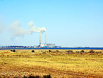
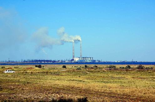
Pavlodar oblast industry view
Author: Utkin Mikhail
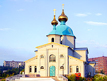
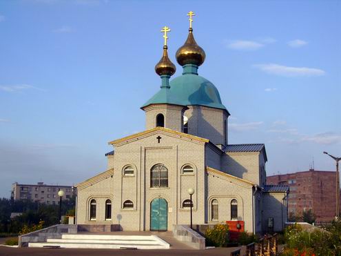
Pavlodar oblast, Kazakhstan church
Author: Puzanov Kirill
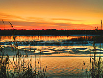
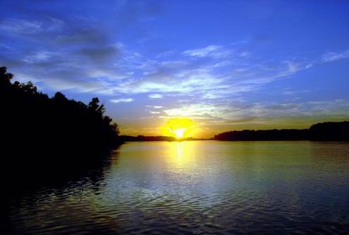
Pavlodar oblast sunset
Author: Konstantin Martalog
Pavlodar oblast economics
Pavlodar oblast is one of the main industrial regions in Kazakhstan. Large industrial companies determine the industrial potential of the region. They produce coal, power energy, alumina, ferroalloys. About 7% of all industrial production of Kazakhstan belongs to Pavlodar oblast as well as 70% of coal, 75% of ferroalloys, about 40% of power energy and oil product.
Over 33% of all coal deposits in Kazakhstan are located in Pavlodar oblast. Ekibastuz and Maikuben deposits are the largest of them. They contain 10,5 and 2,2 billions tons of energy supply sources correspondingly. Most of these deposits are specific as coal is located not deep, sometimes its layers are seen on ground surface.
Pavlodar city, the capital, and Ekibastuz form a rapidly growing industrial complex based on power generated from the large, though low-grade, Ekibastuz coal deposits.
There is also gold mining industry at Maykain and salt production from the salt lakes. Bozshakol is the site of major copper deposit.
Pavlodar oblast is a complicated transportation juncture: it’s there where the largest inner oil pipeline starts (to Shymkent city) as well as the canal Irtysh-Karaganda-Zhezkazgan and railways to Russia, to the center and the south of Kazakhstan. There is navigation on Irtysh river.
Irtysh-Karaganda canal is unique. The canal is 500 km long and water from the Irtysh flows this distance upwards to the mountains, getting over watersheds 500 m high equipped with 22 pumping stations. Without this canal neither coal extraction in Ekibastuz nor black metallurgy developing in Karaganda would be possible. Irtysh-Karaganda Canal starts near the new town of Yermak (founded 1961), the site of a large power station and a ferro-alloying plant.
Wheat is the main cereal produced in Pavlodar oblast on a half of all the fields. On 15-17% of fields other cereals are grown. Besides, potatoes, vegetables, water-melon and melons are also grown. Sheep and cattle also are raised.