7
Amazing Landscapes of the Valley of Kiin Kirish
No comments · Posted by Sergei Rzhevsky in Nature, Regions, Travel
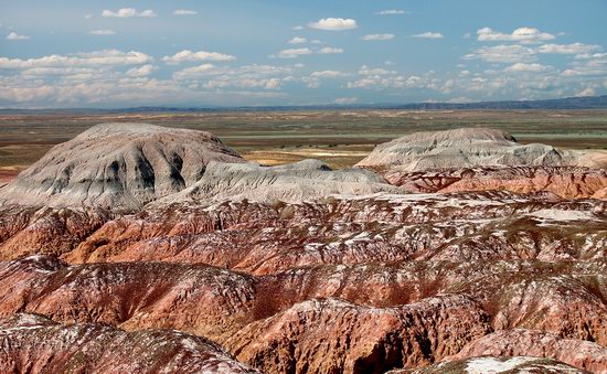
Kiin Kirish, an amazingly picturesque clay canyon, is a unique natural monument located 120 km southeast of the town of Kurshim in the East Kazakhstan region and covers an area of 300 hectares.
This place is also known as “The Town of Spirits”. Multicolored clays, eroded by water and wind, form vivid, bizarre landscapes here. The optimal time for a trip is 3-4 days. Kiin Kirish on Google Maps. Photos by: Sergey Silantjev.
Tags: East Kazakhstan oblast · Ust-Kamenogorsk city
4
Hiking in Gorelnik Gorge in the vicinity of Almaty
No comments · Posted by Sergei Rzhevsky in Nature, Regions, Travel
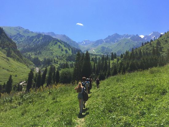
Gorelnik Gorge is one of the most picturesque and easily accessible places located in the mountains near Almaty. It is very suitable for one-day mountain hikes.
To get there you should go to the Medeu ice rink, then climb to the dam, and go about 1.5 km further along the road towards Shymbulak, turn right, and behind the hunter’s house there is an entrance into the gorge. Gorelnik Gorge on Google Maps. Photos by: Ilya Gornostayev.
Tags: Almaty oblast
17
Sunken Forest of Lake Kaindy
No comments · Posted by Sergei Rzhevsky in Nature, Regions, Travel
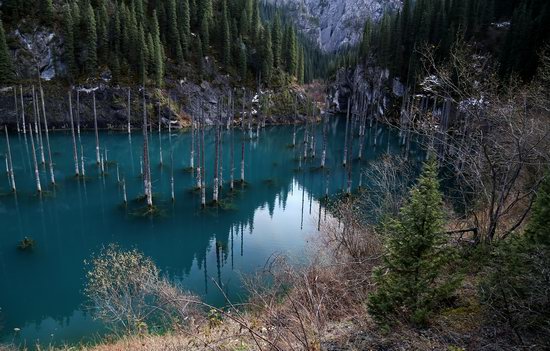
Kaindy is a 400 meters long lake located among coniferous forests at an altitude of 1,667 meters above sea level in the Almaty region of Kazakhstan, 284 km east of Almaty, a popular tourist destination.
Despite the low water temperature, Kaindy is very popular with diving enthusiasts. The main attraction of the lake is the remains of the spruce forest rising straight out of the water. Lake Kaindy on Google Maps. Photos by: Sergio.
Tags: Almaty oblast
14
Park of 28 Panfilovtsev in Almaty
1 Comment · Posted by Sergei Rzhevsky in Cities, Entertainment, Travel
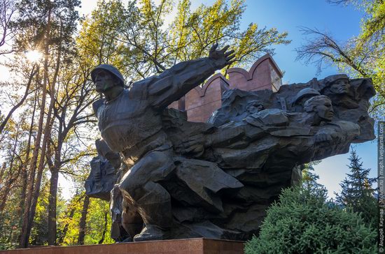
Park of 28 Panfilovtsev is a city park with an area of 18 hectares located in Medeu district of Almaty. Founded in the 1870s, this park in a complex with surrounding buildings is one of the most picturesque city-planning ensembles of Almaty.
The park is a monument of history, architecture and landscape art and is included in the Almaty State Historical, Architectural and Memorial Reserve. Park of 28 Panfilovtsev on Google Maps. Photos by: Andrey Kirnov.
Tags: Almaty city
1
Rock Formations of the Western-Altai Reserve
No comments · Posted by Sergei Rzhevsky in Nature, Regions
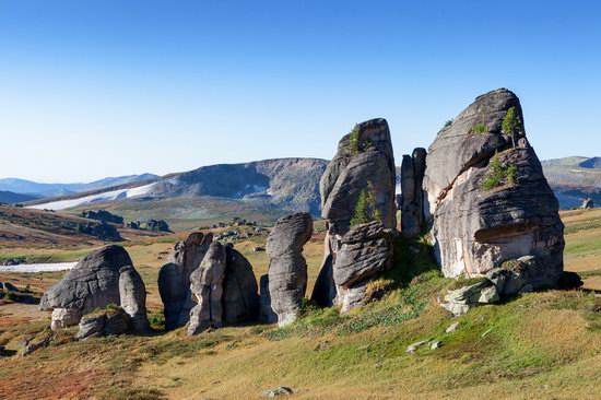
The Western-Altai State Nature Reserve was established with the goal of comprehensive protection of the Altai mountain system in 1992. It covers an area of about 56 thousand hectares at the northeastern border of the East Kazakhstan region, 60 km east of the city of Ridder.
This territory has a complex geological history. Here you can see picturesque rock formations – geological monuments of the distant past. The Western-Altai Reserve on Google Maps. Photos by: Ilya Afanasyev.
Tags: East Kazakhstan oblast · Ridder city
15
Rocky Scenery of the Arkat Mountains
No comments · Posted by Sergei Rzhevsky in Nature, Photos, Regions
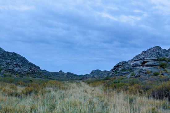
The Arkat Mountains are located in the central part of the East Kazakhstan region, in the area of the settlement of Arkat.
The mountains are very old and almost completely destroyed by erosion except for separately standing rocks. However, despite this, the local landscapes are very picturesque and attract people who prefer active rest. The Arkat Mountains on Google Maps. Photos by: Ilya Afanasyev.
Tags: East Kazakhstan oblast
22
Picturesque Landscapes of the Karkaraly Mountains
No comments · Posted by Sergei Rzhevsky in Nature, Regions, Travel
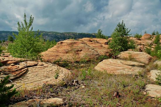
Karkaraly Mountains are a mountain massif located in the Karaganda region of Kazakhstan, in the eastern part of the Kazakh Uplands. The Karkaraly massif consists of three mountain groups.
The mountains are relatively low and consist of granites, porphyrites, quartzites, and other rocks. The highest point of the massif is 1,403 meters. There are numerous lakes.
Tags: Karaganda oblast
2
Charyn – the Grand Canyon of Kazakhstan
No comments · Posted by Sergei Rzhevsky in Nature, Photos, Travel
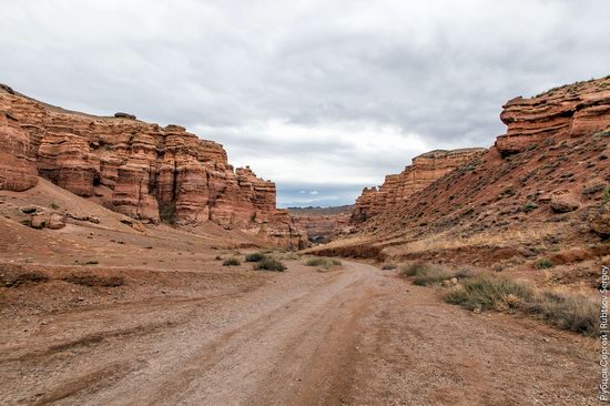
Charyn (Sharyn) Canyon, stretching for 154 km along the Charyn River, is located about 200 km east of Almaty, near the border with China, part of the Charyn National Park.
This picturesque natural monument consists of sedimentary rocks formed about 12 million years ago. The height of the rocks reaches 150-300 m. Charyn Canyon on Google Maps. Photos by: Sergey Rubtsov.
Tags: Almaty oblast
17
Picturesque Chalk Landscapes of Boszhira
No comments · Posted by Sergei Rzhevsky in Nature, Photos, Travel
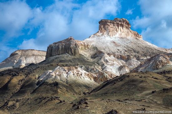
The tract of Boszhira is located in the western part of the Ustyurt plateau on the Mangyshlak peninsula of the Mangistau region.
Boszhira occupies a large area, it takes more than one day to explore it. This place is gradually becoming more popular among tourists. There are no pre-laid routes, you can go wherever you want. Boszhira on Google Maps. Photos by: Vladimir Mulder.
amazing kingdom of chalk cliffs
Tags: Mangystau oblast
25
Tien-Shan Astronomical Observatory
No comments · Posted by Sergei Rzhevsky in Entertainment, Science, Technology
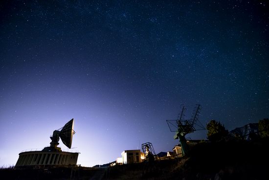
Tien-Shan Astronomical Observatory was founded in the mountains of Trans-Ili Alatau near Big Almay Lake, about 30 km south of Almaty, in 1957.
The height of the plateau on which this scientific object is located is 2,735 meters above sea level. Today, it is part of the National Center for Space Research and Technology of Kazakhstan.
Tags: Almaty oblast
