
TAG | Almaty oblast
7
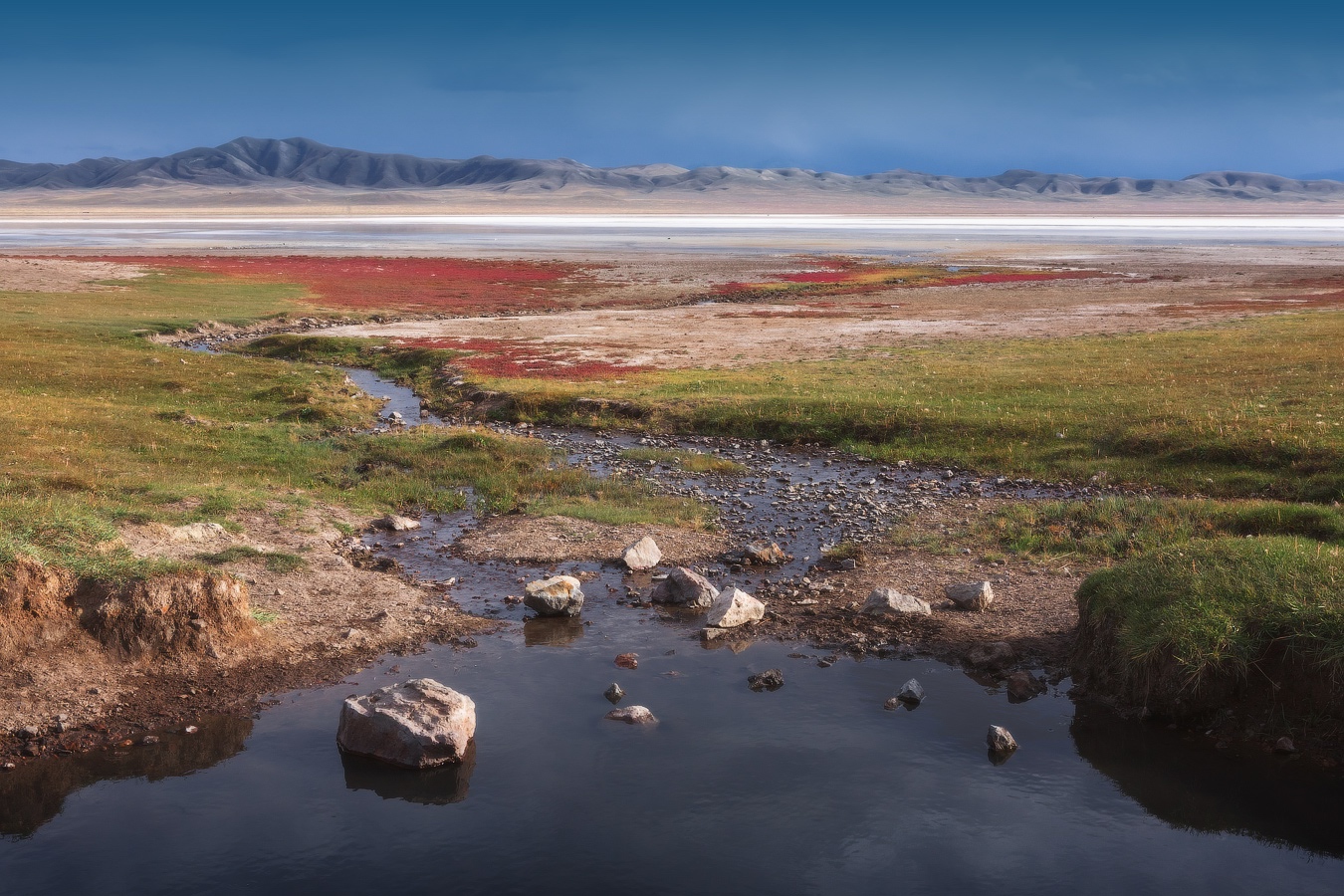
The Unearthly Landscapes of Lake Tuzkol
No comments · Posted by Sergei Rzhevsky in Nature, Photos, Travel
Lake Tuzkol, located in the south-east of Almaty Oblast at an altitude of 1,959 m above sea level, is the saltiest mountain lake in Kazakhstan. The lake is quite large, 5.5 km long and up to 2 km wide in some places, but it’s shallow, only 3 meters deep. Its shores are low and gently sloping.
The salinity of the water varies depending on the season and can reach values comparable to the salinity of the water of the Dead Sea in Israel or the Great Salt Lake in the USA. Translated from the Kazakh language, “tuzkol” means “salt lake”.

Tags: Almaty oblast · landscapes
11
Summer in the Dzungarian Alatau
No comments · Posted by Sergei Rzhevsky in Nature, Photos, Regions
The Dzungarian Alatau is a mountain range located on the border of Jetisu Oblast, a region in the southeast of Kazakhstan, formed in June 2022 by separating it from Almaty Oblast, and the Xinjiang Uygur Autonomous Region of China, between the Ili River and Lake Alakol.
The mountains are named for the nearby desert. The length of this picturesque range is about 450 km, the width varies from 50 to 90 km, the height – up to 4,622 m (Semenov-Tian-Shansky Peak). The Dzungarian Alatau on Google Maps. Photos by: Grigory Bedenko.

Tags: Almaty oblast
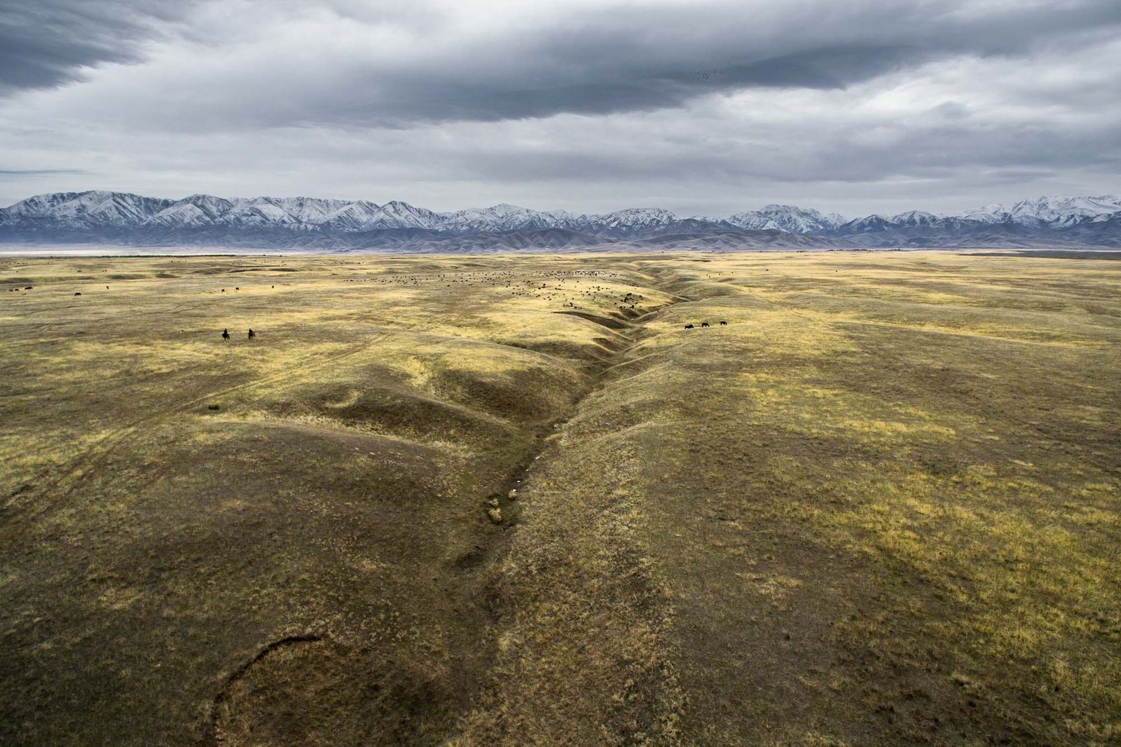
Between the ridges of Bayan-Zhurek and the Dzungarian Alatau, in Almaty Oblast, there is a wide valley of Kaskarau. Its beginning lies at the foot of the Dzungarian Alatau, at an altitude of 1,800-1,900 meters above sea level.
In the valley, a significant number of monuments of archeology of different epochs have been found, including ancient petroglyphs – carved or painted images on stones. Photos by: Sergey Terekhov.

Tags: Almaty oblast
27
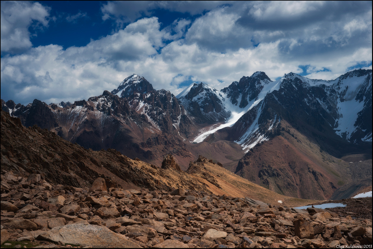
The Mountain Kingdom of Trans-Ili Alatau
No comments · Posted by Sergei Rzhevsky in Nature, Travel
If you decide to climb Titov Peak (3,850 m) in the Trans-Ili Alatau (Almaty Oblast), you will see this amazing mountain scenery.
Trans-Ili Alatau mountain range is located in the northwest of the Tien Shan, on the border of Kazakhstan and Kyrgyzstan. Titov Peak on Google Maps. Photos by: Olga Kulakova.
Tags: Almaty oblast
10
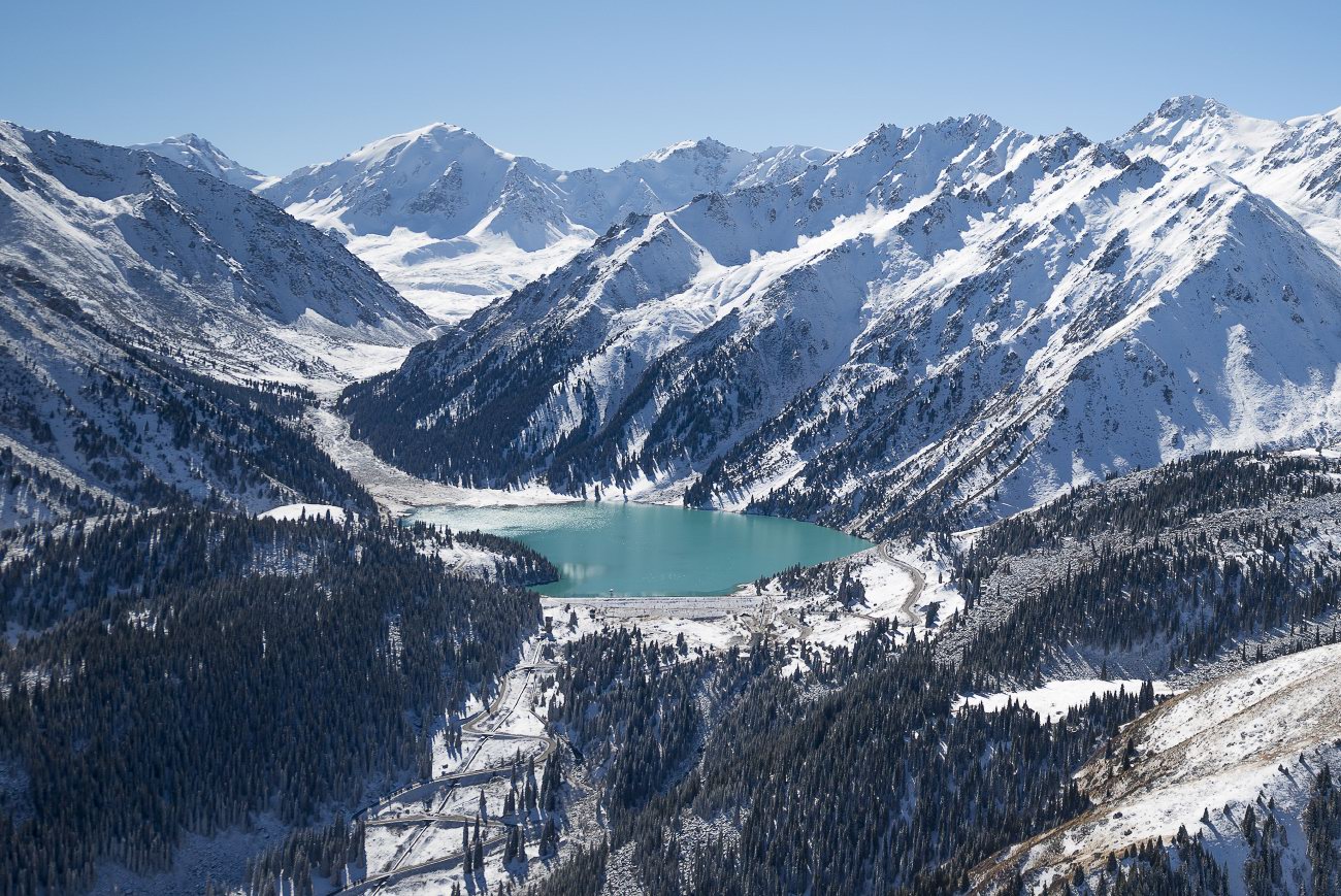
Magnificent Landscapes of the Northern Tian Shan
No comments · Posted by Sergei Rzhevsky in Nature, Photos, Regions
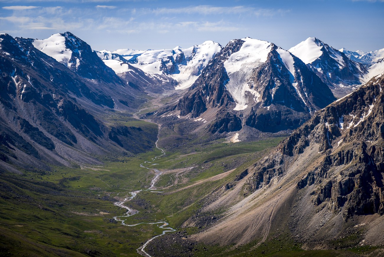
The Tian Shan is a mountain system located in Central Asia in the territory of five countries: Kyrgyzstan, Kazakhstan, China (Xinjiang Uygur Autonomous Region), Tajikistan, and Uzbekistan. It is one of the highest mountain systems in the world with more than thirty peaks over 6,000 meters high.
Let’s look at the landscapes of the northern part of the Tien Shan located in Kazakhstan, near Almaty. The mountains of the Northern Tian Shan are the most visited in Kazakhstan. Photos by: Grigory Bedenko.
Big Almaty Lake located at an altitude of 2,511 meters above sea level.
fly over the Northern Tian Shan
Tags: Almaty oblast
13
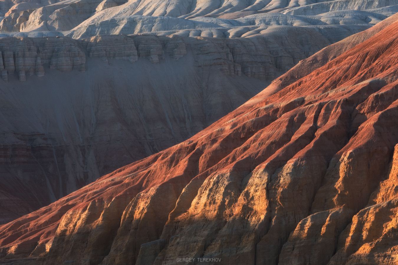
Colorful Landscapes of the Aktau Mountains
No comments · Posted by Sergei Rzhevsky in Nature, Regions, Travel
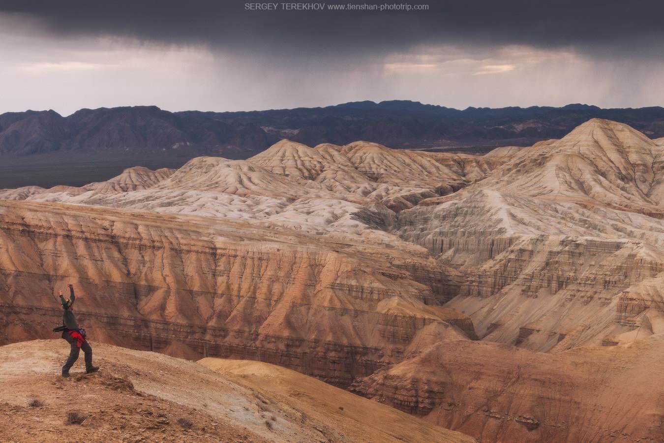
The chalk mountains of Aktau (literally “white mountains”), located about 260 km northeast of Almaty, is a unique natural monument that is part of the Altyn Emel National Park.
These multi-colored hills formed from bluish-gray sandstone and red clay, interspersed with yellow and pink cornelian, jasper, and white quartz, look like a layer cake. The height of the geological deposits reaches hundreds of meters. The Aktau Mountains on Google Maps. Photos by: Sergey Terekhov.
Tags: Almaty oblast
1
Amazing Landscapes of Southern Kazakhstan
No comments · Posted by Sergei Rzhevsky in Nature, Regions, Travel
Southern Kazakhstan is the most densely populated part of the country. Here the largest cities of Kazakhstan, Almaty and Shymkent, are located.
The landscapes of Southern Kazakhstan are surprisingly diverse and represent a combination of arid, rather cold (in winter) and hot (in summer) sparsely populated steppes and deserts, snow-capped mountains, and densely populated foothills. Photos by: Dmitry Balakirev.
Famous boundless steppes of Kazakhstan – one of the symbols of the country.
Tags: Almaty oblast · South Kazakhstan oblast
3
The Aktau Mountains – a Unique Natural Monument
No comments · Posted by Sergei Rzhevsky in Nature, Photos, Travel
The Aktau (“White”) Mountains, located in the Altyn Emel National Park in the south-east of Kazakhstan in Almaty Oblast, arose on the territory where the waters of an ancient ocean used to splash in the era when dinosaurs inhabited the Earth. They are about 400 million years old.
These colorful chalky hills, formed from bluish-gray sandstone and red clay, interspersed with yellow and pink cornelian, jasper and white quartz, reminiscent of a layer cake. These lifeless slopes, made of fragile rocks, intricately cut by erosion, are so unusual that it is impossible to take your eyes off them. Photos by: Sergey Terekhov.
Tags: Almaty oblast
26
Glaciers and Lakes of the Dzungarian Alatau
No comments · Posted by Sergei Rzhevsky in Nature, Photos, Regions
The Dzungarian or Semirechensky Alatau is a mountain system located in the north-east of the Almaty region, between the Ili River and Lake Alakol.
This region is a place with pristine nature because it is located in the border zone with China. There are no roads and settlements here. Some areas can be reached only on horseback or by helicopter. Photos by: Grigory Bedenko.
Tags: Almaty oblast
25
The pristine beauty of Lake Issyk
No comments · Posted by Sergei Rzhevsky in Nature, Photos, Travel
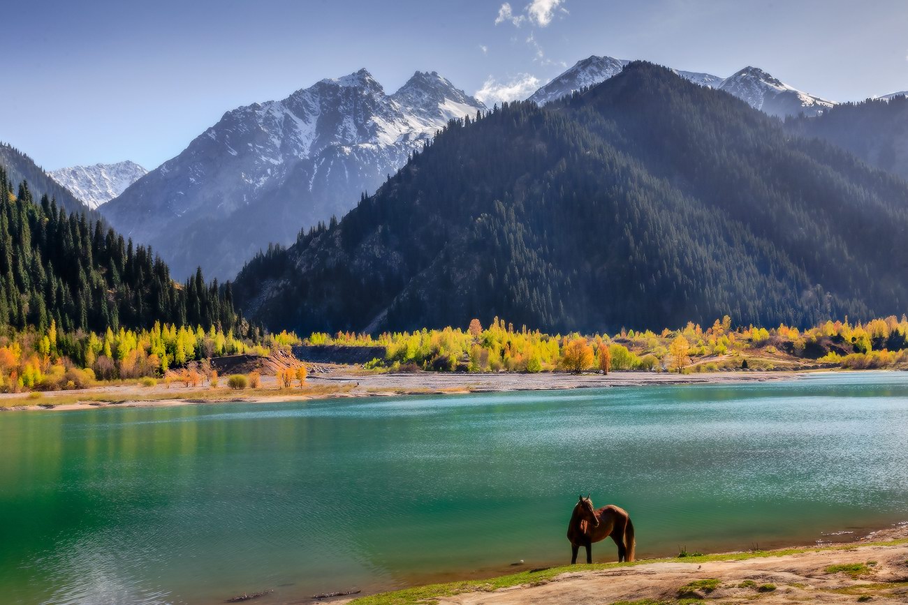
Issyk is a picturesque lake located in the Issyk gorge of the Trans-Ili Alatau mountain range, about 40 km east of Almaty, in the southern part of Almaty Oblast.
It was formed about 8-10 thousand years ago in a landslide that created a natural dam about 300 meters high. Initially, the length of Issyk was 1,850 m, width 500 m, depth 50-79 m. The water is green-blue. The height above sea level is about 1,700 m. Lake Issyk on Google Maps. Photos by: Leonid Dyachenko.
Tags: Almaty oblast
