
TAG | Mangystau oblast
11
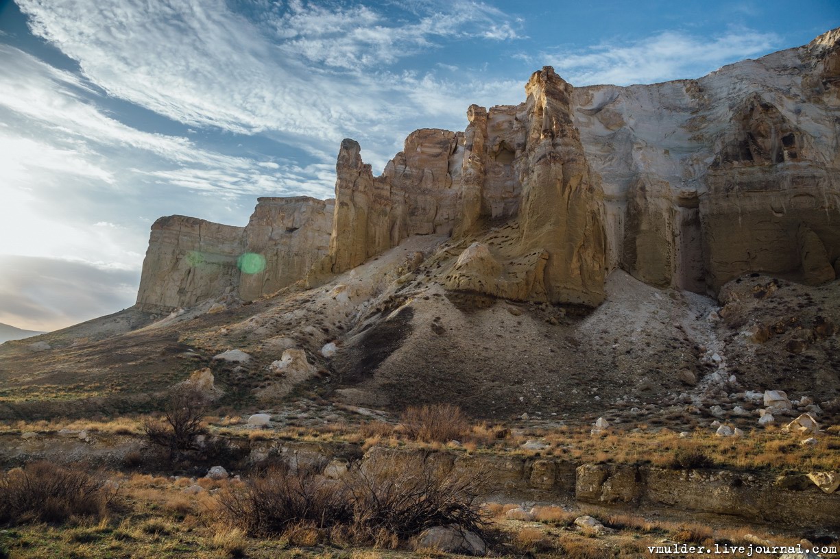
Picturesque Cliffs of Boszhira
No comments · Posted by Sergei Rzhevsky in Nature, Regions, Travel
Boszhira, a mountain range consisting of numerous chalk cliffs, is located in the western part of the Ustyurt plateau on the Mangyshlak Peninsula in Mangystau Oblast.
Formerly a seabed, it covers a vast area and consists of rocks of various, unusual shapes formed by erosion. Exploring it would take more than a day. Boszhira on Google Maps. Photos by: Vladimir Mulder.

Tags: Aktau city · Mangystau oblast
13
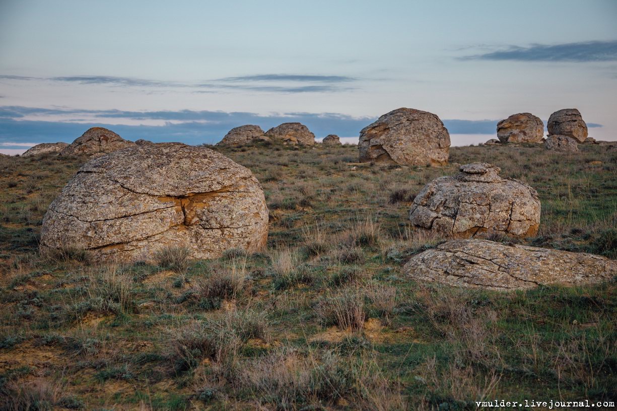
The Valley of Stone Balls on Mangyshlak Peninsula
No comments · Posted by Sergei Rzhevsky in Nature, Regions, Travel
Mangyshlak Peninsula is located on the eastern coast of the Caspian Sea in Kazakhstan. Mangystau Oblast is located on its territory.
One of the natural attractions of the peninsula is the Torysh Tract, which is located about 105 km north of the city of Aktau on the western end of the Western Karatau Ridge, 17 km east of the village of Tauchik.
picturesque geological formations
Tags: Aktau city · Mangystau oblast
20
The field of spherical concretions Torysh in Mangistau
No comments · Posted by Sergei Rzhevsky in Nature, Regions, Travel
According to one local legend, once, the Mangistau region, located in the west of present Kazakhstan, was invaded by the hordes of enemies who covered the land like locusts.
Locals put forth their hands to heaven in prayer for help and they were heard. The heavens opened downpours, thunder and lightning. In an instant, all enemies turned to stone.
Tags: Mangystau oblast
29
Boszhira – the bottom of the dried up sea
No comments · Posted by Sergei Rzhevsky in Nature, Regions, Travel
Urochishche Boszhira is one of the most beautiful places in Kazakhstan. It is a whole range of rock formations of various sizes and shapes located at the bottom of a huge canyon in the western part of the Ustyurt plateau on the Mangyshlak peninsula in Mangystau Oblast of southwestern Kazakhstan.
Boszhira is huge. It will take more than one day to explore it. The weather in Mangyshlak is harsh and unpredictable. The best time to travel to Boszhira is summer. From autumn to mid-spring it often rains here washing out already bad roads. Boszhira on Google Maps. Photos by: Alexey Zhirukhin.

Tags: Aktau city · Mangystau oblast
27
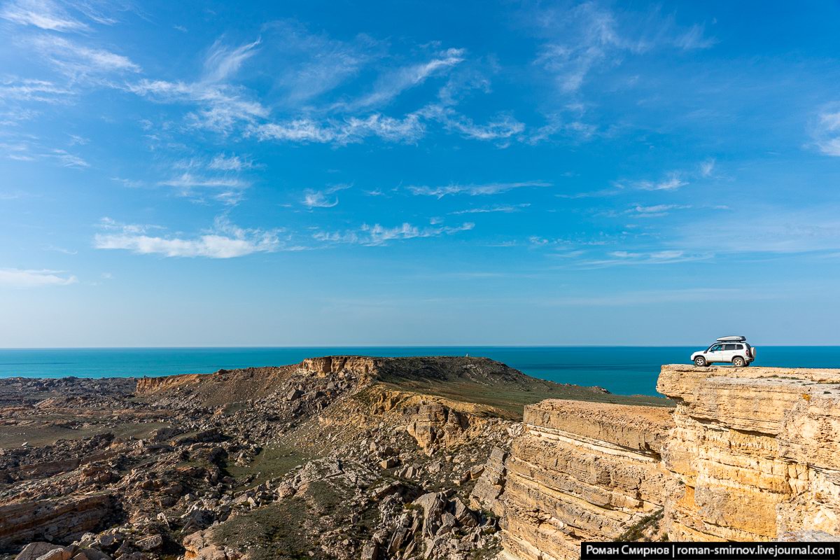
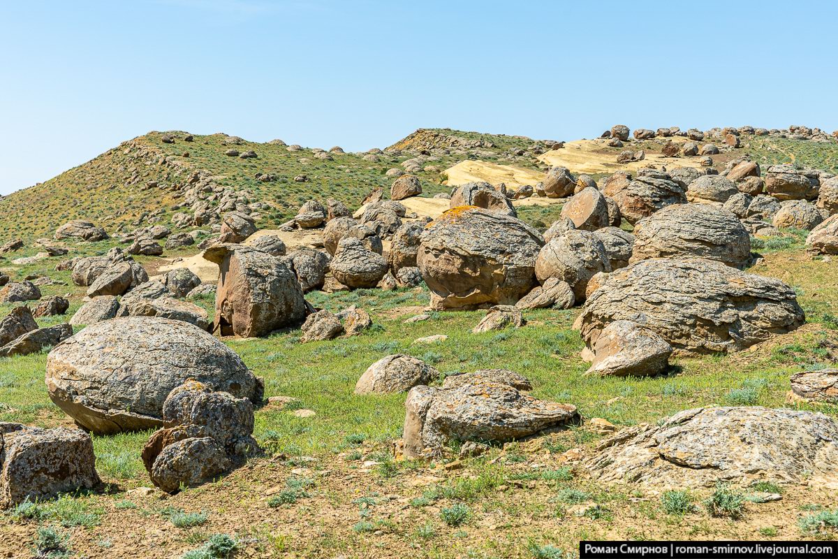
Collapsed Land of Cape Dzhigalgan
No comments · Posted by Sergei Rzhevsky in Nature, Regions, Travel
Cape Dzhigalgan (“collapsed land” in the Kazakh language) is the main attraction of the Tub-Karagan peninsula located on the Mangyshlak peninsula on the eastern shore of the Caspian Sea in the west of the Mangystau region.
This is a mountain range with a giant hollow of almost perfect round shape littered with numerous rocks. Some boulders reach the size of a small village house. The rocks are scattered so chaotically that there is a feeling that the collapse has occurred recently. Cape Dzhigalgan on Google Maps. Photos by: Roman Smirnov.
Tags: Aktau city · Mangystau oblast
8
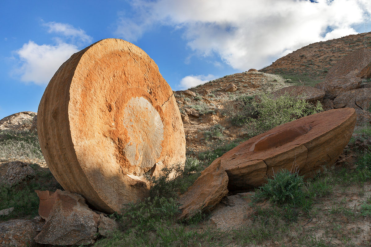
Mysterious Stone Eggs of Mangyshlak
No comments · Posted by Sergei Rzhevsky in Nature, Travel
The Valley of Balls is one of the most interesting and unusual sights of Mangystau Oblast and Western Kazakhstan. Stones of almost perfect spherical shape are scattered along the plateau and its slopes. The height of some stones reaches 1.5 meters or more.
The origin of these stone spheres is still not clear. Their shapes are gradually changing and the landscape becomes more and more mysterious. The Valley of Balls on Google Maps. Photos by: Roman Smirnov.
Tags: Aktau city · Mangystau oblast
11
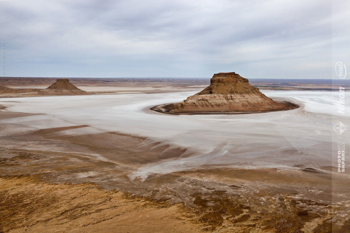
Snow-white landscapes of Sor Tuzbair
No comments · Posted by Sergei Rzhevsky in Nature, Regions, Travel
Sor Tuzbair is a solonchak (salt marsh) located in the Mangystau region in the south-west of Kazakhstan. Almost the entire territory of this region is covered with saline and deserts, water sources are absent.
This is a picturesque area combining three colors: white – salt, limestone, clouds; blue – the sky; yellow-brown – the color of the soil, which emphasizes the whiteness of salt. Sor Tuzbair is a natural combination of deserts, hills and cliffs. People come here to explore the salt marsh and conquer rocky peaks. Sor Tuzbair on Google Maps. Photos by: Natalya Kozlovskaya.
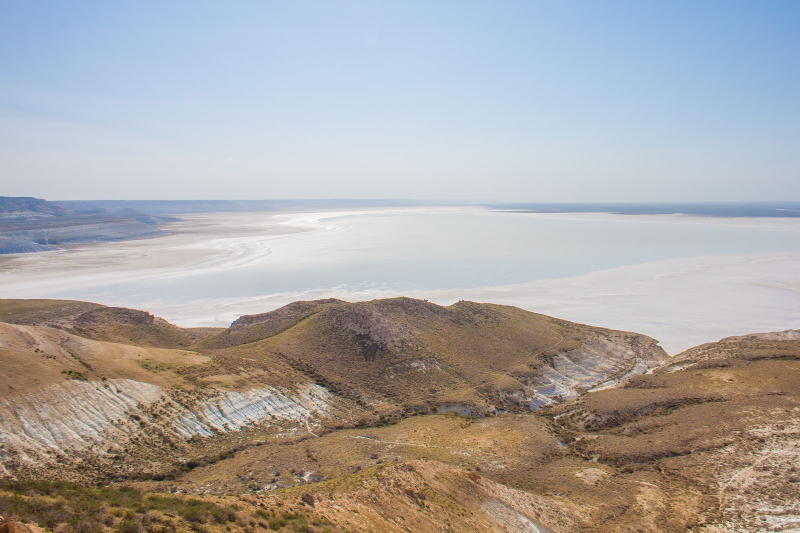
Tags: Mangystau oblast
17
Picturesque Chalk Landscapes of Boszhira
No comments · Posted by Sergei Rzhevsky in Nature, Photos, Travel
The tract of Boszhira is located in the western part of the Ustyurt plateau on the Mangyshlak peninsula of the Mangistau region.
Boszhira occupies a large area, it takes more than one day to explore it. This place is gradually becoming more popular among tourists. There are no pre-laid routes, you can go wherever you want. Boszhira on Google Maps. Photos by: Vladimir Mulder.
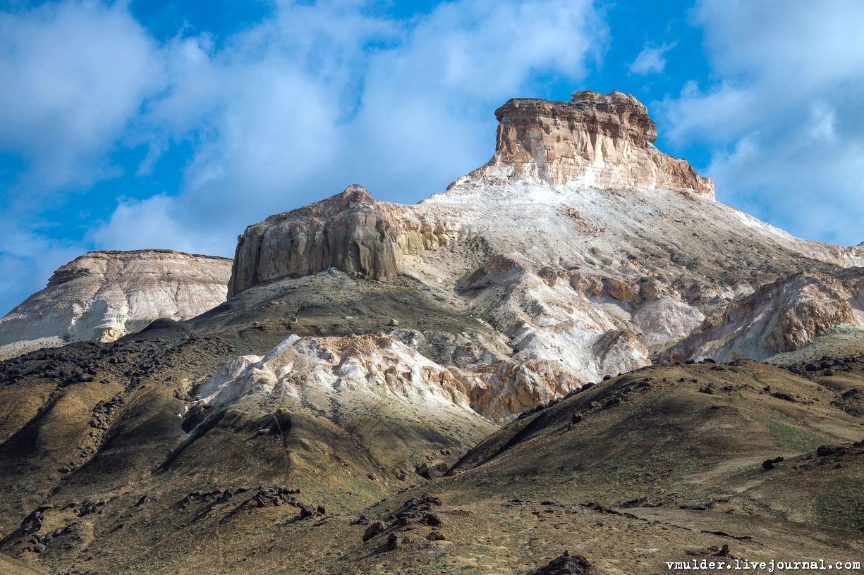
amazing kingdom of chalk cliffs
Tags: Mangystau oblast
10
Senek Sands – a small desert in the Mangystau region
No comments · Posted by Sergei Rzhevsky in Nature, Regions, Travel
Senek is a village with a population of about 2,000 people located in the Karakiyansky district of the Mangystau region.
To the north-east of the village there is a sandy area named after the village – Senek Sands. Here you can see amazingly picturesque landscapes of a fairy tale desert. Senek Sands on Google Maps. Photos by: Vladimir Mulder.
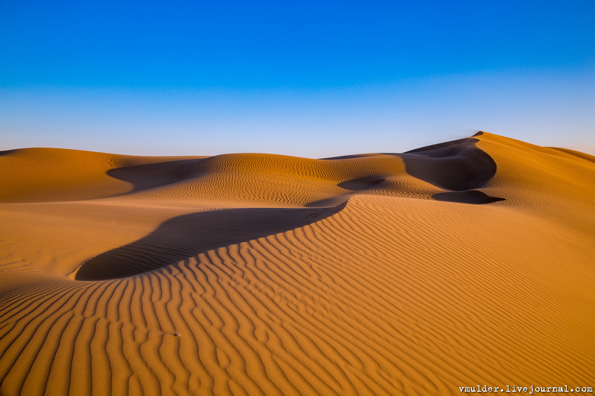
Tags: Mangystau oblast
27
Karynzharyk Depression in the Mangystau Region
No comments · Posted by Sergei Rzhevsky in Nature, Regions, Travel
The Karynzharyk depression is located almost entirely in the territory of the Ustyurt State Nature Reserve in the southwestern part of the Mangystau region in Western Kazakhstan.
The distinctive feature of this area are the five remnant mountains, towering more than 150 meters in the midst of the salt plain. Three of them stand close to each other, locals call these mountains “Three Brothers”.
Tags: Mangystau oblast
