CAT | Travel
1
Urunhayka – peaceful place on the very east of Kazakhstan
No comments · Posted by Sergei Rzhevsky in Nature, Photos, Regions, Travel
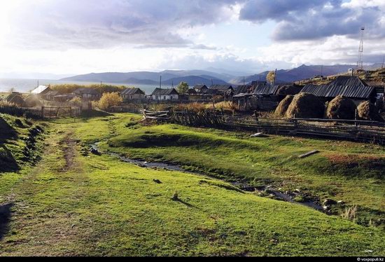
In a picturesque place on the shore of Markakol Lake at the east of Kazakhstan (Kurchum district of East Kazakhstan region) there is a small village Urunhayka.
It is not so easy to get to this distant village. The only way is to drive on the mountain Old-Austrian road built by prisoners a hundred years ago. This is one of the most interesting and picturesque parts of Kazakhstan Altai. Photos by voxpopuli.kz
Tags: East Kazakhstan oblast
30
Unearthly beauty of Bektau-Ata landscapes
1 Comment · Posted by Sergei Rzhevsky in Nature, Photos, Travel
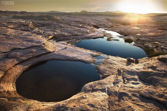
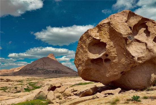
Bektau-Ata is one of the most beautiful places in Kazakhstan and at the same time, this place remains obscure and little-known.
This is a mountainous area about 5-7 km radius located in the middle of the Kazakh steppe about 70 kilometers north of the town of Balkhash, and in close proximity to the Astana-Almaty (M36) highway (Google Maps location).
Tags: Karaganda oblast
Kazakhstan has an extensive railway network with a total length of about 15,000 kilometers. Due to geographical features, trains play a crucial role in the life of the country.
More than 68% of the total turnover and over 57% of the country’s passenger traffic is made by railways. More than 125,000 people, accounting for nearly 1% of the population of Kazakhstan, are employed in the railway industry.
Railway transport is the main way to travel in Kazakhstan. Thanks to the following video you can see how traveling by train across Kazakhstan from south to north (from Almaty to Petropavl) looks like.
Tags: railway
27
Picturesque sceneries of Bektau-Ata
No comments · Posted by Sergei Rzhevsky in Nature, Photos, Travel
Bektau-Ata is a picturesque mountainous area, located in the middle of the Kazakhstan steppe, about 70 kilometers north of the town of Balkhash (Karaganda region).
The area has a radius of about 5-7 km, and its flora is very different from the surrounding steppe. Photos by Ilia Afanasieff
Tags: Balkhash city · Karaganda oblast · landscapes
7
One day in April – beautiful time-lapse of Almaty
No comments · Posted by Alex Smirnov in Cities, Travel, Video
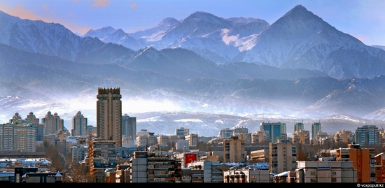
Almaty (also known as Alma-Ata), the ex-capital of Kazakhstan, is located in the southeastern part of Kazakhstan at the foot of Zailiski Ala-Tau mountain system at an elevation of 2,300-3,000 feet (700-900 meters).
Today the city extends about 12.5 miles (20 km) in all directions from its center and is considered one of the most beautiful cities of Kazakhstan, with regular planning, wide, tree-lined streets, numerous parks and orchards, and a backdrop of mountains.
Tags: Almaty city · time-lapse
7
Tamgaly Tas – the drawings on the rocks
No comments · Posted by Alex Smirnov in Nature, Travel, Video
Tamgaly Tas in Kazakh language means “stones with the signs”. Here on the rocks a large number of petroglyphs are preserved, among which the most famous image is the picture of the three Buddhist deities. Under the figures the sacred text is carved in Sanskrit, dating from the 12th century.
The rocks are located near the Ili River, 120 km north of Almaty. Today this place is popular with tourists, including rock-climbers, who gather here in spring and fall. Arid and semiarid landscape of the valley is one of the most picturesque places in Almaty region.
Tags: Almaty oblast · drawings · rocks · Tamgaly Tas
29
Kazakhstan – the land of contrasts
No comments · Posted by Alex Smirnov in Overview, Travel, Video
Kazakhstan is a vast territory, reaching the size of Western Europe, but with a population of sixteen million. This is a land of mountains, fast rivers and waterfalls, glaciers and mountain pastures.
Kazakhstan is a land of boundless steppes, hills and green meadows stretching to the horizon. In winter, temperatures reach minus forty degrees Celsius, and in summer, on the contrary, it is forty-degree heat.
The country occupies an area of historic Great Silk Road, at the junction of East and West, north and south, connecting the air and land routes of Europe, Asia and the Middle East.
15
The beauty of Zhambyl oblast nature
No comments · Posted by Alex Smirnov in Nature, Travel, Video
Zhambyl oblast is located in southern Kazakhstan. The region was named after Kazakh poet Zhambyl Dzhabayev (1846-1945).
Zhambyl oblast has good opportunities for developing tourism both inner and international. The territory of the region was crossed by the Great Silk way along which there are a lot of interesting monuments of history and culture.
The region is rich in great number of landscape and biological territories valuable for eco tourism, for example, Northern region of Western Tyan-Shan. Flora and fauna are unique there.
Tags: Zhambyl oblast
Almaty, the ex-capital of Kazakhstan, is situated in the southeastern part of Kazakhstan at the foot of Zailiski Ala-Tau mountain system at an elevation of 2,300-3,000 feet (700-900 meters).
Almaty is called a garden city. It has about 80 square meters of green plantations for each of its million-odd residents. Photos by Maksim Zolotukhin from voxpopuli.kz
Tags: Almaty city · bird's eye views
A couple of nice time-lapse videos of Kazakhstan new capital city Astana located in the steppe region of the country and former capital, largest city of Kazakhstan Almaty surrounded by the mountains.
Tags: Almaty city · Astana city · time-lapse
