
Aktau Mountains (translated as “white mountains”) are chalk mountains of different colors, mostly white, located in the territory of the national park of Altyn-Emel in the central part of Almaty Oblast. It will take you about 5-7 hours to get here from Almaty. Aktau Mountains on Google Maps. Photos by: Sergey Terekhov.
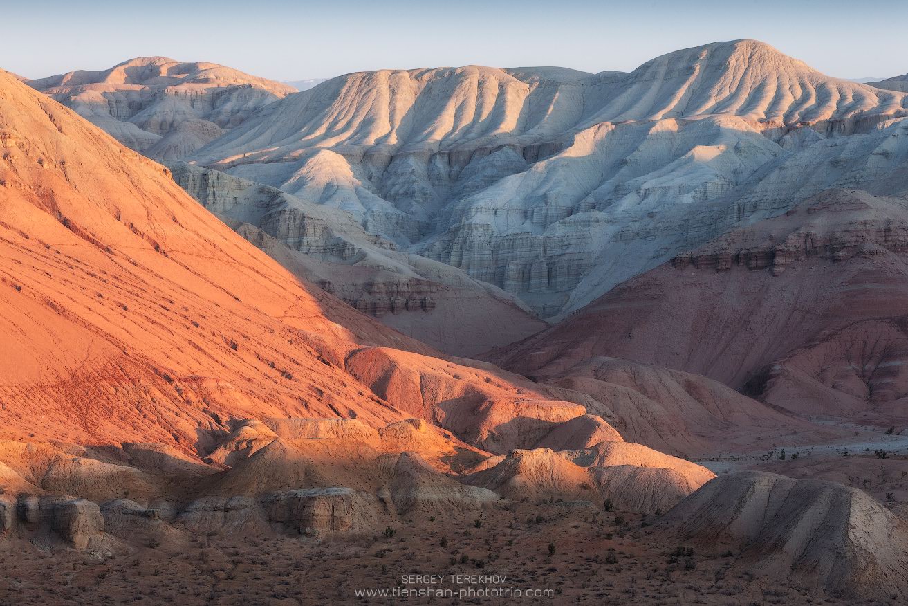
Tags: Almaty oblast
8
The Ascension Cathedral in Almaty
No comments · Posted by Sergei Rzhevsky in Architecture, Religion
The Ascension Cathedral (1904-1907), also known as Zenkov’s Cathedral (in honor its architect Andrei Zenkov), is located on the territory of the Park of 28 Panfilov Guardsmen in Almaty. It is included in the list of historical and cultural monuments of Kazakhstan of republican significance.
This church is a unique architectural structure – one of the tallest wooden buildings in the world and the tallest Orthodox wooden church. The highest point at the upper end of the cross on the main dome is 39.64 meters, at the top of the bell tower – 46 meters. Zenkov’s Cathedral on Google Maps. Photos by: Sergio.
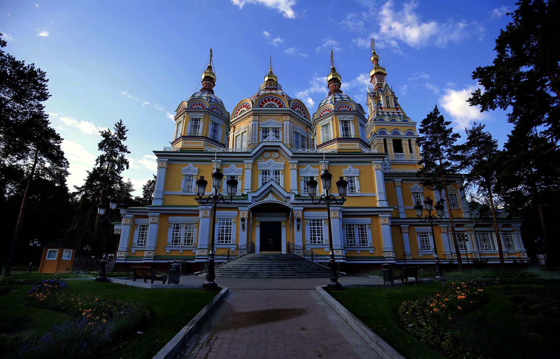
Tags: Almaty city
7
Picturesque Mountain Plateau of Asy
No comments · Posted by Sergei Rzhevsky in Nature, Regions, Travel
Asy (Assy), a mountain plateau located at an altitude of 2,560 meters above sea level about 100 kilometers east of Almaty, is one of the largest intermountain valleys of the Northern Tien Shan. The length of the plateau is more than 20 km, the width – up to 15 km.
In summer, this area is used as a huge pasture. The best time to visit the plateau is the end of May – the beginning of June, when numerous herbs bloom here. Asy Plateau on Google Maps. Photos by: Sergey Terekhov.
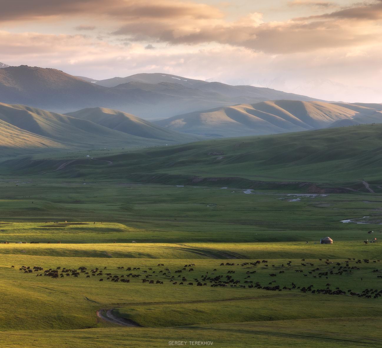
Tags: Almaty oblast
Out with the old, in with the new! Sending Happy New Year best wishes to you!
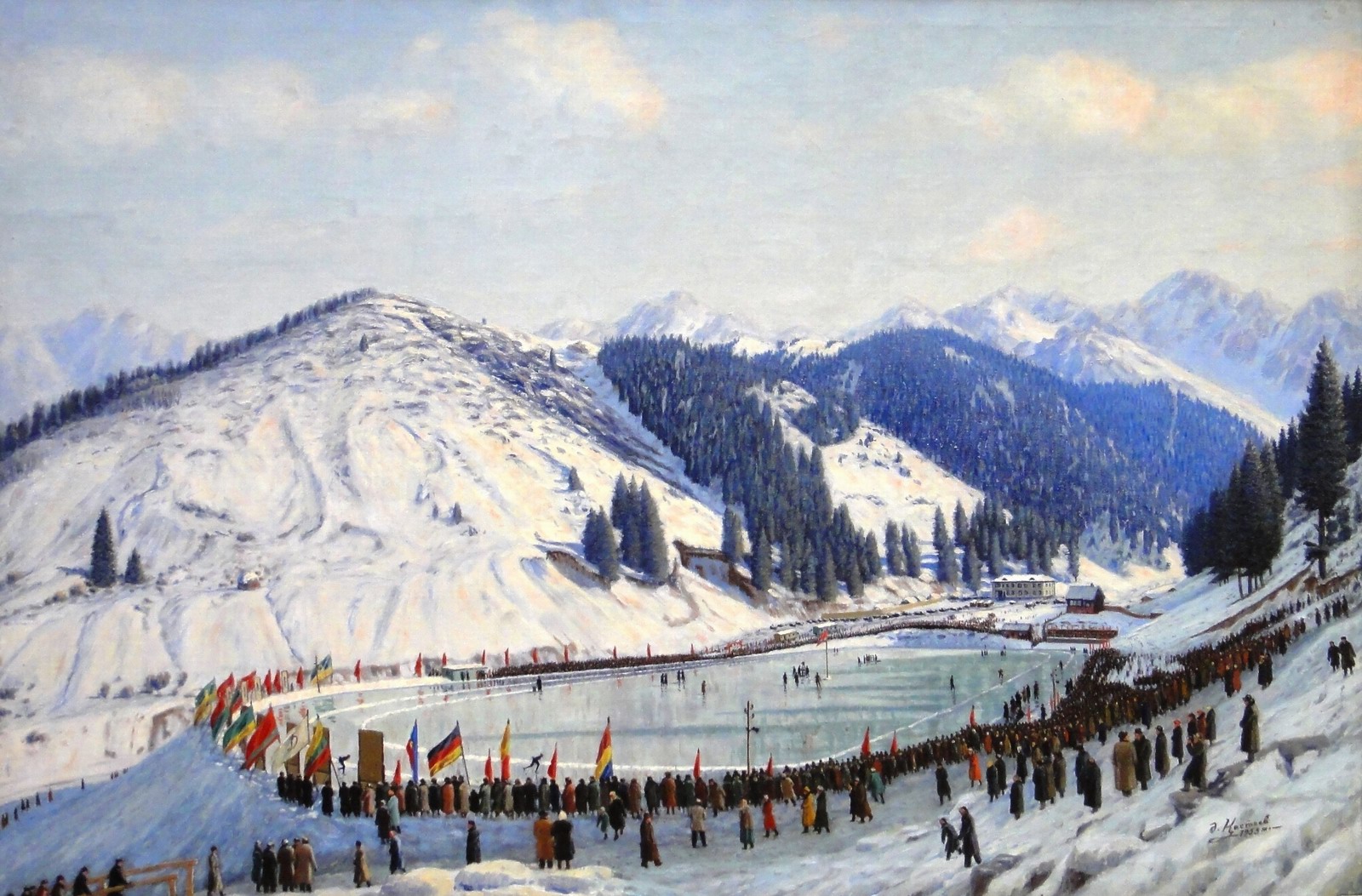
On the mountain skating rink of Medeu (1955) by Abylkhan Kasteev.
Tags: No tags
1
Landscapes of the Tekes River Valley
No comments · Posted by Sergei Rzhevsky in Nature, Photos, Regions
On the territory of Kazakhstan, the Tekes River flows mainly in a wide intermountain valley in Raiymbek District – one of the most beautiful places in Almaty Oblast located in its southeastern part. This area is rarely visited by tourists, which contributed to the preservation of its pristine nature. Photos by: Sergey Terekhov.
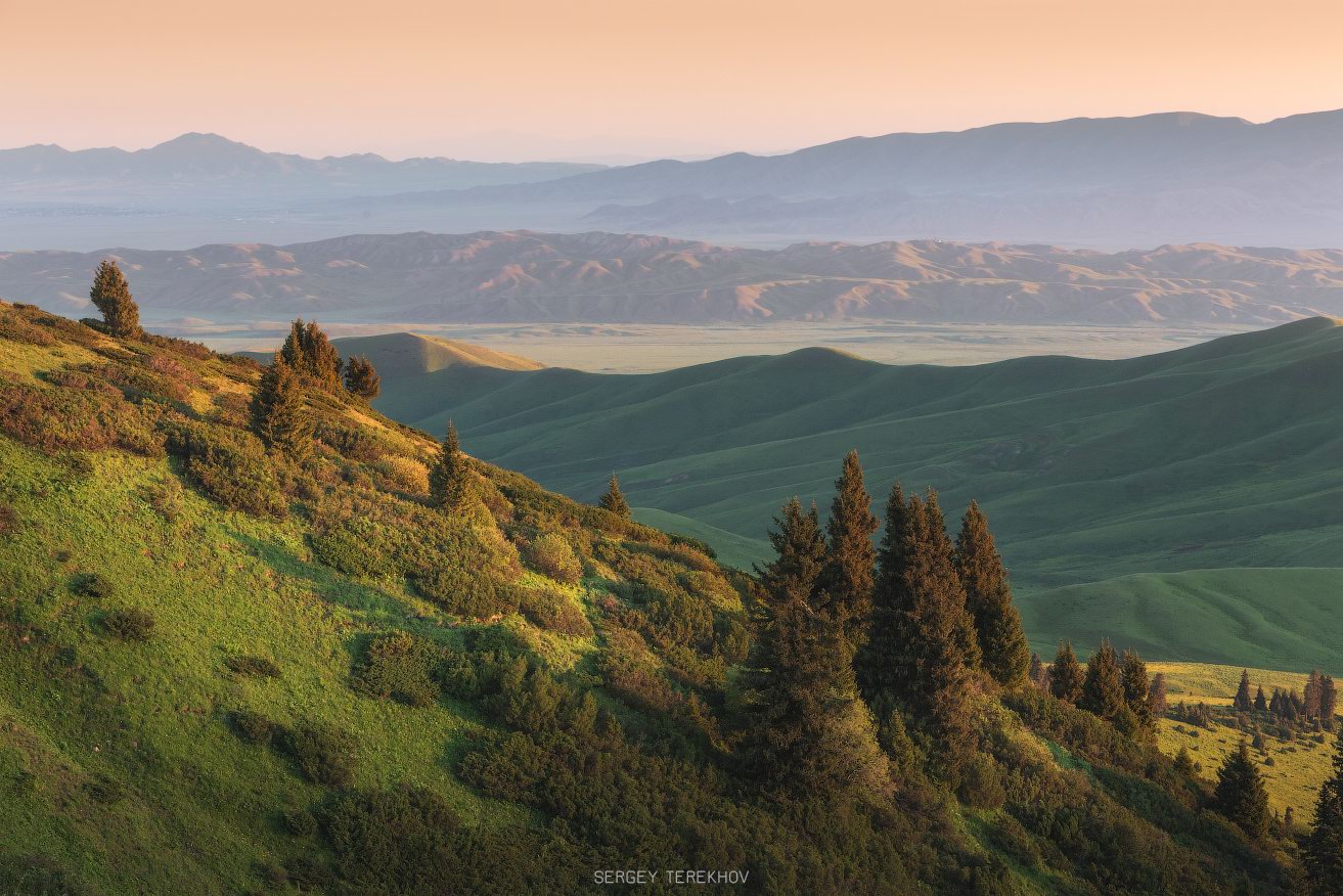
Tags: Almaty oblast
8
Mysterious Stone Eggs of Mangyshlak
No comments · Posted by Sergei Rzhevsky in Nature, Travel
The Valley of Balls is one of the most interesting and unusual sights of Mangystau Oblast and Western Kazakhstan. Stones of almost perfect spherical shape are scattered along the plateau and its slopes. The height of some stones reaches 1.5 meters or more.
The origin of these stone spheres is still not clear. Their shapes are gradually changing and the landscape becomes more and more mysterious. The Valley of Balls on Google Maps. Photos by: Roman Smirnov.
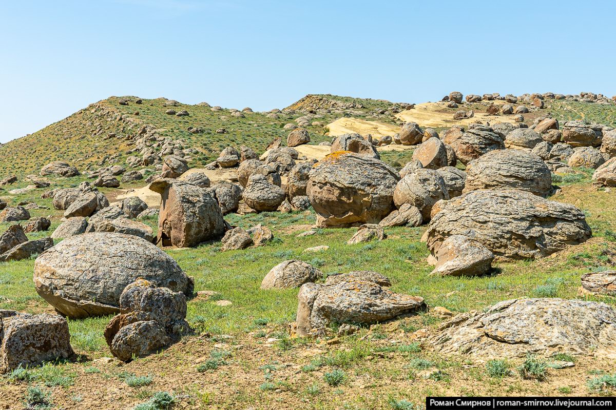
Tags: Aktau city · Mangystau oblast
16
Magnificent views from the top of Mount Akkogyt
No comments · Posted by Sergei Rzhevsky in Nature, Regions, Travel
The following beautiful photos were taken on the top of Mount Akkogyt (3,009 m) located in the south-east of the Almaty region and belonging to the mountain range of Terskey Alatau (Terskey Ala-Too).
Most of this mountain range is situated in Kyrgyzstan, but there is a small part of it on the territory of Kazakhstan. Mount Akkogyt on Google Maps. Photos by: Sergey Terekhov.

Tags: Almaty oblast
20
Tuzkol – the Saltiest Mountain Lake in Kazakhstan
No comments · Posted by Sergei Rzhevsky in Nature, Regions, Travel
Tuzkol is a picturesque salty mountain lake located at an altitude of about 1,950 meters above sea level in the southeast of the Almaty region. In clear weather, in the south, you can see the majestic peaks of the Tien Shan.
Salinity of Lake Tuzkol varies by seasons and can reach almost the same levels as in the Dead Sea in Israel or the Great Salt Lake in the USA. Lake Tuzkol on Google Maps. Photos by: Sergey Terekhov.
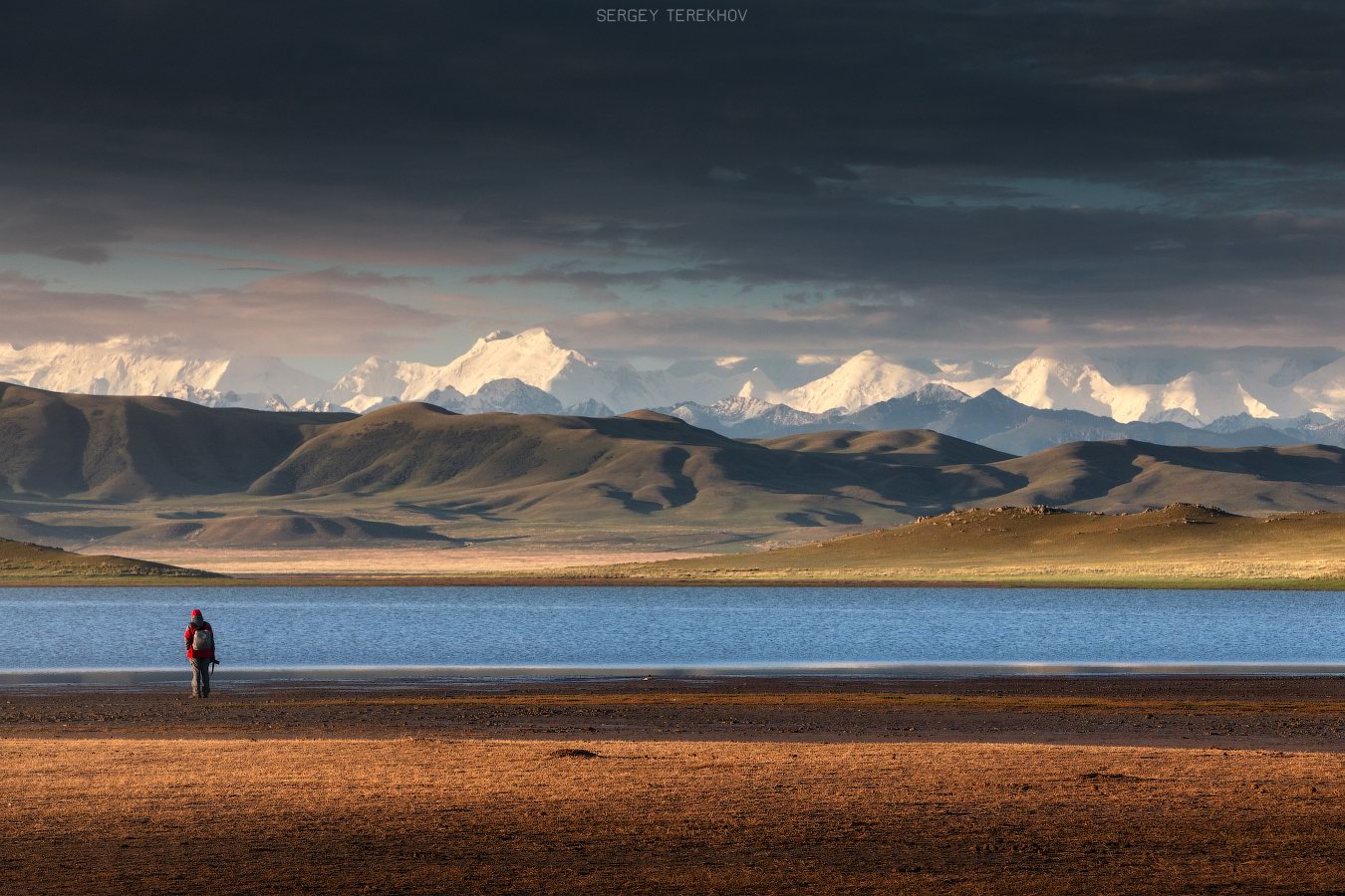
Tags: Almaty oblast
31
Morning on Aktolagay Plateau
No comments · Posted by Sergei Rzhevsky in Nature, Regions, Travel
Morning on the plateau of Aktolagay – a snow-white mountain range located in the very west of Aktobe Oblast, about 250 km east of Atyrau. This is a picturesque wasteland with no paved roads, houses, trees, and even drinking water – the realm of the wind where sometimes you can meet horses and camels.
Wind and water, flowing abundantly down the mountain range during heavy rains, turned the plateau into an amazing world of chalk figures. Aktolagay Plateau on Google Maps. Photos by: Aleksandr Manzhosov.
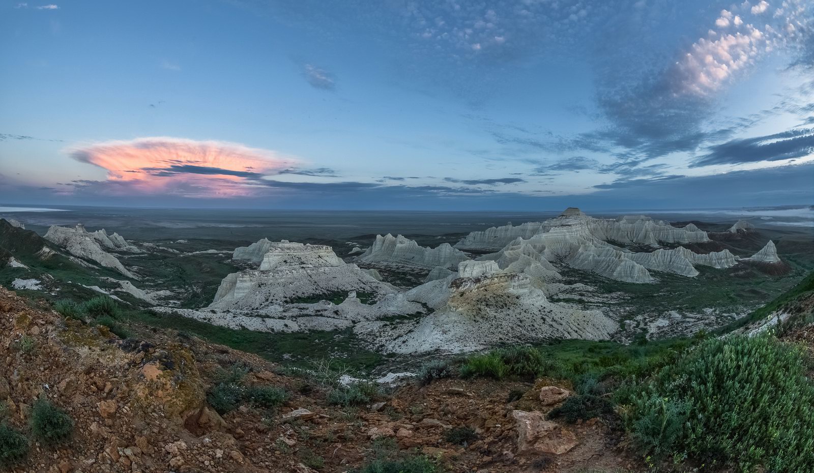
Tags: Aktobe oblast
23
Bizarre Chalk Cliffs of Akkergeshen Plateau
No comments · Posted by Sergei Rzhevsky in Nature, Regions, Travel
Akkergeshen Plateau, known for its bizarre weathered snow-white cliffs, is located about 56 km northeast of the town of Kulsary in the Atyrau region.
Shark teeth, remains of dinosaurs, prints of ancient plants and animals on stones – all this can still be found on this chalky plateau. Akkergeshen Plateau on Google Maps. Photos by: Denis Frantsouzov.
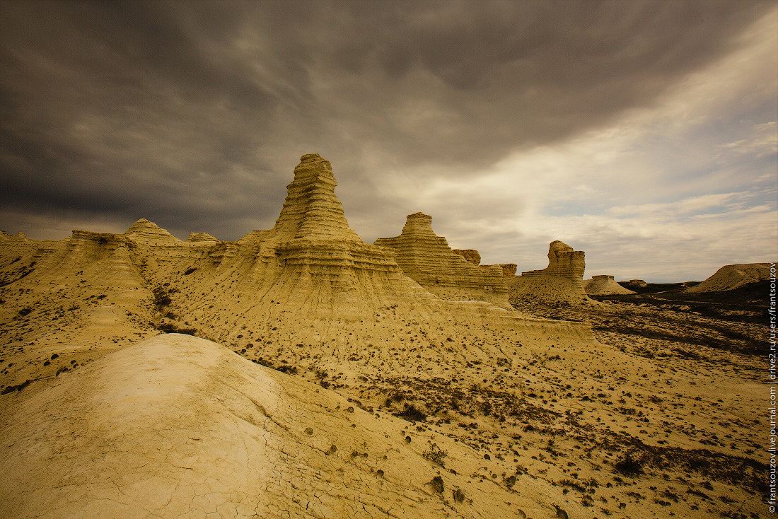
Tags: Atyrau oblast
