
16
Lucky Jet vs Aviator: a comparison of two high-end Kazakhstan betting games with similar strategies and interfaces
No comments · Posted by Sergei Rzhevsky in Entertainment
Arcade mini-games are becoming increasingly popular in the gaming halls of modern online casinos. Among the leaders in terms of player attention are almost always the crash games Aviator from the developer Spribe and Lucky Jet, accessed by the provider 1win. These games provide players with unique opportunities for fun and winnings, which can be tried out at casino aviator kz. Aviator and Lucky Jet have a similar interface and gameplay principles. So what choice to make between two great arcade games at online casinos? Today we will make a detailed comparison of both games, review their features and help you make the right decision.

Tags: No tags
24
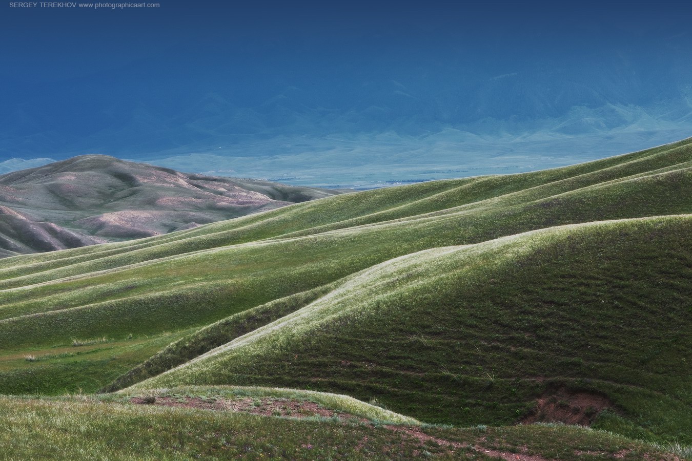
Amazing landscapes around Lake Tuzkol
No comments · Posted by Sergei Rzhevsky in Nature, Photos, Travel
Tuzkol is a salty mountain lake in Kazakhstan, located at an altitude of 1,959 m above sea level in Raiymbek District in the south-east of Almaty Oblast, about 310 km from Almaty. Translated from the Kazakh language, “tuzkol” means “salt lake”. The salinity of Lake Tuzkol varies with the seasons and is sometimes almost the same as in the Dead Sea in Israel or the Great Salt Lake in the US.
Raiymbek District is one of the most picturesque districts of Almaty Oblast. You can go there at any time of the year, but if you want to travel further into the mountains, the best time to go is from June to September. Lake Tuzkol on Google Maps. Photos by: Sergey Terekhov.
Tags: Almaty oblast · landscapes
19
88 Fortunes and Beyond: Asian-Themed Slot Adventures
No comments · Posted by Sergei Rzhevsky in Entertainment
The allure of Asian culture, rich with traditions, mysticism, and symbolism, has inspired some of the most captivating and rewarding slot games in the casino world. One such iconic game is “88 Fortunes,” a slot that celebrates Asian heritage with its symbolism and potential for prosperity.
In this blog, we will explore “88 Fortunes” and other Asian-themed slot adventures, uncovering the treasures they hold and providing insights into the world of these captivating games.

Tags: No tags
19
DoubleDown Casino vs. Big Fish Casino: Which Is Better for You?
No comments · Posted by Sergei Rzhevsky in Entertainment
In the fast-paced world of mobile gaming, casinos have successfully migrated from physical establishments to the virtual realm. With a multitude of options at your fingertips, choosing the right online casino app can be a daunting task.
Among the heavyweights in the industry are DoubleDown Casino and Big Fish Casino, both vying for your attention and virtual chips. But which one is better suited for you? In this comprehensive comparison, we will dissect these two casino giants to help you make an informed decision.

Tags: No tags
11
Watch Team Kazakhstan at the 2024 Olympic Games on Your Mobile Device
No comments · Posted by Sergei Rzhevsky in Sports
Google Images Creative Commons Licenses
Kazakhstan is a nation that loves sports, from the youth ranks and amateurs through to the professionals. Evidence of the country’s love of sport is everywhere, including its grand stadiums, successful teams at major competitions like the Olympic Games, and the massive number of followers supporting top performers.
Sport is part of the culture in Kazakhstan, and you don’t have to look for evidence. It may be a well-guarded secret, but Kazak tourism owes much to the country’s top sporting talent, with visitors arriving worldwide to watch competitions, stare at the impressive stadiums, and watch a country punch well above its weight. If you love sports, there’s plenty to see here, and 2023 could be the year to visit.
The leading sportsbooks cover the best fixtures, allowing you to predict the results and target a profit using only your smartphone. When playing competitive markets on soccer, boxing, and horse racing, firms offer the best sportsbook sign up bonus. When joining, you must search for a firm with the most generous odds and best sportsbook bonus, including free bets, cashback, and enhanced odds.
Tags: No tags
20
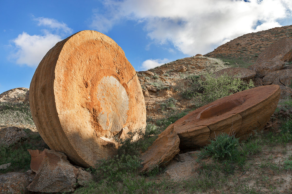
The field of spherical concretions Torysh in Mangistau
No comments · Posted by Sergei Rzhevsky in Nature, Regions, Travel
According to one local legend, once, the Mangistau region, located in the west of present Kazakhstan, was invaded by the hordes of enemies who covered the land like locusts.
Locals put forth their hands to heaven in prayer for help and they were heard. The heavens opened downpours, thunder and lightning. In an instant, all enemies turned to stone.
Tags: Mangystau oblast
5
Kazakhstan’s Microfinance Sector Adds 44.3% in Assets: Emerging Markets Drive Growth
No comments · Posted by Alex Smirnov in Economy
Intro
Microfinance institutions in Kazakhstan enjoyed a banner year in terms of asset growth, according to a new report from the National Bank of Kazakhstan. The sector as a whole saw assets grow by 44.3%, thanks largely to rising demand from emerging markets. This is great news for the country’s small businesses and entrepreneurs, who are increasingly able to access the capital they need to grow and expand.
Growth During the Quarantine
Kazakhstan’s microfinance sector has seen significant growth during the quarantine period. The number of microfinance organizations operating in the country has increased by 20%, and the average loan size has increased by 30%. The sector has also seen an increase in the number of new clients, with the majority of new clients being women. This growth is largely due to the fact that many Kazakhs have lost their jobs or had their income reduced due to the pandemic. As a result, microfinance organizations have been able to provide much-needed financial assistance to many families. The sector is expected to continue to grow in the coming months, as more and more Kazakhs turn to microfinance for financial assistance.
Tags: No tags
7
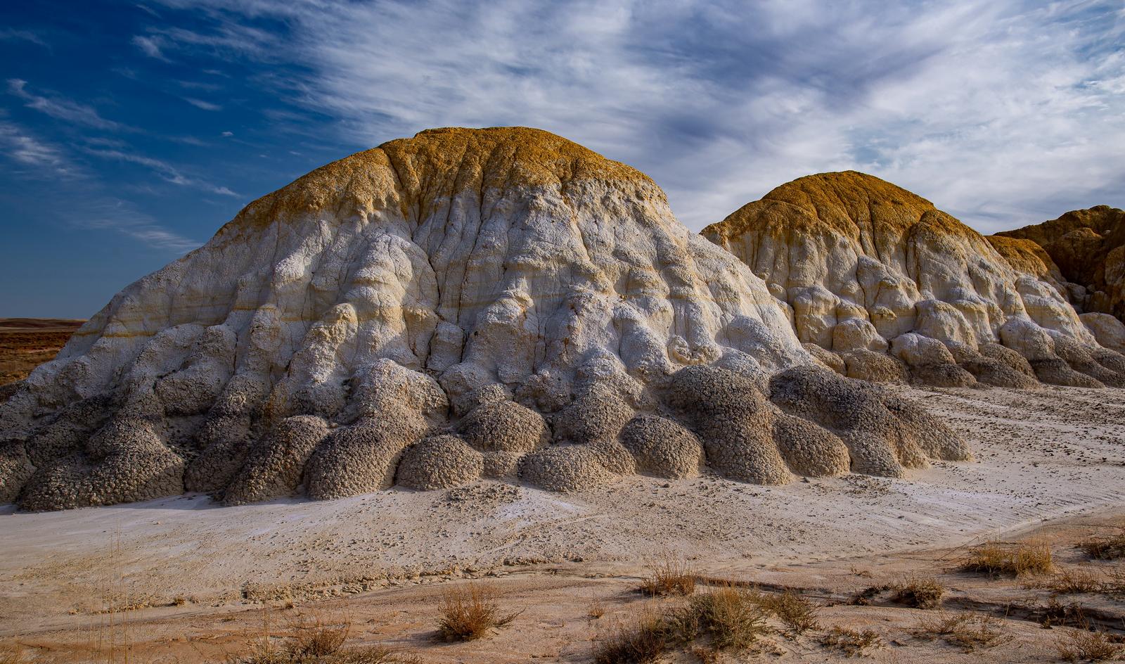
Multicolored Chalk Mountains of Akzhar
No comments · Posted by Sergei Rzhevsky in Regions, Travel
The chalk mountains of Akzhar are one of the brightest, in the truest sense of the word, natural attractions of the endless expanses of Saryarka (Kazakh Upland) – an ancient, heavily eroded mountainous region in the central part of Kazakhstan.
The highest mountains are located in the east of Saryarka and the red-yellow Akzhar mountains can be found in the extreme southwest, on the border of the Karagandy and Kostanay regions. Akzhar Mountains on Google Maps. Photos by: Evgeniy Drobotenko.
Tags: Karaganda oblast · Kostanay oblast
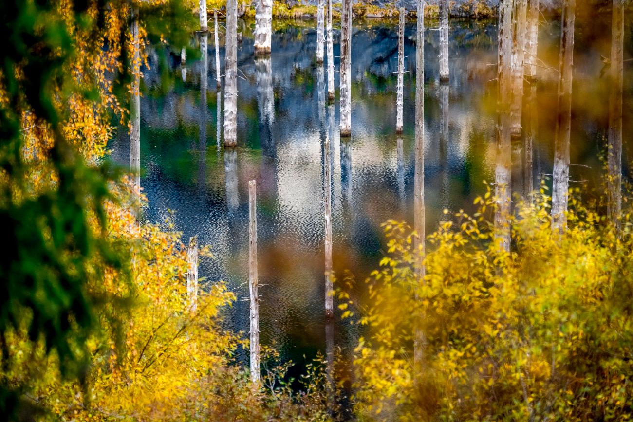
Lake Kaindy is located in the south-east of Kazakhstan in one of the gorges of the Kungey-Alatau mountain system at an altitude of 1,667 meters above sea level. The lake was formed as a result of the powerful Kemin earthquake in 1911.
The main feature of this unique natural reservoir is the trunks of the Tien Shan spruces, which protrude directly from the water. Before the earthquake, there was a spruce forest in the gorge. Scientists say that these trunks are about 150-200 years old. The wood is practically petrified and does not decompose.
Tags: Almaty oblast
29
Boszhira – the bottom of the dried up sea
No comments · Posted by Sergei Rzhevsky in Nature, Regions, Travel
Urochishche Boszhira is one of the most beautiful places in Kazakhstan. It is a whole range of rock formations of various sizes and shapes located at the bottom of a huge canyon in the western part of the Ustyurt plateau on the Mangyshlak peninsula in Mangystau Oblast of southwestern Kazakhstan.
Boszhira is huge. It will take more than one day to explore it. The weather in Mangyshlak is harsh and unpredictable. The best time to travel to Boszhira is summer. From autumn to mid-spring it often rains here washing out already bad roads. Boszhira on Google Maps. Photos by: Alexey Zhirukhin.

Tags: Aktau city · Mangystau oblast
