1
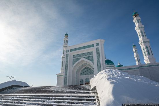
Karaganda Regional Central Mosque
No comments · Posted by Sergei Rzhevsky in Photos, Religion, Travel
Karaganda Regional Central Mosque is the fourth largest mosque of Kazakhstan in size and capacity after two mosques in Astana and one in Almaty.
It can accommodate up to 4,000 people, 3,200 in the main hall on the second floor and 800 in the hall for women on the third floor.
Tags: Karaganda city · mosques
18
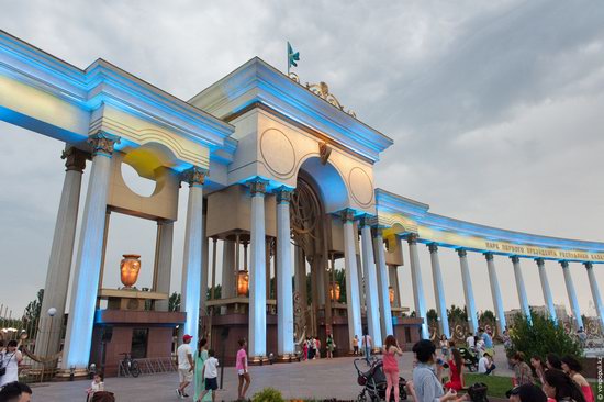
The park named after the First President of Kazakhstan
No comments · Posted by Sergei Rzhevsky in Cities, Photos, Travel
The park named after the First President of the Republic of Kazakhstan is an arboretum located in Almaty, at the intersection of Navoi Street and Al-Farabi Avenue in Bostandyk district.
Opened in July 2010, the park has a total area of 73 hectares. Since its opening it has become one of the favorite places for leisure activities of residents and visitors of Almaty, a center of large-scale celebrations. Source: voxpopuli.kz.
Tags: Almaty city
7
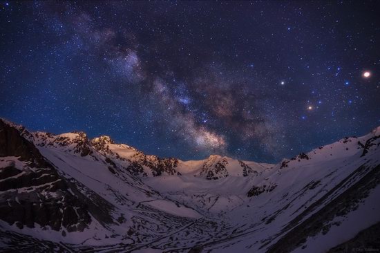
The beauty of nature in the area of Tuyuksu glacier
No comments · Posted by Sergei Rzhevsky in Nature, Photos
Tuyuksu is a central, valley glacier in Kazakhstan, located on the northern slope of Trans-Ili Alatau Ridge, in the upper reaches of the Malaya Almatinka River, at the foot of Tuyuksu Pass.
Here, about 25 km from Almaty, in Maloye Almatinskoye Gorge (the height above sea level – 2,400 meters), you can find a mountaineering camp “Tuyuk-Su” – one of the best places to get basic skills of mountaineering. Photos by: Olga Kulakova.
Starry night on Tuyuksu.
Tags: Almaty city
25
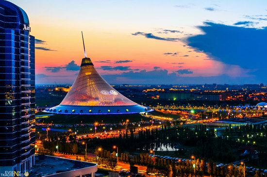
Astana at night – the views from the roofs
No comments · Posted by Sergei Rzhevsky in Architecture, Cities, Photos
June 10, 1998, Astana became the new capital of Kazakhstan. Today, it is the third largest city of the country with a population of about 900 thousand people.
Over the past years a lot of interesting modern architectural and urban development projects were implemented in Astana. Let’s take a look at the city at night from a height. Photos by: Evgeny Tkachenko.
Tags: Astana city
15
Beautiful canyon of the Temirlik River
No comments · Posted by Sergei Rzhevsky in Nature, Photos, Travel
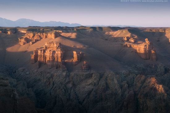
The Temirlik River, the right tributary of the Charyn River, located in the Almaty region, forms an amazing canyon that is not inferior to the famous “Valley of Castles” located in the Charyn Canyon.
This canyon is smaller, but it is also very beautiful. You can spend a weekend near the mountain stream flowing through the bottom of the canyon. The best time to visit – spring and autumn, when there is no sweltering heat. Photos by: Sergey Terekhov.
Tags: Almaty oblast
3
Lake Tuzkol – the view from above
No comments · Posted by Sergei Rzhevsky in Nature, Photos, Regions
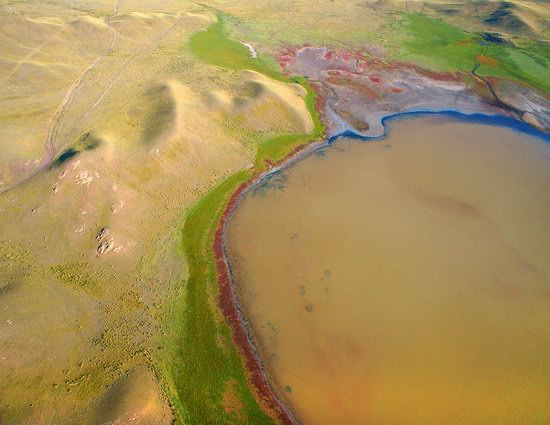
Tuzkol is a small mountain lake located at an altitude of 1,950 meters above sea level in the south-east of the Almaty region, about 310 km from Almaty. The name of the lake means “salty” in the Kazakh language.
The salinity of Lake Tuzkol varies with the seasons of the year. It can reach almost the same level as in the Dead Sea in Israel or Great Salt Lake in the United States. Tuzkol is the saltiest mountain lake in Kazakhstan.
Tags: Almaty oblast
19
Charyn Canyon in the cold season
No comments · Posted by Sergei Rzhevsky in Nature, Photos, Travel
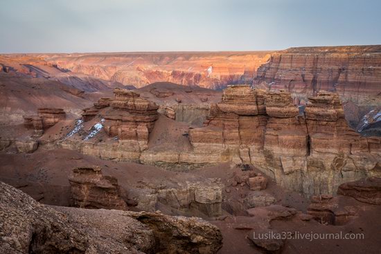
Charyn Canyon, one of the main natural attractions of Kazakhstan, is located relatively close to Almaty (about 200 km). You can go there by car all year round. Every local taxi driver will take you there for a reasonable price.
The age of the canyon is estimated at 12 million years. Its total length is about 150 km, but the most popular place is the so-called “Valley of the Castles”, the length – about 2 km, the width – 20-80 m. Photos by: lusika33.
Tags: Almaty oblast · landscapes
12
The lakes of Kensu – a place of great beauty
No comments · Posted by Sergei Rzhevsky in Nature, Photos, Regions
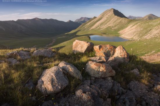
A long time ago this place was covered by a mountain glacier, but climate change led to its disappearance and a system of beautiful small mountain lakes formed here.
The system of lakes in the upper reaches of the Kensu River, on the border of Kyrgyzstan and Kazakhstan, is located about 260 km from Almaty, in the Almaty region. This is a unique area of untouched wildlife with eight lakes flowing into each other. Photos by: Sergey Terekhov.
Tags: Almaty oblast · landscapes
2
Golden Autumn on Kolsai Lakes
No comments · Posted by Sergei Rzhevsky in Nature, Photos, Regions
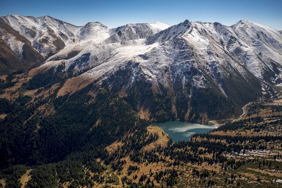
In the south-eastern part of the mountain system Ile Alatau (the most northern ridge of Tien Shan), near Almaty, you can find three beautiful tectonic lakes. They are called Kolsai lakes.
All three lakes are surrounded by pine forests and have rich underwater flora and fauna. The water in the lakes is crystal clear. Kolsai Lakes National Park on Google Maps. Photos by: Gregory Bedenko.
Upper Kolsai Lake (2,850 meters above sea level) is the smallest of the three lakes.
Tags: Almaty oblast
24
Boszhira tract at sunset and at night
No comments · Posted by Sergei Rzhevsky in Nature, Photos, Regions
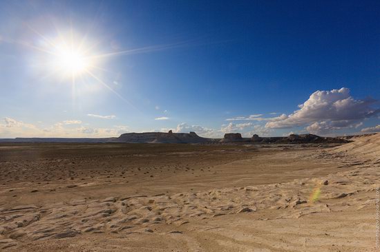
Boszhira tract is located in the western part of the Ustyurt Plateau, on Mangyshlak Peninsula in the Mangistau region. The highway Necropolis Becket-Ata – Zhanaozen passes about 20 km from the tract.
As the tract covers a huge area, it will take more than one day to explore it. This place is little known and inaccessible to tourists. Everything is white here – canyons, peaks, mountains-towers, mountains-castles, mountains-yurts, etc.
Tags: Mangystau oblast
