TAG | Karaganda oblast
2
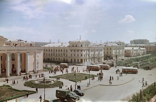
Temirtau early in the second half of the 20th century
No comments · Posted by Sergei Rzhevsky in History
This very vivid picture of the Soviet past of Kazakhstan made by photographer and journalist Semyon Fridlyand looks like a frame from a historical movie.
It is Temirtau city located in Karaganda region early in the second half of the 20th century.
Tags: Karaganda oblast
7
One of the Largest Coal Mines in Kazakhstan
No comments · Posted by Sergei Rzhevsky in Economy, Photos
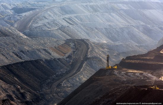
The main source of economic growth in Kazakhstan is the extraction of various natural resources, including coal. Coal mine “Molodezhny” located near Karaganda is among the largest coal producers of the country.
Annual production is about 7 million tons of coal a year. BelAZ trucks (capacity up to 130 tons) are used to transport coal. 1,150 people are working here; the average wage is about $ 300 a month. Coal mine “Molodezhny” location on Google Maps. Photos by Vadim Makhorov
How coal is mined in Kazakhstan
Tags: Karaganda oblast
15
Kent Mountains – beautiful place in Central Kazakhstan
No comments · Posted by Sergei Rzhevsky in Nature, Regions, Travel
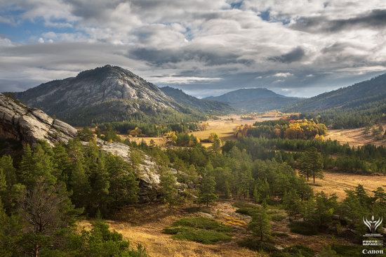
Natural Reserve Kyzyl-Kent is located in the east of Kent Mountains, 250 km south-east of Karaganda.
Mountainous oasis Kent is of great interest due to the fact that these areas are not developed and do not attract a lot of tourists because of the lack of large bodies of water. The following nice photos of this place were captured in September 2012 by Ilia Afanasieff
Tags: Karaganda oblast
24
Beautiful views of Karkaraly national park
No comments · Posted by Sergei Rzhevsky in Nature, Photos
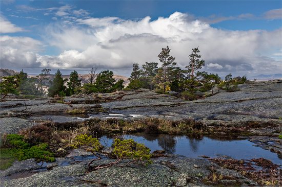
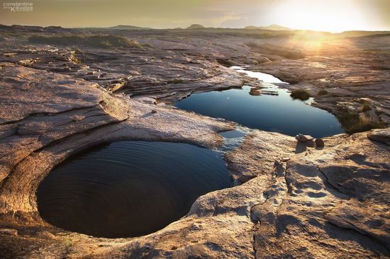
Karkaraly state national nature park is a national park in Kazakhstan, located in Karaganda region. It is one of the protected areas of Kazakhstan because of the exceptional diversity of central Kazakhstan landscapes presented. Karkaraly nature park on Google Maps. Photos by Constantine Kikvidze
Tags: Karaganda oblast
30
Unearthly beauty of Bektau-Ata landscapes
1 Comment · Posted by Sergei Rzhevsky in Nature, Photos, Travel
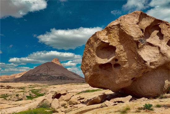
Bektau-Ata is one of the most beautiful places in Kazakhstan and at the same time, this place remains obscure and little-known.
This is a mountainous area about 5-7 km radius located in the middle of the Kazakh steppe about 70 kilometers north of the town of Balkhash, and in close proximity to the Astana-Almaty (M36) highway (Google Maps location).
Tags: Karaganda oblast
27
Picturesque sceneries of Bektau-Ata
No comments · Posted by Sergei Rzhevsky in Nature, Photos, Travel
Bektau-Ata is a picturesque mountainous area, located in the middle of the Kazakhstan steppe, about 70 kilometers north of the town of Balkhash (Karaganda region).
The area has a radius of about 5-7 km, and its flora is very different from the surrounding steppe. Photos by Ilia Afanasieff
Tags: Balkhash city · Karaganda oblast · landscapes
28
Picturesque landscapes of the north and east of Kazakhstan
2 Comments · Posted by Sergei Rzhevsky in Nature, Photos
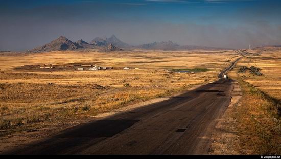
Kazakhstan is known for incredible diversity of natural landscapes that can be found on its vast territory.
The following beautiful photos were taken during trips to Karaganda and East Kazakhstan regions of the country at different times of the year by photographer Constantine Kikvidze for voxpopuli.kz
Tags: East Kazakhstan oblast · Karaganda oblast · landscapes
7
Semipalatinsk nuclear test site – 20 years after the closure
1 Comment · Posted by Alex Smirnov in History, Nature, Photos, Video
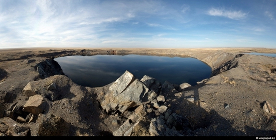
Not so long ago Kazakhstan commemorated the 20th anniversary of closure of the Semipalatinsk nuclear test site. It is located on the border of East Kazakhstan, Pavlodar and Karaganda oblasts, about 130 km northwest of Semey city.
The main attraction of the area is “atomic” lake, which is located at the test site “Balapan”. It was formed in the explosion of a thermonuclear warhead of 140 kilotons of power in 1965.
The diameter of the lake is 500 meters; depth from the surface to the bottom is about 80 meters. In a similar way the Soviet strategists planned to build water reservoirs in arid regions of the Soviet Union. Photos by Grigory Bedenko for voxpopuli.kz
Tags: East Kazakhstan oblast · Karaganda oblast · Pavlodar oblast · Semipalatinsk nuclear test site
4
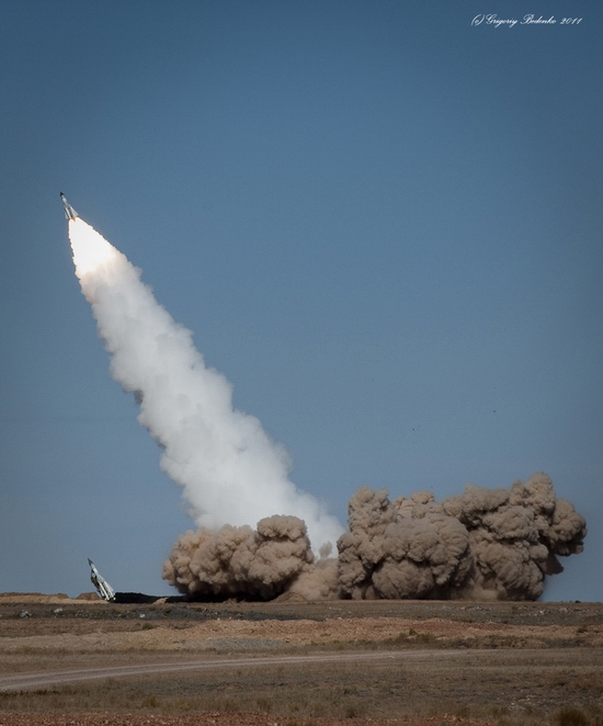
Missile firing at Sary-Shagan testing ground
No comments · Posted by Sergei Rzhevsky in Army, Photos
Sary-Shagan is a military testing ground in Kazakhstan. It is located to the northwest and west of Lake Balkhash in the desert Betpak-Dala on the territories of Karaganda and Zhambyl oblasts.
Sary-Shagan is the first and only in Eurasia ground for developing and testing anti-missile weapons. Military units of the Ministry of Defense of Kazakhstan have regular training activities there. Photos by Grigoriy Bedenko.
Tags: Karaganda oblast · missiles · Sary-Shagan · testing ground · Zhambyl oblast
30
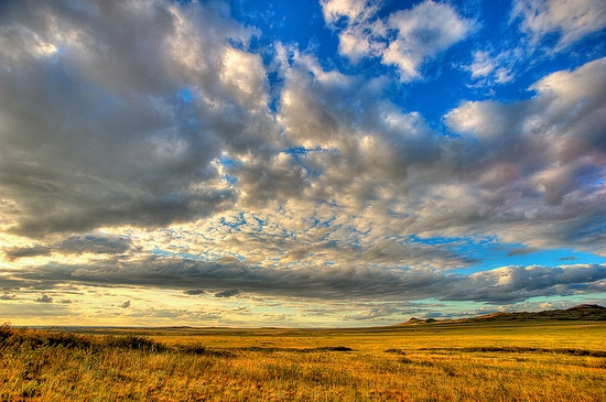
The sceneries of Karaganda oblast steppe
No comments · Posted by Sergei Rzhevsky in Nature, Photos, Society
The nature of Karaganda oblast is beautiful but this land also preserves the historical memory of the tragic events happened in its past. The following memorials are dedicated to the victims of Stalin’s repressions. The photos were captured by mishgun.
Tags: Karaganda oblast · landscapes · memorials

