
TAG | Almaty oblast
26
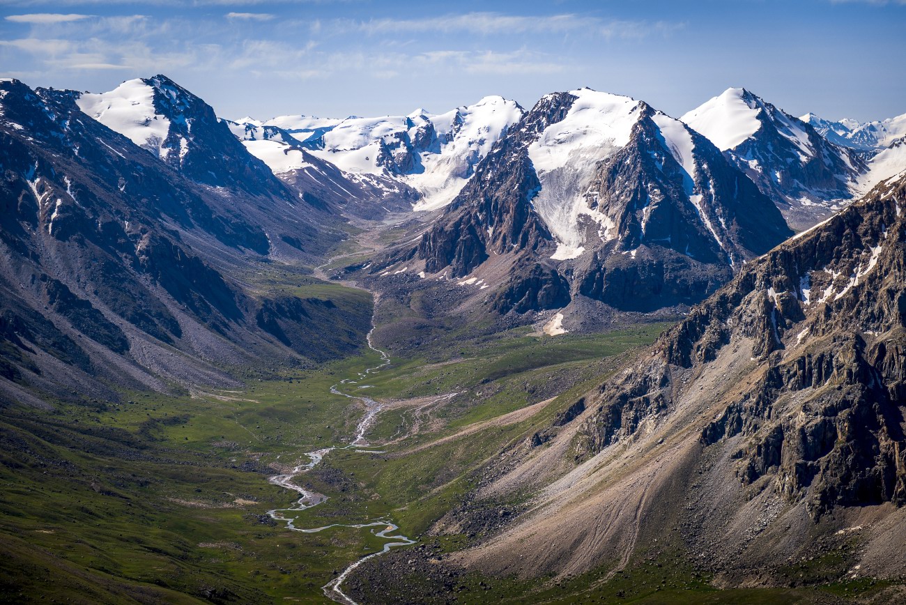
Glaciers and Lakes of the Dzungarian Alatau
No comments · Posted by Sergei Rzhevsky in Nature, Photos, Regions
The Dzungarian or Semirechensky Alatau is a mountain system located in the north-east of the Almaty region, between the Ili River and Lake Alakol.
This region is a place with pristine nature because it is located in the border zone with China. There are no roads and settlements here. Some areas can be reached only on horseback or by helicopter. Photos by: Grigory Bedenko.

Tags: Almaty oblast
25
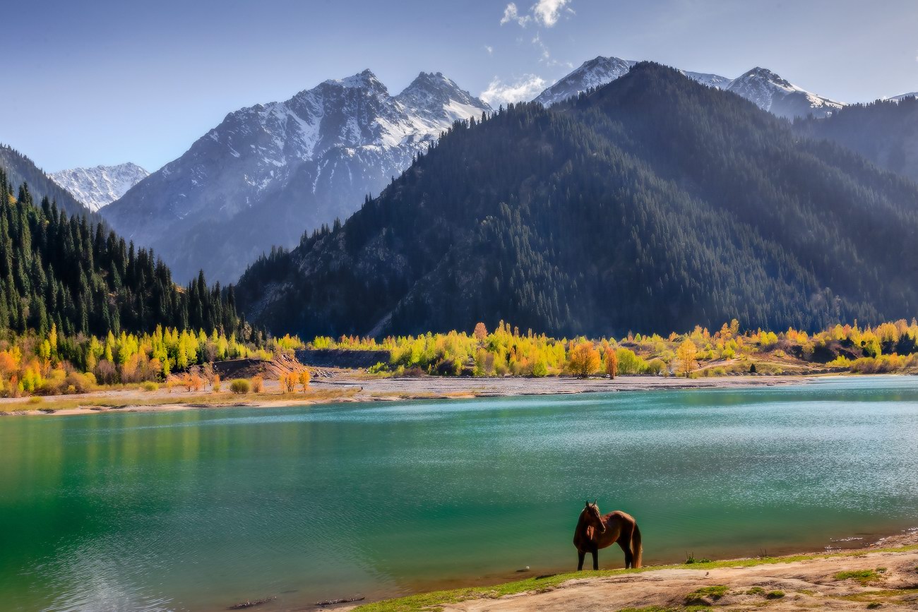
The pristine beauty of Lake Issyk
No comments · Posted by Sergei Rzhevsky in Nature, Photos, Travel
Issyk is a picturesque lake located in the Issyk gorge of the Trans-Ili Alatau mountain range, about 40 km east of Almaty, in the southern part of Almaty Oblast.
It was formed about 8-10 thousand years ago in a landslide that created a natural dam about 300 meters high. Initially, the length of Issyk was 1,850 m, width 500 m, depth 50-79 m. The water is green-blue. The height above sea level is about 1,700 m. Lake Issyk on Google Maps. Photos by: Leonid Dyachenko.
Tags: Almaty oblast
24
Amazing landscapes around Lake Tuzkol
No comments · Posted by Sergei Rzhevsky in Nature, Photos, Travel
Tuzkol is a salty mountain lake in Kazakhstan, located at an altitude of 1,959 m above sea level in Raiymbek District in the south-east of Almaty Oblast, about 310 km from Almaty. Translated from the Kazakh language, “tuzkol” means “salt lake”. The salinity of Lake Tuzkol varies with the seasons and is sometimes almost the same as in the Dead Sea in Israel or the Great Salt Lake in the US.
Raiymbek District is one of the most picturesque districts of Almaty Oblast. You can go there at any time of the year, but if you want to travel further into the mountains, the best time to go is from June to September. Lake Tuzkol on Google Maps. Photos by: Sergey Terekhov.
Tags: Almaty oblast · landscapes
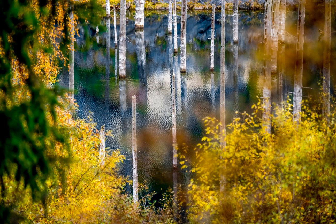
Lake Kaindy is located in the south-east of Kazakhstan in one of the gorges of the Kungey-Alatau mountain system at an altitude of 1,667 meters above sea level. The lake was formed as a result of the powerful Kemin earthquake in 1911.
The main feature of this unique natural reservoir is the trunks of the Tien Shan spruces, which protrude directly from the water. Before the earthquake, there was a spruce forest in the gorge. Scientists say that these trunks are about 150-200 years old. The wood is practically petrified and does not decompose.
Tags: Almaty oblast
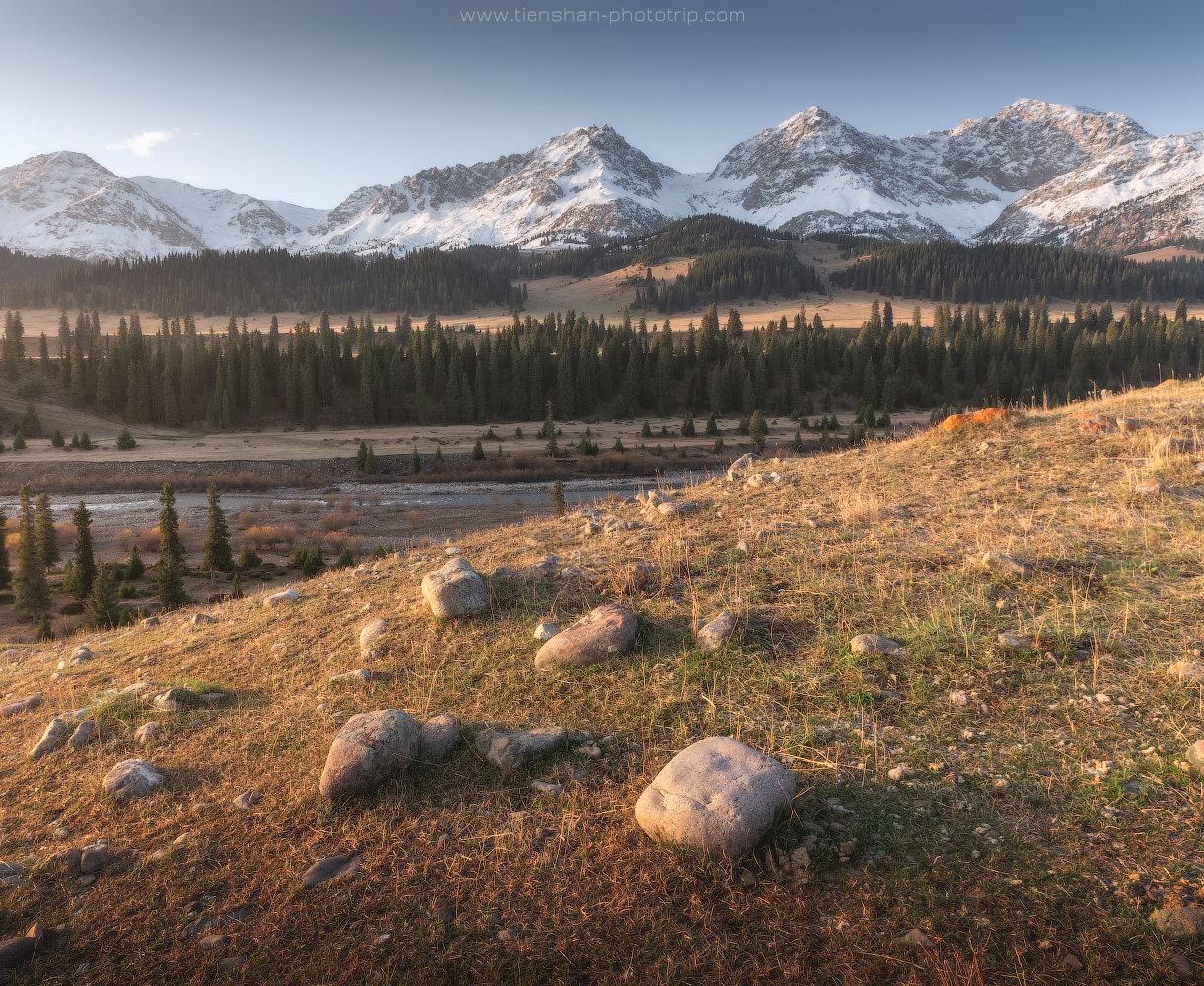
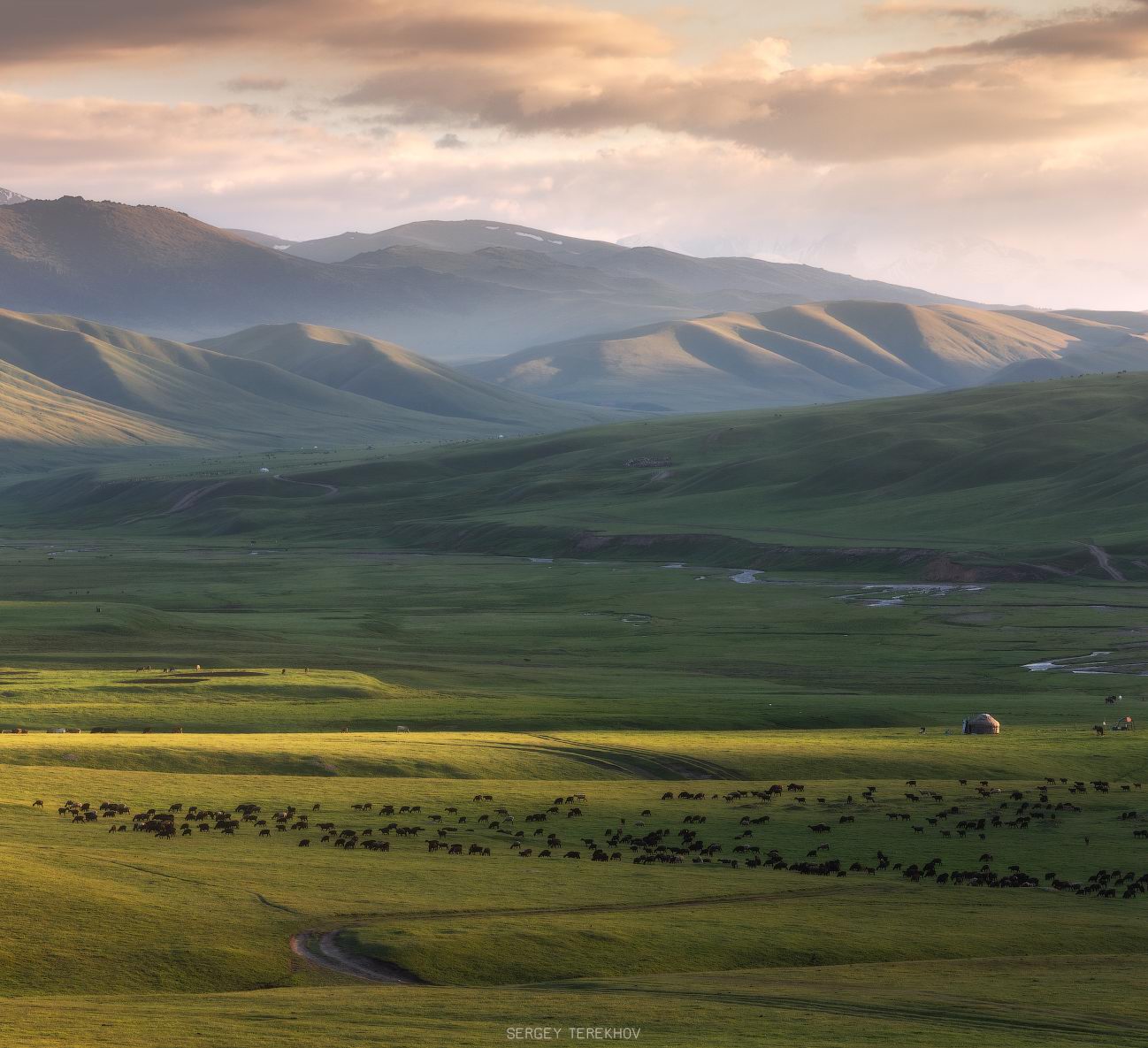
27
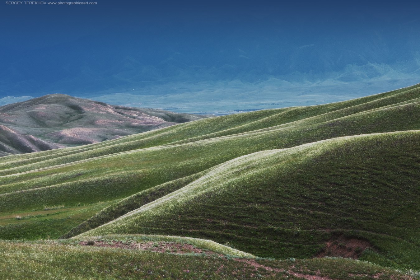
Breathtaking Landscapes of the Asy Plateau
No comments · Posted by Sergei Rzhevsky in Nature, Regions
The Asy Plateau is located in the south of Almaty Oblast at an altitude of about 2,200-2,750 meters above sea level. In the distant past, it was a place through which the routes of caravans from Europe and Central Asia to China and India ran.
The Asy-Turgen observatory can be found at the western end of the plateau. Today, this place is used as a summer pasture and attracts tourists. The Asy Plateau on Google Maps. Photos by: Sergey Terekhov.

Tags: Almaty oblast
18
Bizarre saline lakes south of Lake Balkhash
No comments · Posted by Sergei Rzhevsky in Nature, Regions
The vast territory south of Lake Balkhash is called Semirechye (“the region of seven rivers”) because of seven large rivers that flow into Balkhash, one of the largest lakes in Central Asia.
The soils in this region are mostly desert and rich in various minerals. In spring, numerous lakes are formed on the salt marshes, which are of a seasonal nature; by the end of summer they dry up. As a result, minerals form very bizarre patterns on the surface of these formations. Photos by: Grigory Bedenko.
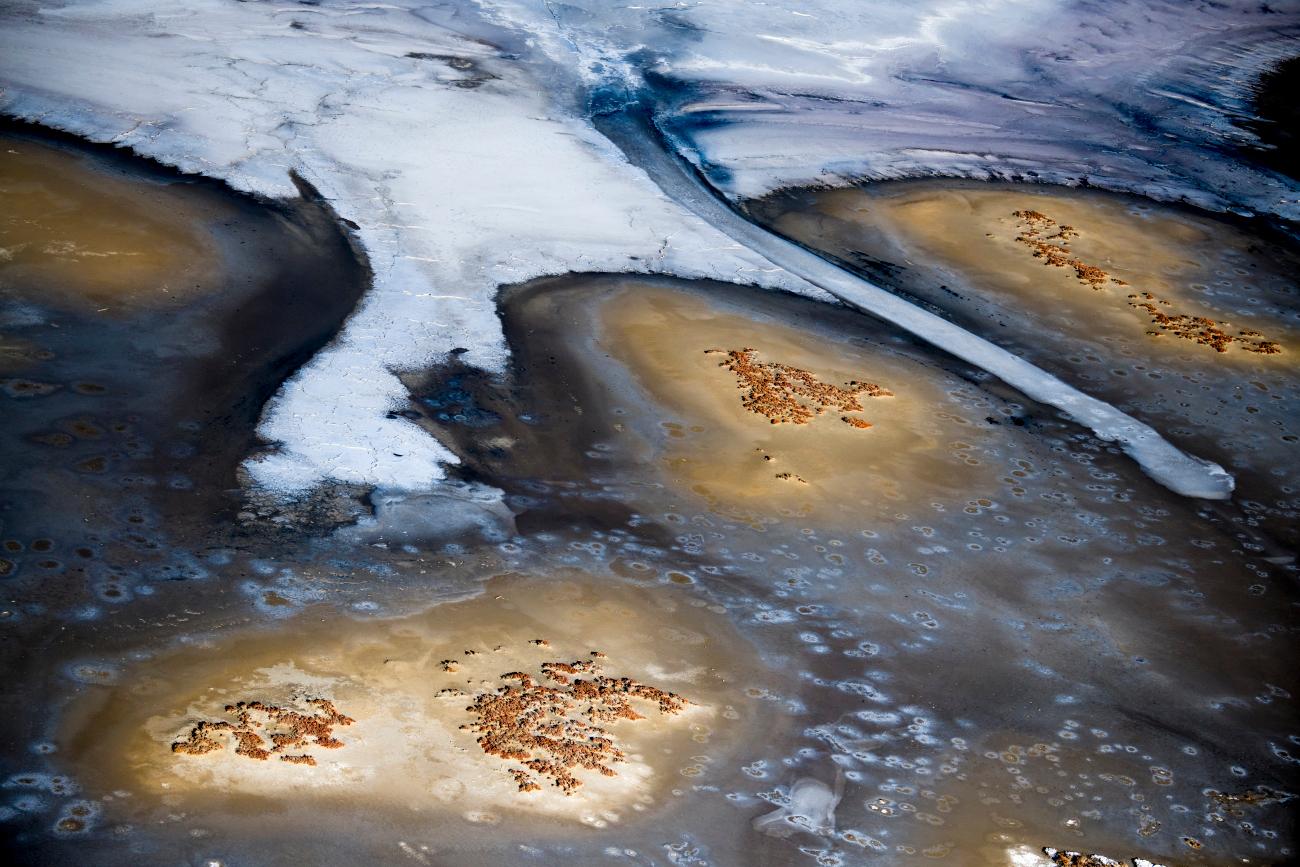
Tags: Almaty oblast
25
Autumn in the valley of the Tekes River
No comments · Posted by Sergei Rzhevsky in Nature, Regions
The Tekes is a 438 km long river, of which about 100 km flows through the territory of Kazakhstan, including 40 km inside the territory of Kazakhstan and about 60 km along the border of Kazakhstan and China.
The river originates on the northern slope of the Terskey Alatau Range. In Kazakhstan, the river flows mainly in a picturesque wide intermountain valley, which separates the Eastern Tien Shan from the Ketmen Ridge. This is one of the most beautiful places in Almaty Oblast, which, however, is little known to tourists. The Tekes River on Google Maps. Photos by: Sergey Terekhov.
Tags: Almaty oblast
29
Glaciers and Lakes of Trans-Ili Alatau
No comments · Posted by Sergei Rzhevsky in Nature, Regions
Trans-Ili Alatau is a mountain range located in the northwest of the Tien Shan mountain system, on the border of Kazakhstan and Kyrgyzstan. The city of Almaty, the former capital of Kazakhstan, is located in its northern foothills, as well as the famous Medeo sports complex, Assy-Turgen Observatory, and the alpine ski resort Chimbulak.
The name “Trans-Ili Alatau” was adopted in 1865, when the famous traveler and geographer P.P. Semenov stopped at the crossing of the Ili River and saw a grand ridge that stretched behind the river. Trans-Ili Alatau on Google Maps. Photos by: Grigory Bedenko.
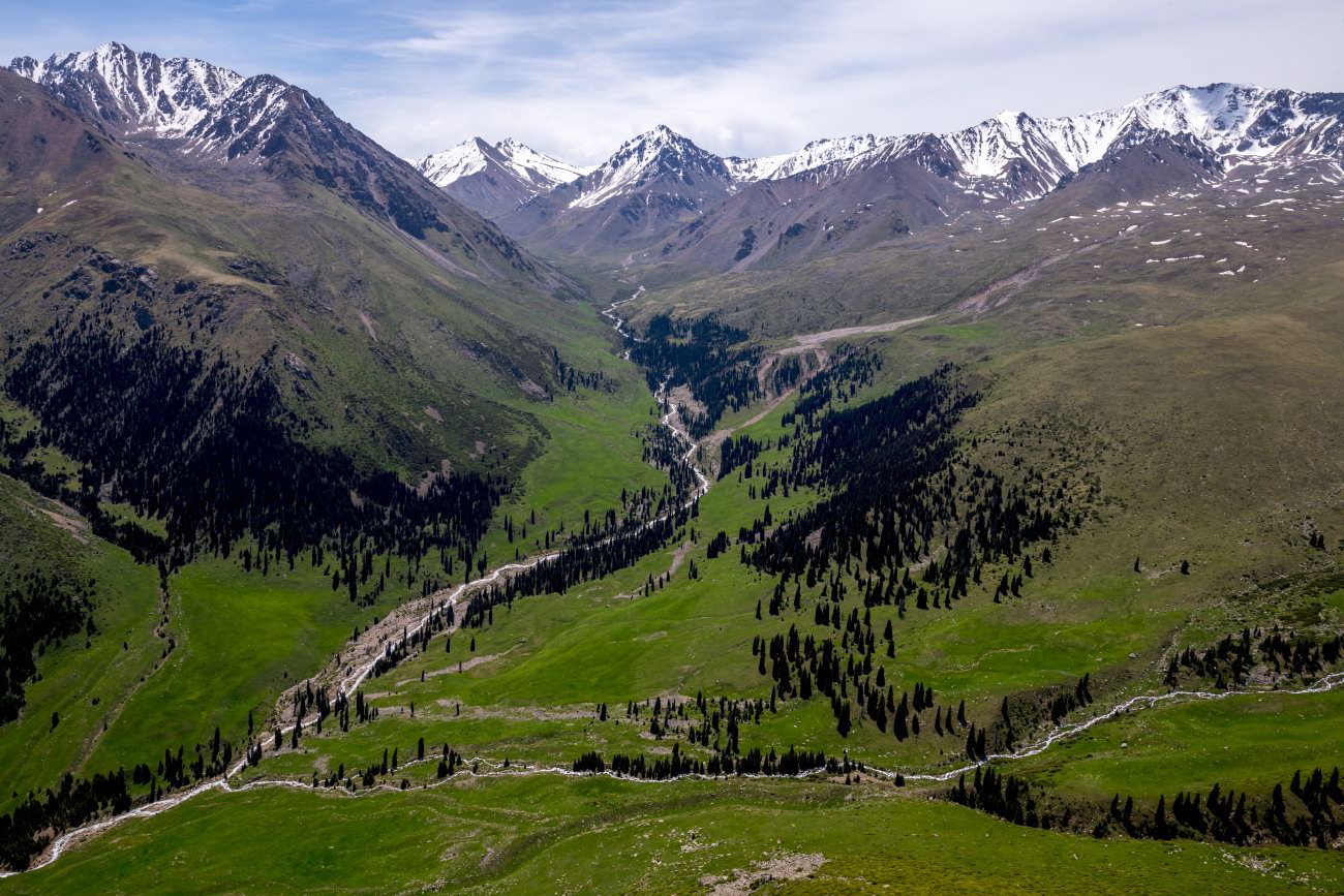
Tags: Almaty oblast
Aktau Mountains (translated as “white mountains”) are chalk mountains of different colors, mostly white, located in the territory of the national park of Altyn-Emel in the central part of Almaty Oblast. It will take you about 5-7 hours to get here from Almaty. Aktau Mountains on Google Maps. Photos by: Sergey Terekhov.
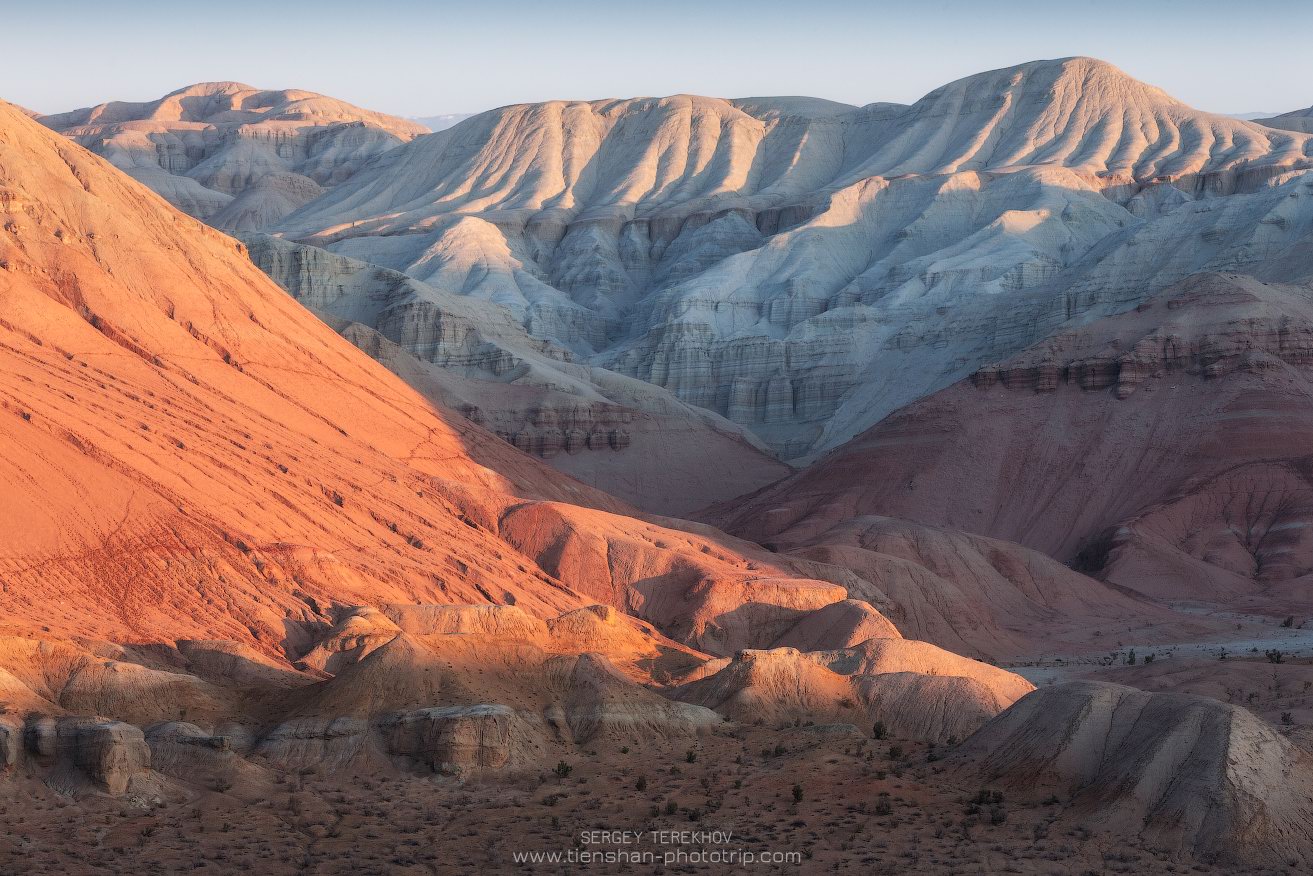
Tags: Almaty oblast
7
Picturesque Mountain Plateau of Asy
No comments · Posted by Sergei Rzhevsky in Nature, Regions, Travel
Asy (Assy), a mountain plateau located at an altitude of 2,560 meters above sea level about 100 kilometers east of Almaty, is one of the largest intermountain valleys of the Northern Tien Shan. The length of the plateau is more than 20 km, the width – up to 15 km.
In summer, this area is used as a huge pasture. The best time to visit the plateau is the end of May – the beginning of June, when numerous herbs bloom here. Asy Plateau on Google Maps. Photos by: Sergey Terekhov.
Tags: Almaty oblast
