
TAG | East Kazakhstan oblast
22
Beautiful landscapes in the very east of Kazakhstan
No comments · Posted by Sergei Rzhevsky in Regions, Travel
The Katon-Karagay district occupies the north-eastern part of the territory of East Kazakhstan Oblast. It is the easternmost part of the country bordering China and Russia.
The Katon-Karagay State National Natural Park located here is the largest national park in Kazakhstan and is included in the UNESCO list of specially protected heritage. This territory is remote, inaccessible, and very picturesque. Photos by: Sergey Terekhov.


Tags: East Kazakhstan oblast
7
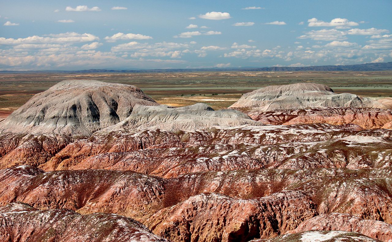
Amazing Landscapes of the Valley of Kiin Kirish
No comments · Posted by Sergei Rzhevsky in Nature, Regions, Travel
Kiin Kirish, an amazingly picturesque clay canyon, is a unique natural monument located 120 km southeast of the town of Kurshim in the East Kazakhstan region and covers an area of 300 hectares.
This place is also known as “The Town of Spirits”. Multicolored clays, eroded by water and wind, form vivid, bizarre landscapes here. The optimal time for a trip is 3-4 days. Kiin Kirish on Google Maps. Photos by: Sergey Silantjev.
Tags: East Kazakhstan oblast · Ust-Kamenogorsk city
1
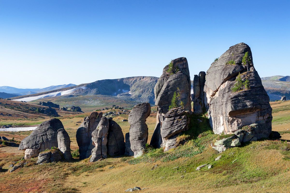
Rock Formations of the Western-Altai Reserve
No comments · Posted by Sergei Rzhevsky in Nature, Regions
The Western-Altai State Nature Reserve was established with the goal of comprehensive protection of the Altai mountain system in 1992. It covers an area of about 56 thousand hectares at the northeastern border of the East Kazakhstan region, 60 km east of the city of Ridder.
This territory has a complex geological history. Here you can see picturesque rock formations – geological monuments of the distant past. The Western-Altai Reserve on Google Maps. Photos by: Ilya Afanasyev.
Tags: East Kazakhstan oblast · Ridder city
15
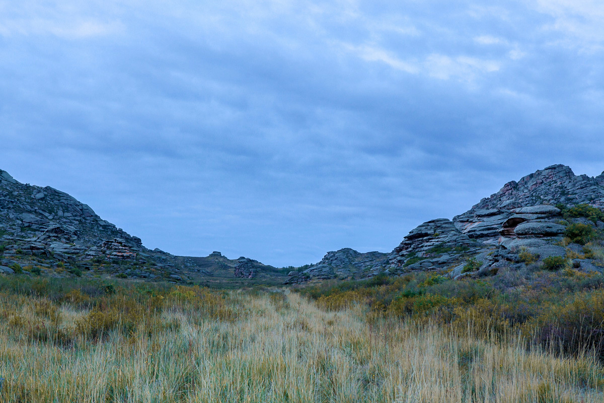
Rocky Scenery of the Arkat Mountains
No comments · Posted by Sergei Rzhevsky in Nature, Photos, Regions
The Arkat Mountains are located in the central part of the East Kazakhstan region, in the area of the settlement of Arkat.
The mountains are very old and almost completely destroyed by erosion except for separately standing rocks. However, despite this, the local landscapes are very picturesque and attract people who prefer active rest. The Arkat Mountains on Google Maps. Photos by: Ilya Afanasyev.
Tags: East Kazakhstan oblast
31
The beauty of the lakes Alakol and Balkhash
No comments · Posted by Sergei Rzhevsky in Nature, Photos, Regions
Alakol in Kazakh means “multi-colored lake.” It is situated on the border of the east and southeast of Kazakhstan. In the south-western part its water is clean and very clear, in the north-east – the water is muddy.
The lake water is strongly mineralized and is considered therapeutic. The length of the lake is 104 kilometers, the maximum width – 52 kilometers, the depth – 54 meters. Lake Alakol on Google Maps. Photos by: Grigoriy Bedenko.
Tags: Almaty oblast · East Kazakhstan oblast
30
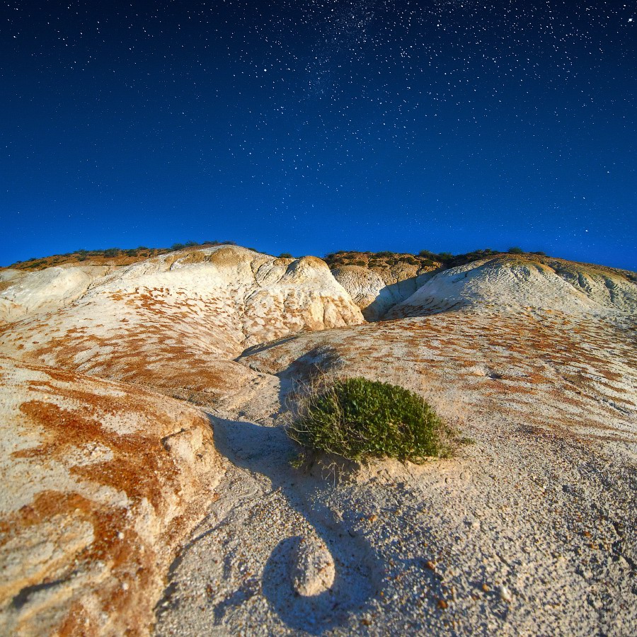
Nights of the East Kazakhstan
No comments · Posted by Sergei Rzhevsky in Nature, Photos, Regions
Let’s enjoy beautiful night landscapes of the East Kazakhstan region.
The following photos were taken in such wonderful places as Bukhtarma reservoir (the largest water reservoir in Kazakhstan), Lake Zaisan, Cape Shekelmes, Kiin-Kirish Canyon. Photos by: Anna Anikina.
Tags: East Kazakhstan oblast
24
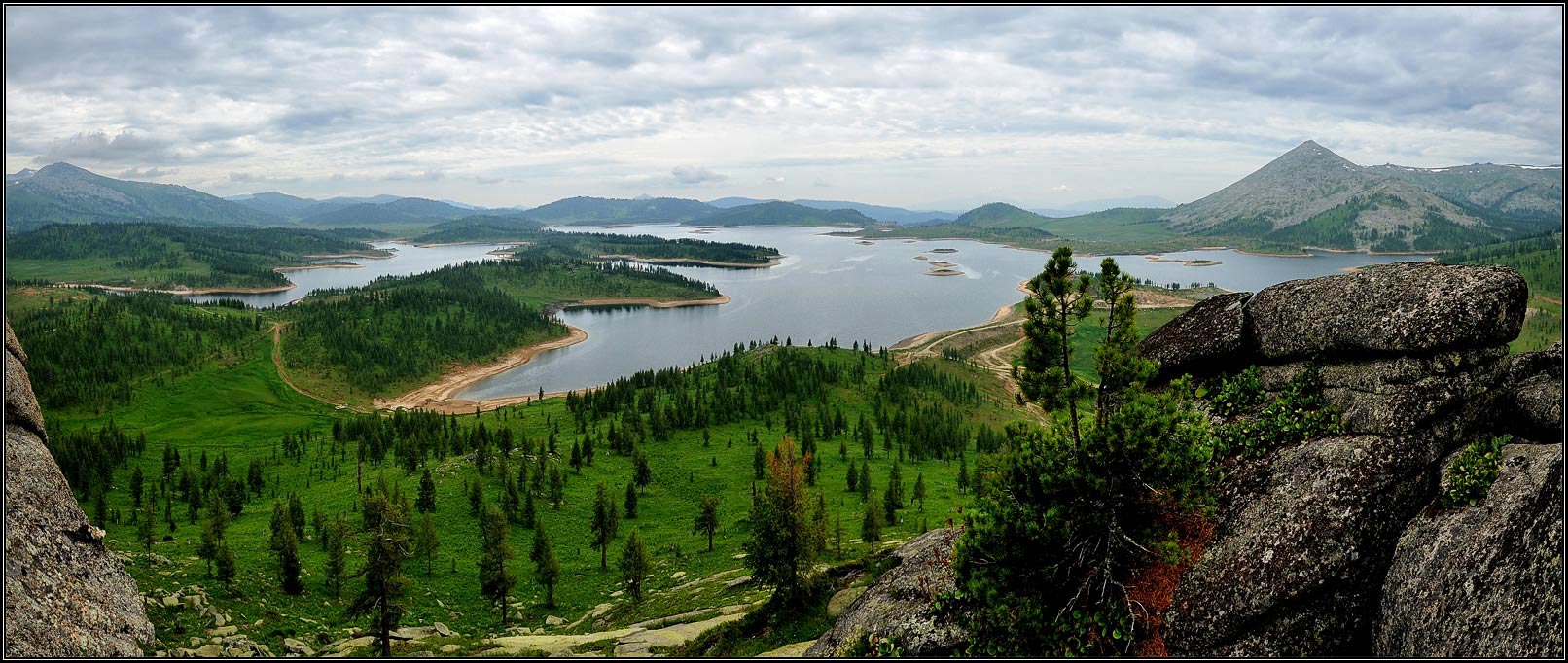
Beautiful Maloulbinskoe Reservoir
No comments · Posted by Sergei Rzhevsky in Photos, Regions, Technology
Maloulbinskoe reservoir, located about 20 km to the south-east of Ridder city (East Kazakhstan region), was built by prisoners of war and convicts in 1938.
Today, this place is a historical landmark in the field of engineering and technology. To some extent, the reservoir is an open-air museum. Maloulbinskoe reservoir on Google Maps. Photo by: Alexey Maznicin.
Tags: East Kazakhstan oblast · Ridder city
14
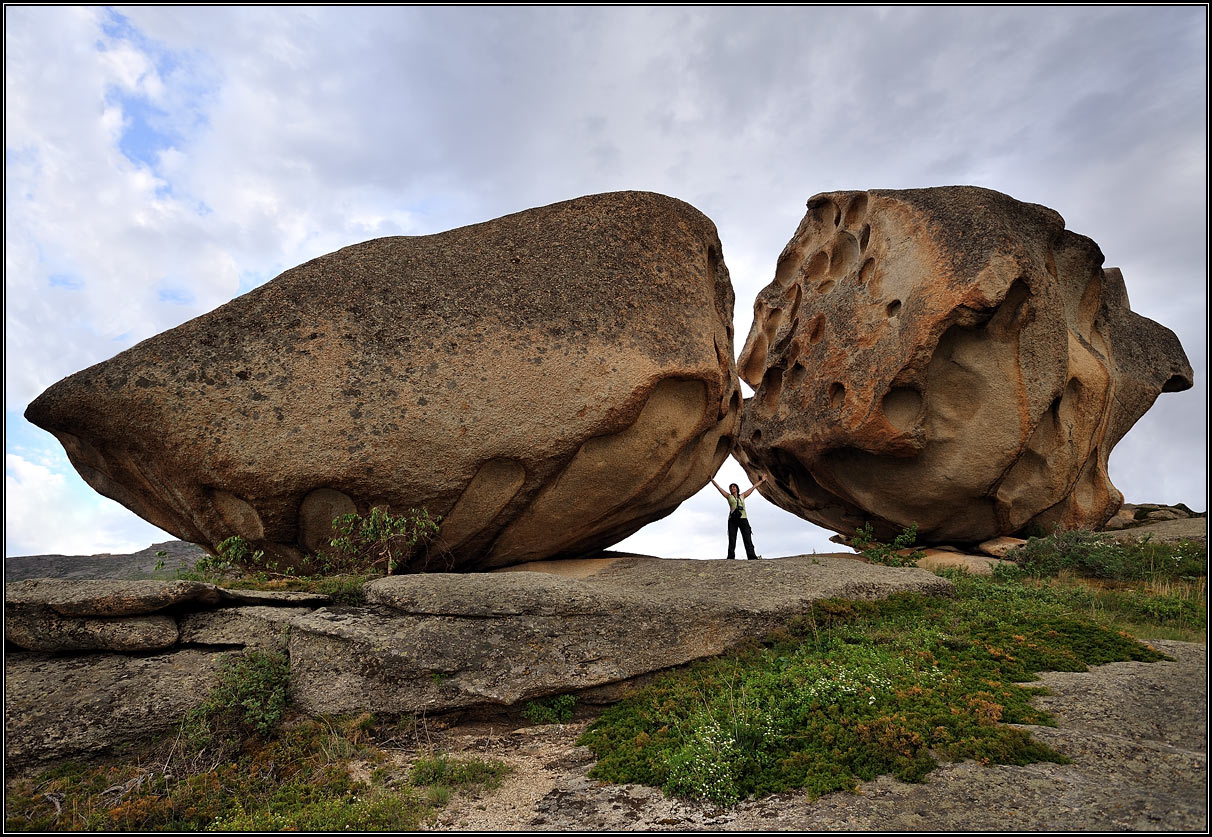
Giant boulders on the shores of Lake Dubygalinskoe
No comments · Posted by Sergei Rzhevsky in Nature, Regions, Travel
Lake Dubygalinskoe (also known as Lake Okun’ki) is located in Ulansky district of East Kazakhstan region. It is situated at the foot of the northern slopes of Mount Dubygaly.
Besides the fact that this lake is a great place for fishing, it attracts travelers for its giant boulders picturesquely scattered along the shores. Lake Okun’ki on Google Maps. The photos were taken by Alexey Maznicin.
Tags: East Kazakhstan oblast · landscapes
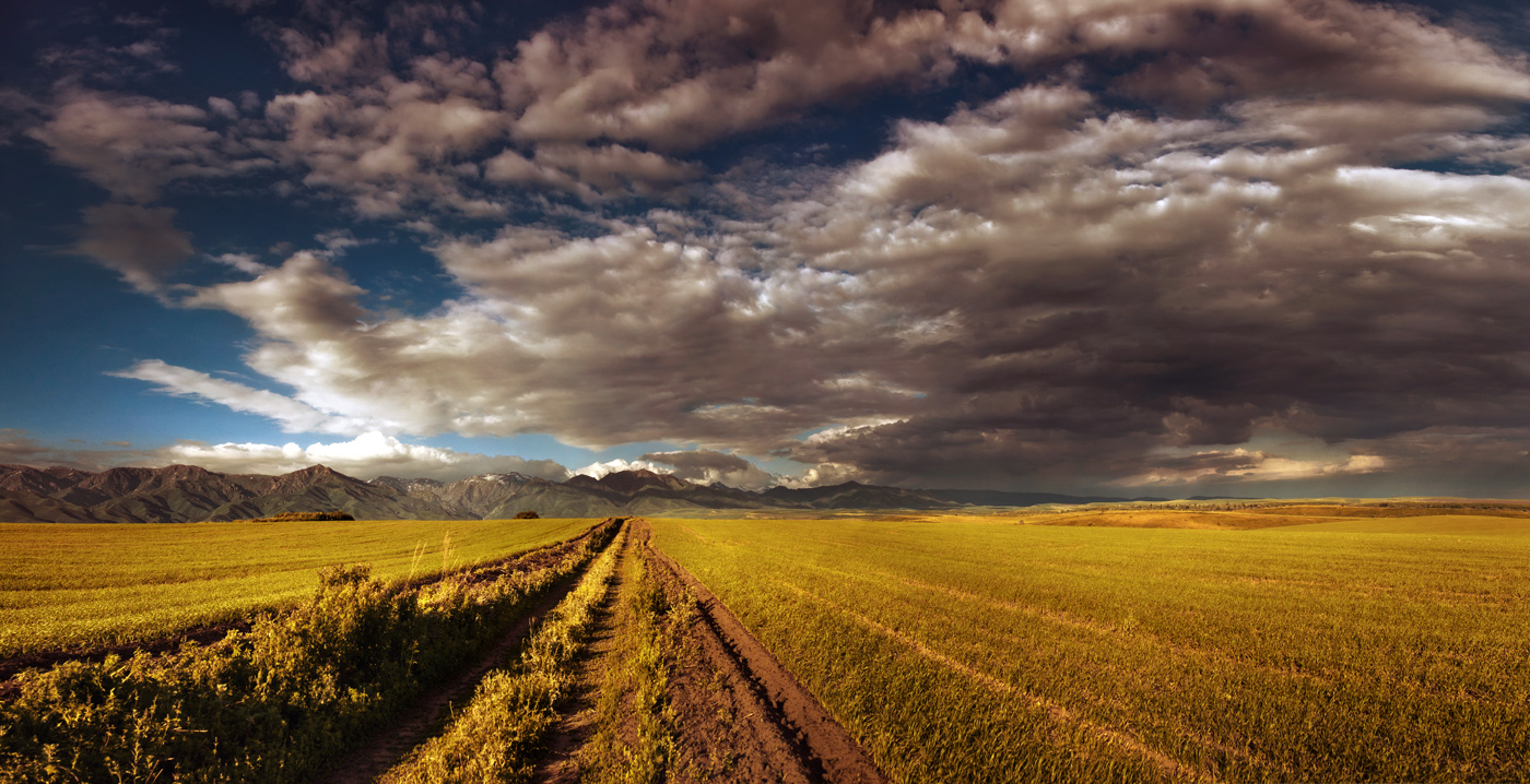
Kazakhstan is known as the land of steppes and this beautiful picture taken in East Kazakhstan region of the country can be a nice illustration of this fact. Photo by Arina Ratushnova-Osintseva
Tags: East Kazakhstan oblast · landscapes
31
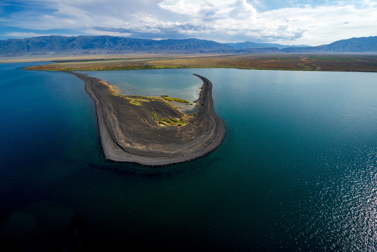
Flaming sand of Lake Zaysan
No comments · Posted by Sergei Rzhevsky in Nature, Regions, Travel
Zaysan is a relatively large lake (length – 105 km, width – 22-48 km) located in eastern Kazakhstan (East Kazakhstan oblast), about 60 km from the border with China.
Shekelmes Bay has almost perfect semicircular shape. There is a belief that the bizarre metamorphosis of sand that you can see in this place is a result of the fall of a meteorite on the shore of the lake. Lake Zaysan on Google Maps. Photos by Ilia Afanasieff
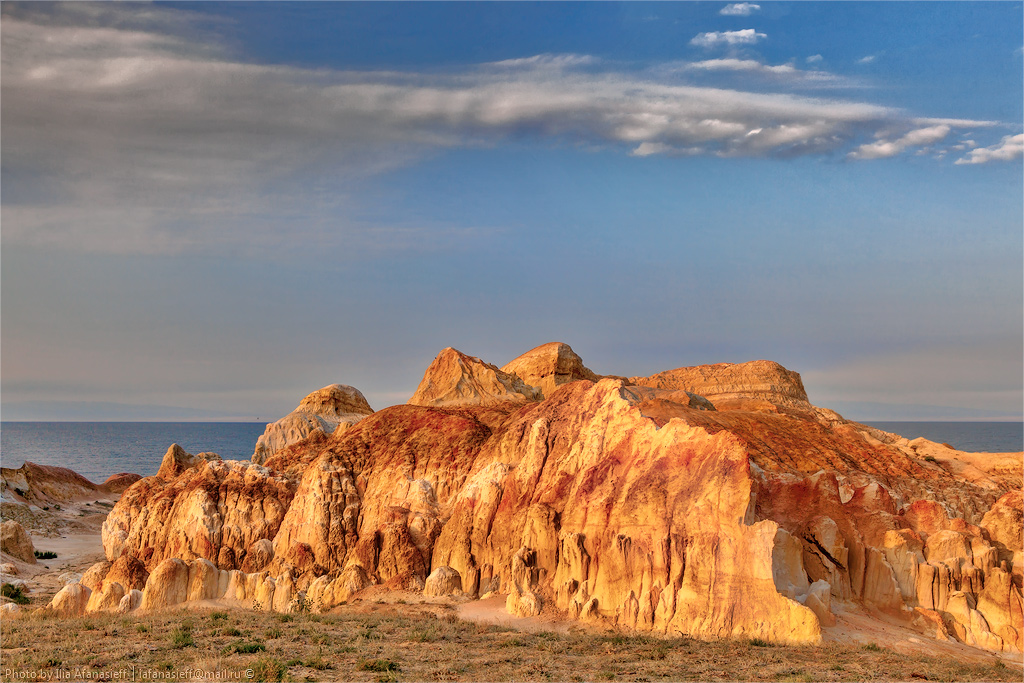
Tags: East Kazakhstan oblast · landscapes
