
CAT | Nature
10
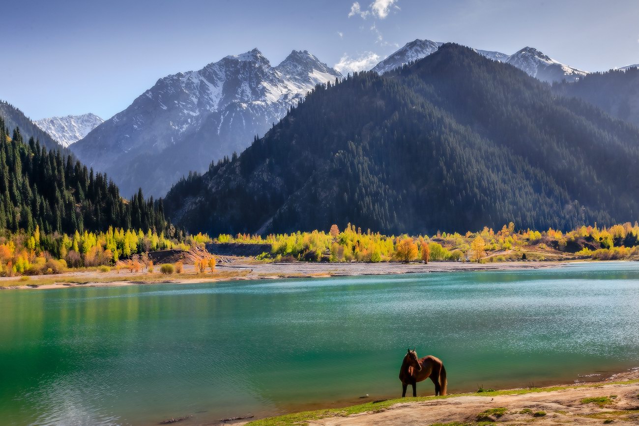
Magnificent Landscapes of the Northern Tian Shan
No comments · Posted by Sergei Rzhevsky in Nature, Photos, Regions
The Tian Shan is a mountain system located in Central Asia in the territory of five countries: Kyrgyzstan, Kazakhstan, China (Xinjiang Uygur Autonomous Region), Tajikistan, and Uzbekistan. It is one of the highest mountain systems in the world with more than thirty peaks over 6,000 meters high.
Let’s look at the landscapes of the northern part of the Tien Shan located in Kazakhstan, near Almaty. The mountains of the Northern Tian Shan are the most visited in Kazakhstan. Photos by: Grigory Bedenko.
Big Almaty Lake located at an altitude of 2,511 meters above sea level.
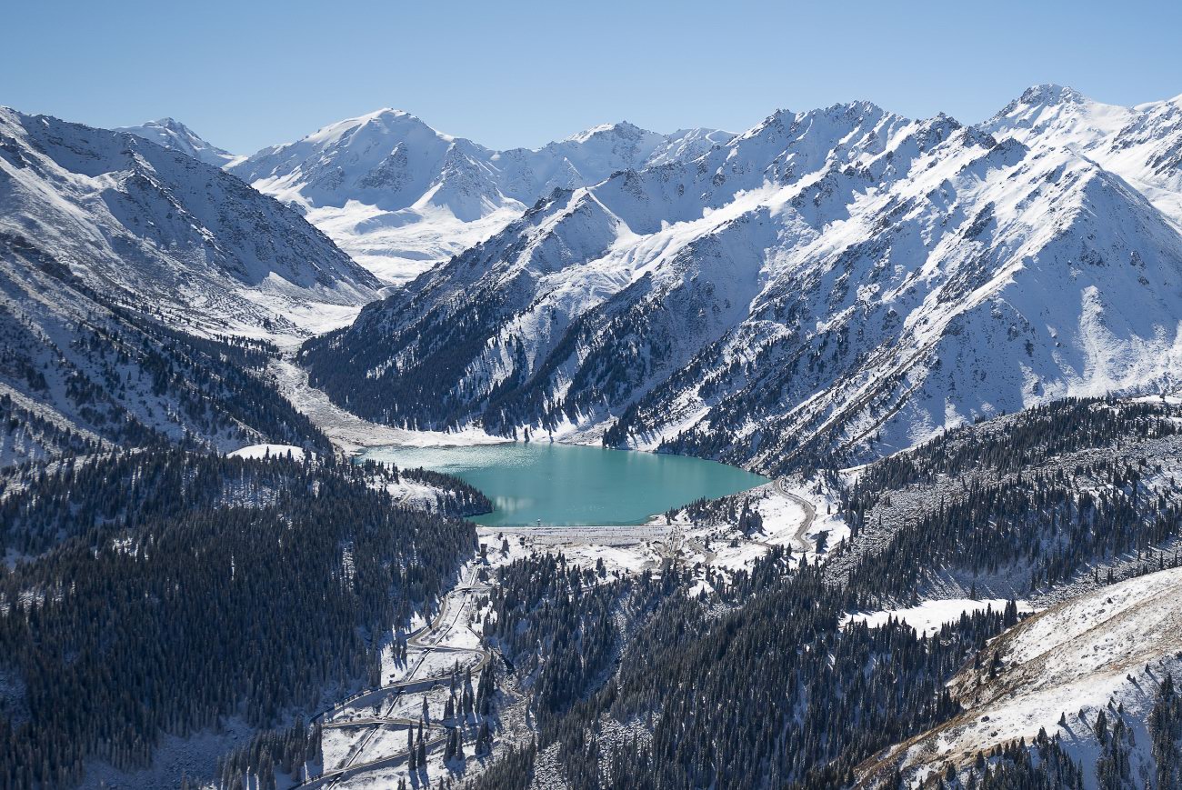
fly over the Northern Tian Shan

Tags: Almaty oblast
13
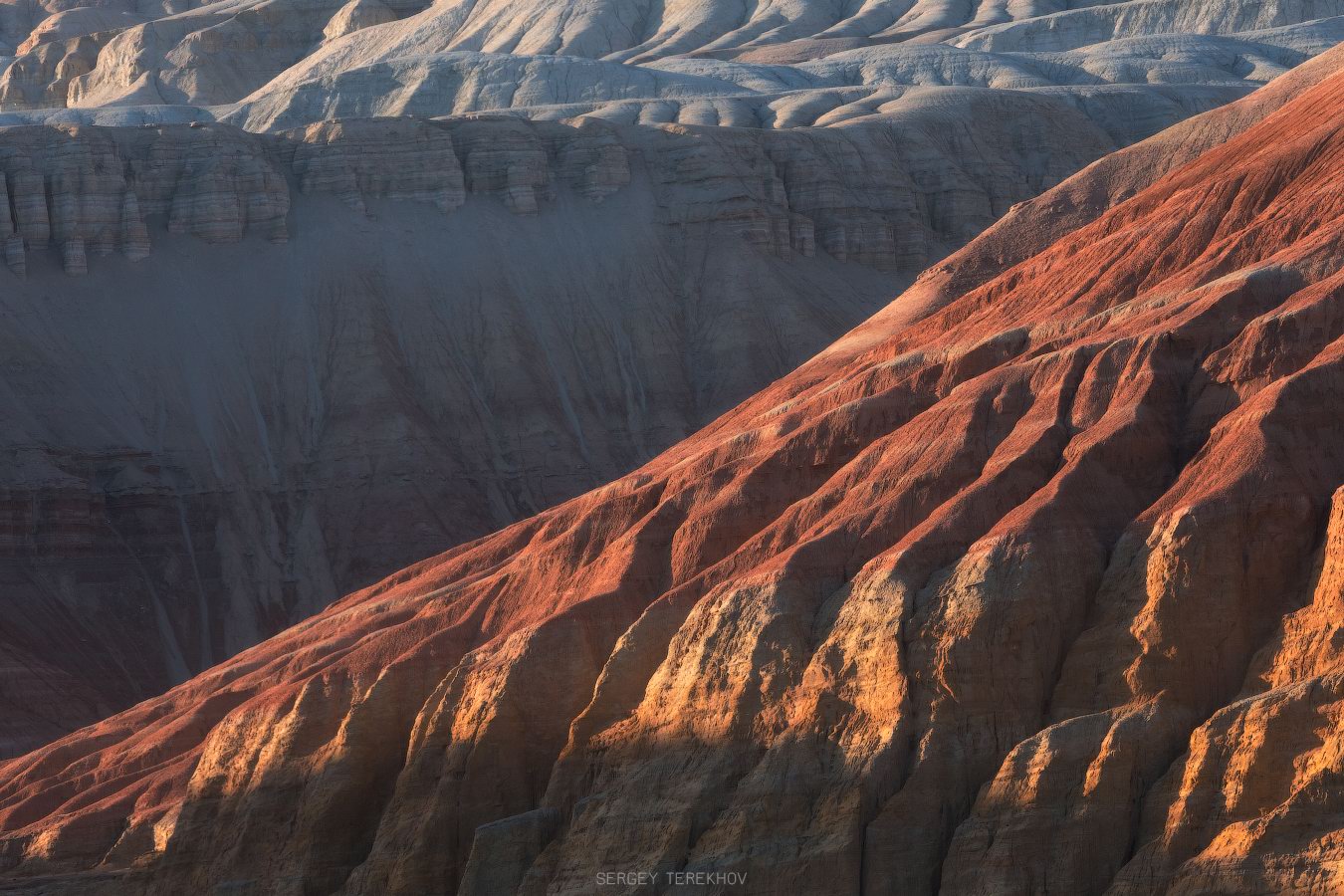
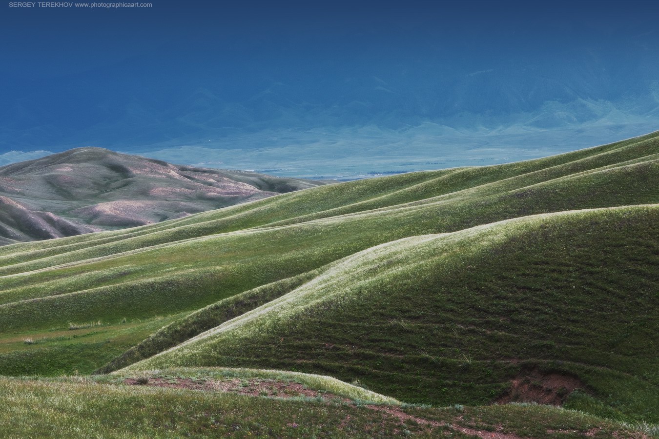
Colorful Landscapes of the Aktau Mountains
No comments · Posted by Sergei Rzhevsky in Nature, Regions, Travel
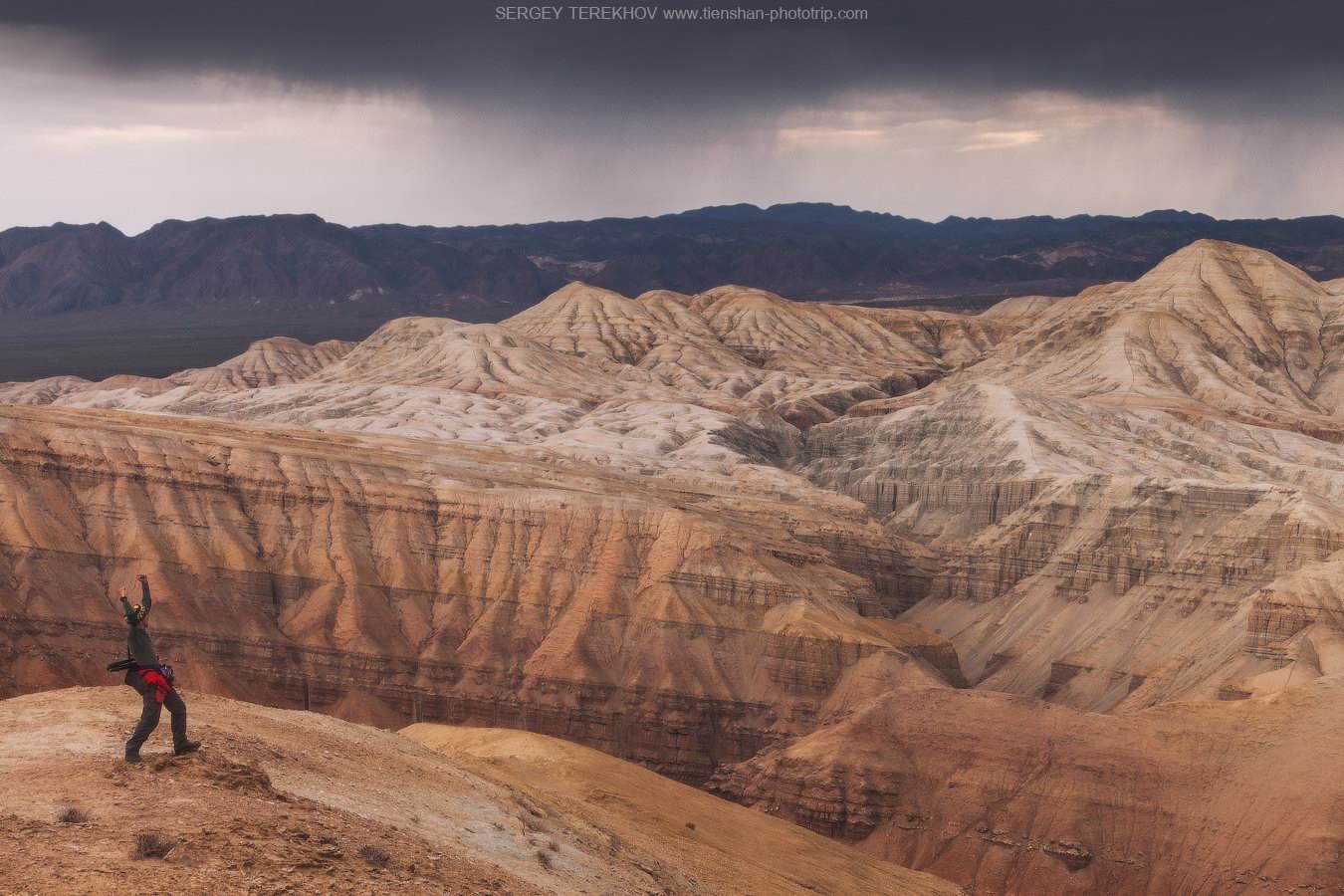
The chalk mountains of Aktau (literally “white mountains”), located about 260 km northeast of Almaty, is a unique natural monument that is part of the Altyn Emel National Park.
These multi-colored hills formed from bluish-gray sandstone and red clay, interspersed with yellow and pink cornelian, jasper, and white quartz, look like a layer cake. The height of the geological deposits reaches hundreds of meters. The Aktau Mountains on Google Maps. Photos by: Sergey Terekhov.
Tags: Almaty oblast
1
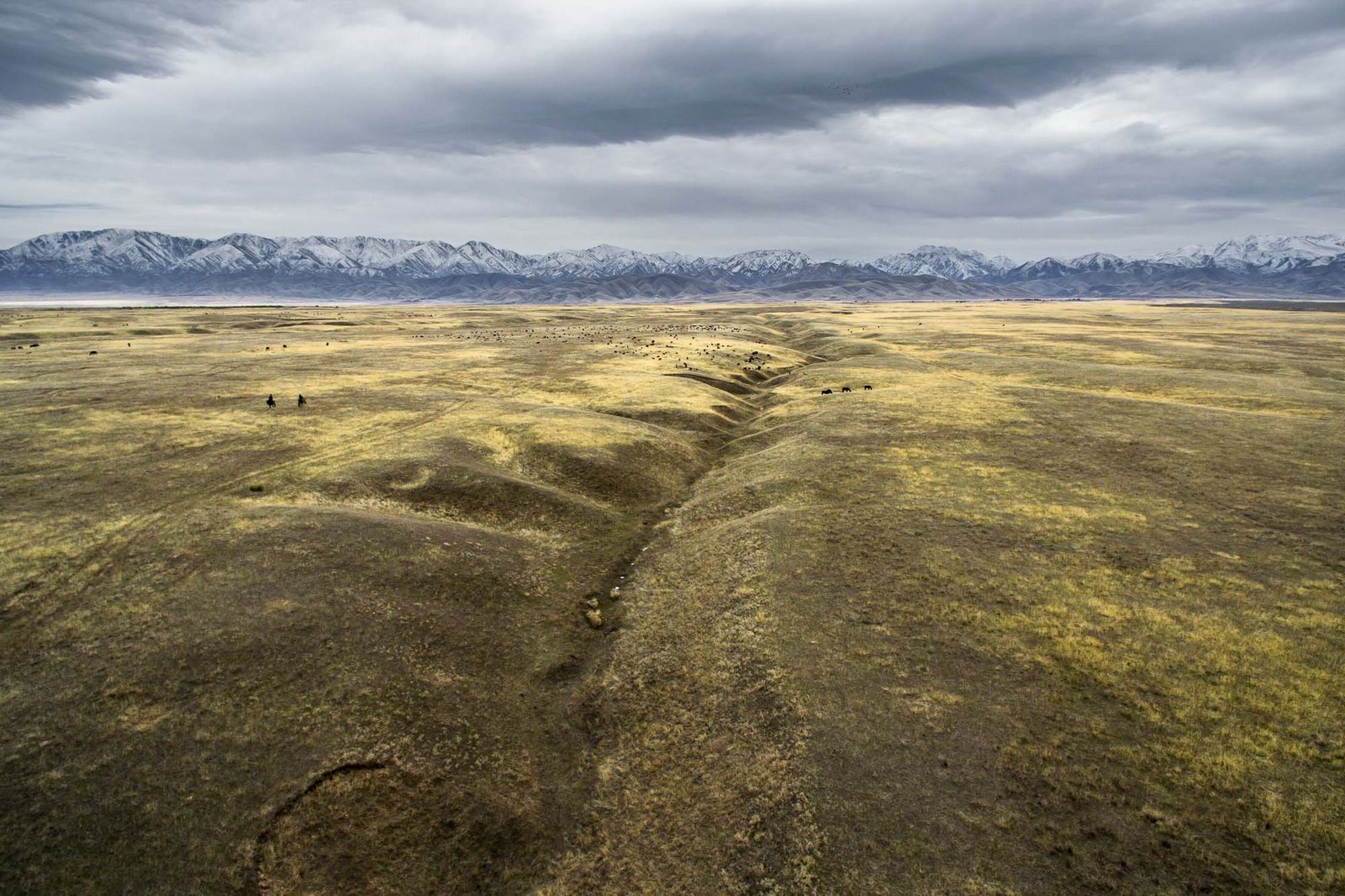
Amazing Landscapes of Southern Kazakhstan
No comments · Posted by Sergei Rzhevsky in Nature, Regions, Travel
Southern Kazakhstan is the most densely populated part of the country. Here the largest cities of Kazakhstan, Almaty and Shymkent, are located.
The landscapes of Southern Kazakhstan are surprisingly diverse and represent a combination of arid, rather cold (in winter) and hot (in summer) sparsely populated steppes and deserts, snow-capped mountains, and densely populated foothills. Photos by: Dmitry Balakirev.
Famous boundless steppes of Kazakhstan – one of the symbols of the country.
Tags: Almaty oblast · South Kazakhstan oblast
13
The Valley of Stone Balls on Mangyshlak Peninsula
No comments · Posted by Sergei Rzhevsky in Nature, Regions, Travel
Mangyshlak Peninsula is located on the eastern coast of the Caspian Sea in Kazakhstan. Mangystau Oblast is located on its territory.
One of the natural attractions of the peninsula is the Torysh Tract, which is located about 105 km north of the city of Aktau on the western end of the Western Karatau Ridge, 17 km east of the village of Tauchik.
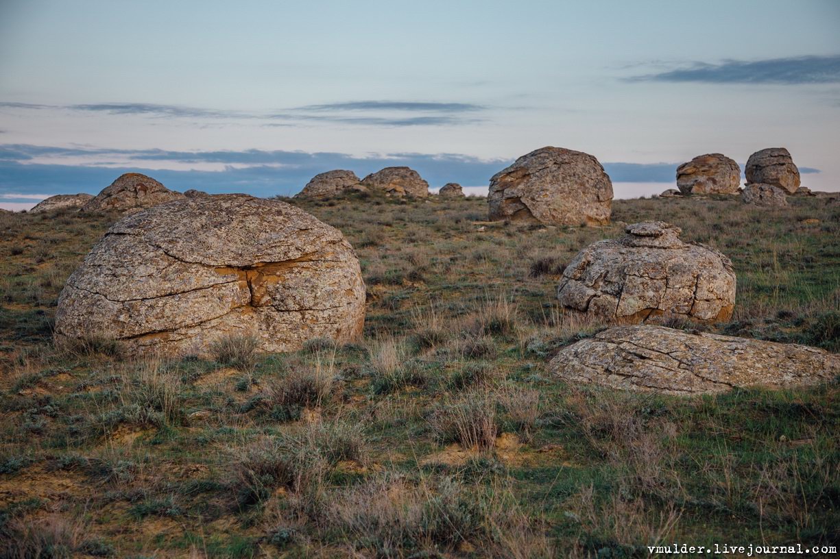
picturesque geological formations
Tags: Aktau city · Mangystau oblast
5
8 Best National Parks to Explore Worldwide
No comments · Posted by Sergei Rzhevsky in Nature, Travel
Exploring national parks worldwide offers a unique opportunity to experience some of nature’s most breathtaking landscapes and diverse ecosystems. From the dramatic fjords of New Zealand to the vast savannas of Tanzania, these protected areas are celebrated for their stunning beauty, rich biodiversity, and outdoor adventure opportunities.
Each park provides a distinct glimpse into the natural world, whether it’s through witnessing the annual wildebeest migration in the Serengeti or hiking the rugged trails of Torres del Paine. Whether you seek thrilling wildlife encounters, serene natural beauty, or challenging hikes, these national parks offer unforgettable experiences that highlight the wonders of our planet and inspire a deeper appreciation for the environment.
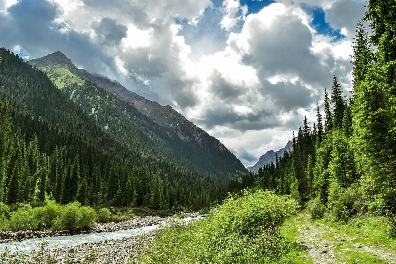
Image by trejlerfilms from Pixabay
Tags: No tags
3
The Aktau Mountains – a Unique Natural Monument
No comments · Posted by Sergei Rzhevsky in Nature, Photos, Travel
The Aktau (“White”) Mountains, located in the Altyn Emel National Park in the south-east of Kazakhstan in Almaty Oblast, arose on the territory where the waters of an ancient ocean used to splash in the era when dinosaurs inhabited the Earth. They are about 400 million years old.
These colorful chalky hills, formed from bluish-gray sandstone and red clay, interspersed with yellow and pink cornelian, jasper and white quartz, reminiscent of a layer cake. These lifeless slopes, made of fragile rocks, intricately cut by erosion, are so unusual that it is impossible to take your eyes off them. Photos by: Sergey Terekhov.
Tags: Almaty oblast
13
Bizarre Rocks of the Kent Mountains
No comments · Posted by Sergei Rzhevsky in Nature, Regions, Travel
The Kent Mountains, one of the oldest mountain ranges on Earth, is a very picturesque and unique natural and historical area. It is located in the Karkaraly district of Karaganda Oblast in central Kazakhstan and is part of Karkaraly National Park.
These mountains (the highest point is Mount Tursun, 1,469 meters high) is an island massif that rises like an impregnable granite wall above the surrounding steppe. A lot of mountain rivers and streams flow down from the mountains; through their valleys you can get inside this huge granite island and enjoy majestic views of pristine nature with bizarre rocks, boulders and ridges. The Kent Mountains on Google Maps. Photos by: Zekkadrb.
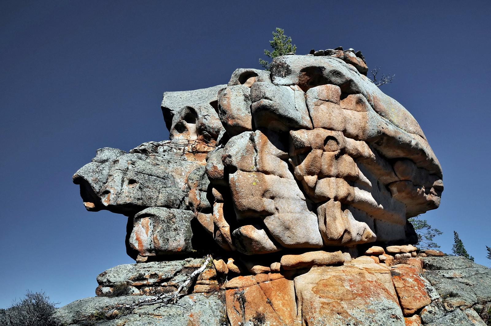
trekking in the ancient mountains
Tags: Karaganda oblast
26
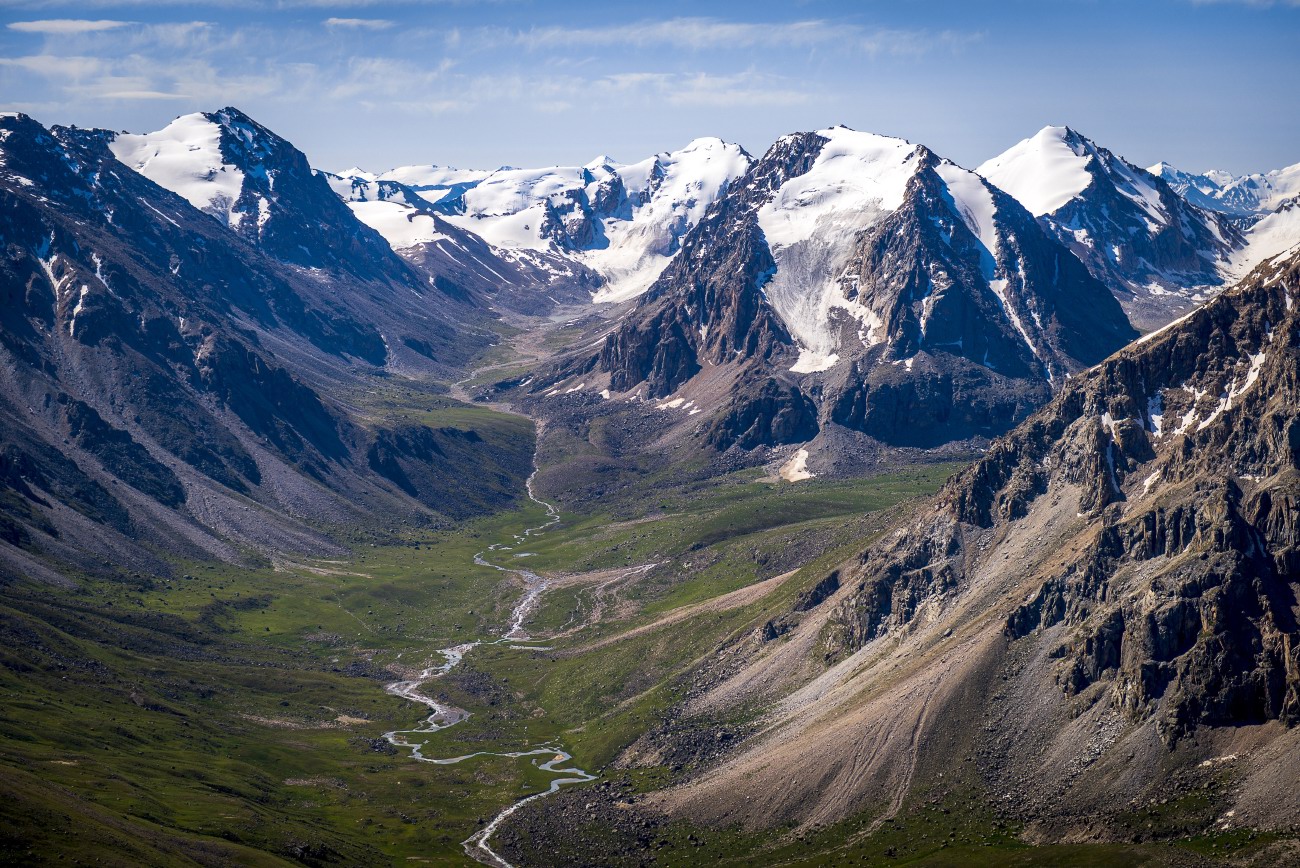
Glaciers and Lakes of the Dzungarian Alatau
No comments · Posted by Sergei Rzhevsky in Nature, Photos, Regions
The Dzungarian or Semirechensky Alatau is a mountain system located in the north-east of the Almaty region, between the Ili River and Lake Alakol.
This region is a place with pristine nature because it is located in the border zone with China. There are no roads and settlements here. Some areas can be reached only on horseback or by helicopter. Photos by: Grigory Bedenko.
Tags: Almaty oblast
25
The pristine beauty of Lake Issyk
No comments · Posted by Sergei Rzhevsky in Nature, Photos, Travel
Issyk is a picturesque lake located in the Issyk gorge of the Trans-Ili Alatau mountain range, about 40 km east of Almaty, in the southern part of Almaty Oblast.
It was formed about 8-10 thousand years ago in a landslide that created a natural dam about 300 meters high. Initially, the length of Issyk was 1,850 m, width 500 m, depth 50-79 m. The water is green-blue. The height above sea level is about 1,700 m. Lake Issyk on Google Maps. Photos by: Leonid Dyachenko.
Tags: Almaty oblast
24
Amazing landscapes around Lake Tuzkol
No comments · Posted by Sergei Rzhevsky in Nature, Photos, Travel
Tuzkol is a salty mountain lake in Kazakhstan, located at an altitude of 1,959 m above sea level in Raiymbek District in the south-east of Almaty Oblast, about 310 km from Almaty. Translated from the Kazakh language, “tuzkol” means “salt lake”. The salinity of Lake Tuzkol varies with the seasons and is sometimes almost the same as in the Dead Sea in Israel or the Great Salt Lake in the US.
Raiymbek District is one of the most picturesque districts of Almaty Oblast. You can go there at any time of the year, but if you want to travel further into the mountains, the best time to go is from June to September. Lake Tuzkol on Google Maps. Photos by: Sergey Terekhov.
Tags: Almaty oblast · landscapes
