
CAT | Regions
15
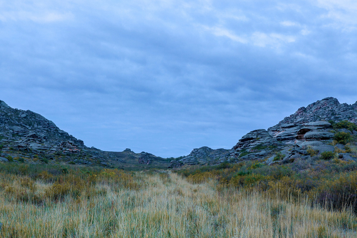
Rocky Scenery of the Arkat Mountains
No comments · Posted by Sergei Rzhevsky in Nature, Photos, Regions
The Arkat Mountains are located in the central part of the East Kazakhstan region, in the area of the settlement of Arkat.
The mountains are very old and almost completely destroyed by erosion except for separately standing rocks. However, despite this, the local landscapes are very picturesque and attract people who prefer active rest. The Arkat Mountains on Google Maps. Photos by: Ilya Afanasyev.

Tags: East Kazakhstan oblast
13
Late Autumn in the Southeast of Kazakhstan
No comments · Posted by Sergei Rzhevsky in Nature, Regions, Travel
The southeastern part of Kazakhstan, a vast area known as Semirechye (Zhetysu), belongs to the few regions of Kazakhstan with rich bioresources.
Seven large rivers flow into Lake Balkhash – hence the name to the region. The longest river is the Ili, which brings to Lake Balkhash about 70% of all incoming water. Semirechye on Google Maps. Photos by: Grigory Bedenko.
Lakes in the delta of the Ili River sometimes have a very bizarre shape.

Tags: Almaty oblast
27
Saryarka – Steppe and Lakes of Kazakhstan
No comments · Posted by Sergei Rzhevsky in Nature, Regions
Saryarka is a vast steppe territory located in Northern and Central Kazakhstan, in the Akmola and Karaganda regions. It is known for its harsh climate, unique ecosystem with rich flora and fauna, and picturesque views.
Saryarka – Steppe and Lakes of Northern Kazakhstan is the first natural World Heritage site in Kazakhstan and Central Asia. It consists of two reserves, Korgalzhyn (Central Kazakhstan) and Naurzum (Northern Kazakhstan), with a total area of 450,344 hectares. Korgalzhyn Reserve of Saryarka on Google Maps. Photos by: Grigory Bedenko.

Tags: Akmola oblast · Karaganda oblast
10
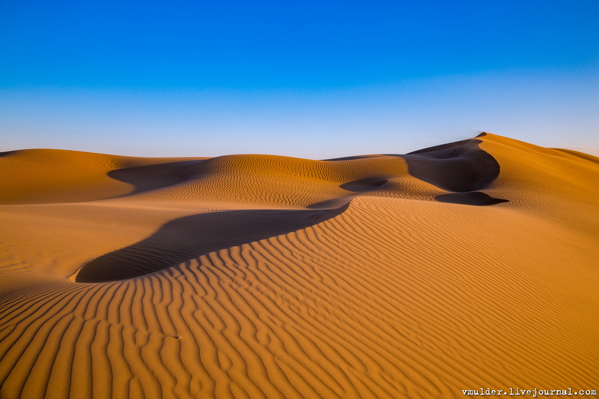
Senek Sands – a small desert in the Mangystau region
No comments · Posted by Sergei Rzhevsky in Nature, Regions, Travel
Senek is a village with a population of about 2,000 people located in the Karakiyansky district of the Mangystau region.
To the north-east of the village there is a sandy area named after the village – Senek Sands. Here you can see amazingly picturesque landscapes of a fairy tale desert. Senek Sands on Google Maps. Photos by: Vladimir Mulder.
Tags: Mangystau oblast
29
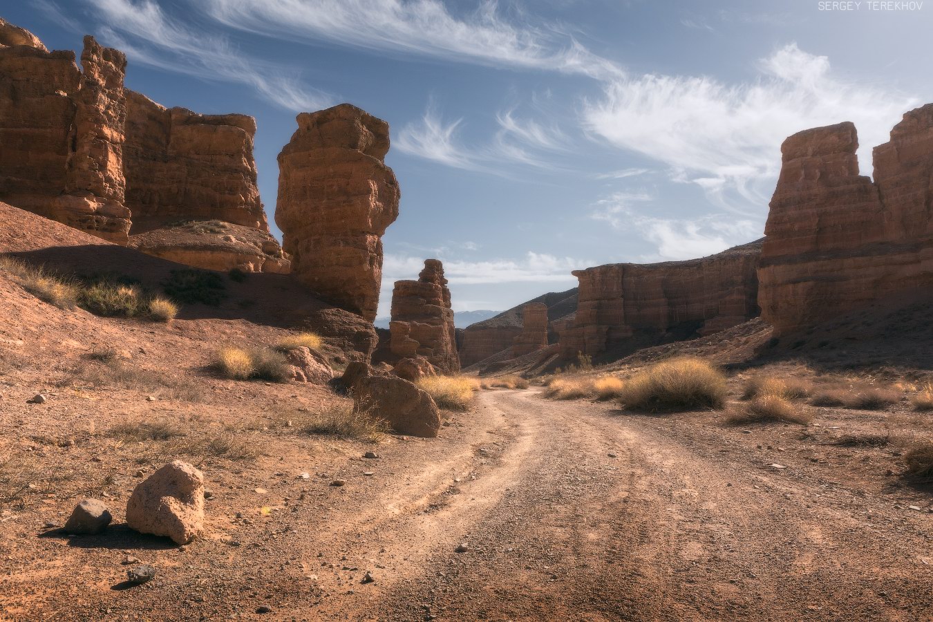
Valley of Castles in Charyn Canyon
No comments · Posted by Sergei Rzhevsky in Nature, Regions, Travel
Charyn Canyon (also known as Sharyn Canyon) stretches for 154 km along the Charyn River on the territory of the Charyn National Park, about 200 km east of Almaty, near the border with China.
It is a magnificent natural monument built of sedimentary rocks, which age is about 12 million years. The height of the steep slopes of the canyon reaches 150-300 m. Charyn Canyon on Google Maps. Photos by: Sergey Terekhov.
Tags: Almaty oblast
17
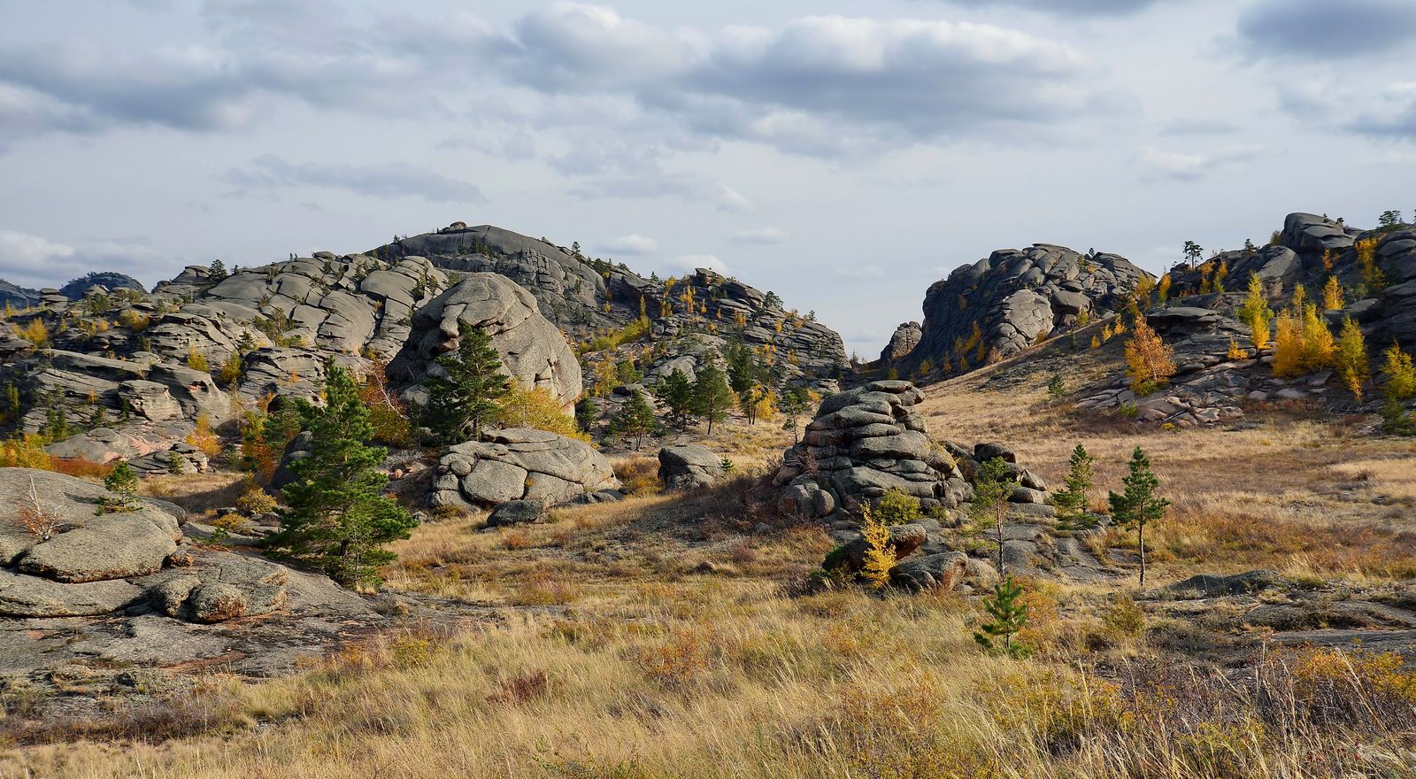
Picturesque landscapes of Bayanaul mountains
No comments · Posted by Sergei Rzhevsky in Nature, Regions, Travel
Bayanaul mountains are a mountain range located in the southwest of the Pavlodar region of Kazakhstan. The mountains stretch from west to east for 40-50 km, from north to south – for 20-25 km. The highest point, Mount Akbet, reaches 1,022 m above sea level.
Bayanaul State National Natural Park, one of the most protected natural areas of Kazakhstan, was created in this territory. Founded in 1985, it became the first national park in the country. Bayanaul mountains on Google Maps. Photos by: Zekkadrb.
Tags: Pavlodar oblast
27
Karynzharyk Depression in the Mangystau Region
No comments · Posted by Sergei Rzhevsky in Nature, Regions, Travel
The Karynzharyk depression is located almost entirely in the territory of the Ustyurt State Nature Reserve in the southwestern part of the Mangystau region in Western Kazakhstan.
The distinctive feature of this area are the five remnant mountains, towering more than 150 meters in the midst of the salt plain. Three of them stand close to each other, locals call these mountains “Three Brothers”.
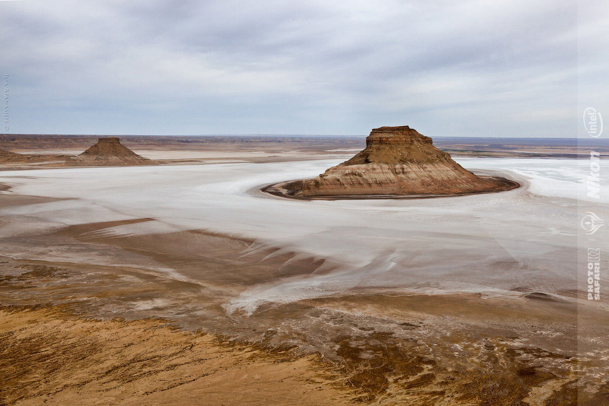
Tags: Mangystau oblast
21
Amazing Landscapes of the Ustyurt Plateau
No comments · Posted by Sergei Rzhevsky in Nature, Regions, Travel
Ustyurt is a huge desert and a plateau with an area of more than 200,000 kilometers located in the west of Central Asia (in Kazakhstan (Mangystau oblast), Turkmenistan and Uzbekistan), between Mangyshlak and Kara-Bogaz-Gol in the west, the Aral Sea and the Amudarya delta in the east. Ustyurt National Preserve is located on this territory. The Ustyurt Plateau on Google Maps. Photos by: Vladimir Mulder.
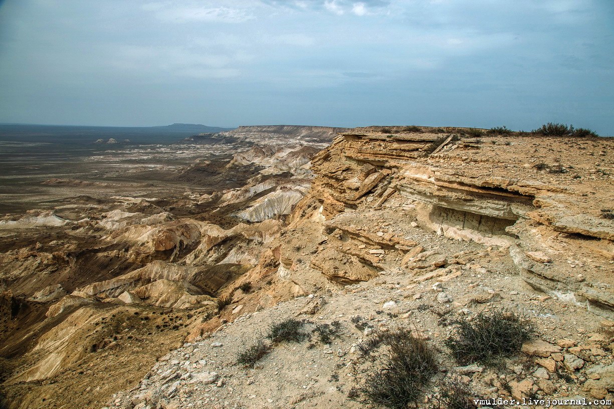
Tags: Mangystau oblast
11
Singing Barkhan in the Altyn-Emel National Park
No comments · Posted by Sergei Rzhevsky in Nature, Regions, Travel
The so-called “singing barkhan”, consisting of sand of light tones, has a length of up to 3 km and a height of 150 m. It is located in the Altyn-Emel National Park in the Almaty region, 182 km north-east of Almaty.
This monument of nature is famous for the fact that in dry weather the sands emit sounds similar to the melody of the organ. Singing Barkhan on Google Maps. Photos by: Sergey Terekhov.
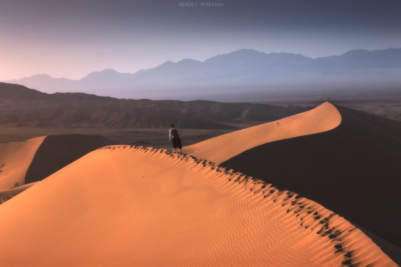
Tags: Almaty oblast
25
Ulytau – one the oldest mountains in Kazakhstan
1 Comment · Posted by Sergei Rzhevsky in Nature, Photos, Regions
Ulytau is a complex of low mountains located in the southwest of Kazakh Upland (Sary Arka) – a steppe in Central Kazakhstan, in the northwest of the Karaganda region.
It is one of the oldest mountain ranges of Sary Arka that stretches from north to south for 200 km. The highest point is Akmeshit Peak (1,131 m).
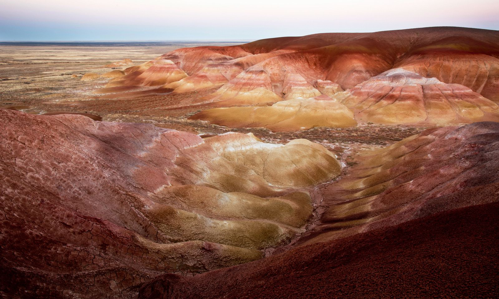
scenic yellow, red and orange mountains
Tags: Karaganda oblast
