
CAT | Photos
26
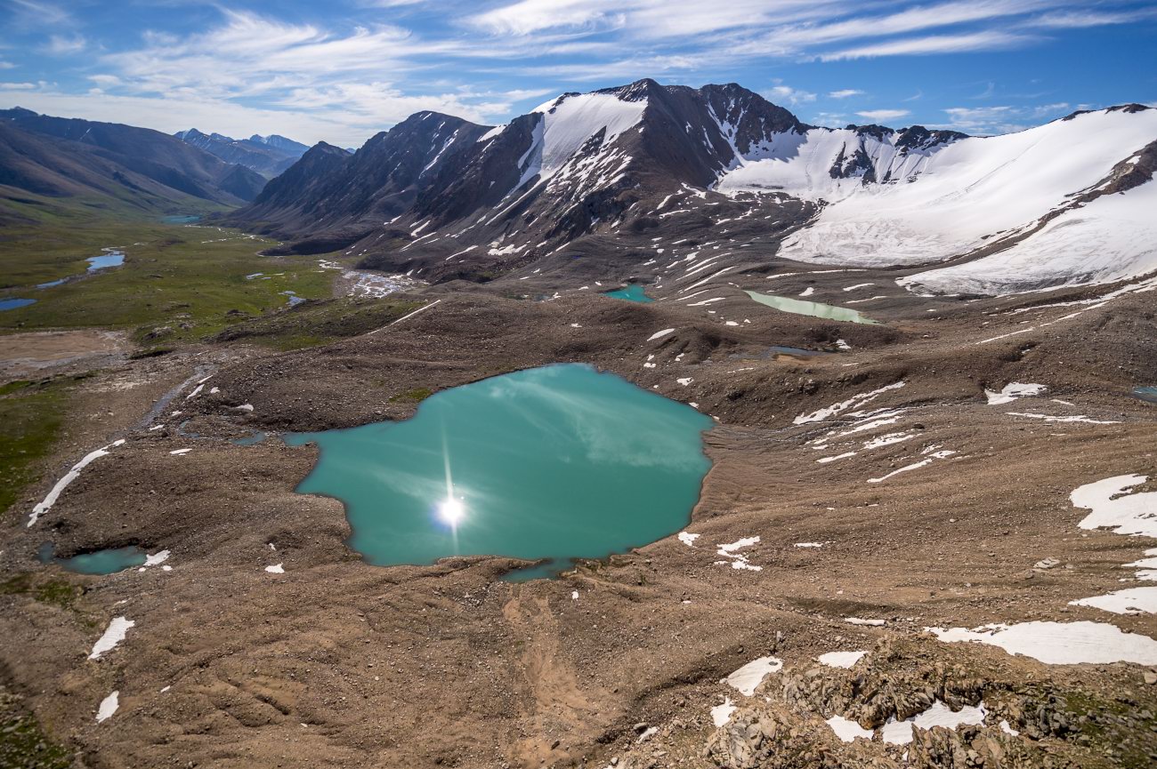
Glaciers and Lakes of the Dzungarian Alatau
No comments · Posted by Sergei Rzhevsky in Nature, Photos, Regions
The Dzungarian or Semirechensky Alatau is a mountain system located in the north-east of the Almaty region, between the Ili River and Lake Alakol.
This region is a place with pristine nature because it is located in the border zone with China. There are no roads and settlements here. Some areas can be reached only on horseback or by helicopter. Photos by: Grigory Bedenko.
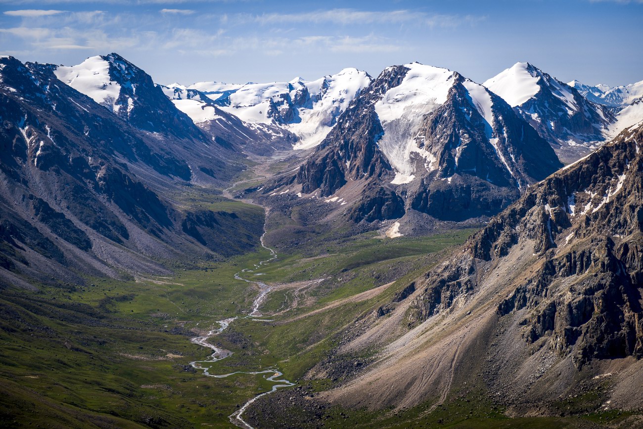

Tags: Almaty oblast
25
The pristine beauty of Lake Issyk
No comments · Posted by Sergei Rzhevsky in Nature, Photos, Travel
Issyk is a picturesque lake located in the Issyk gorge of the Trans-Ili Alatau mountain range, about 40 km east of Almaty, in the southern part of Almaty Oblast.
It was formed about 8-10 thousand years ago in a landslide that created a natural dam about 300 meters high. Initially, the length of Issyk was 1,850 m, width 500 m, depth 50-79 m. The water is green-blue. The height above sea level is about 1,700 m. Lake Issyk on Google Maps. Photos by: Leonid Dyachenko.
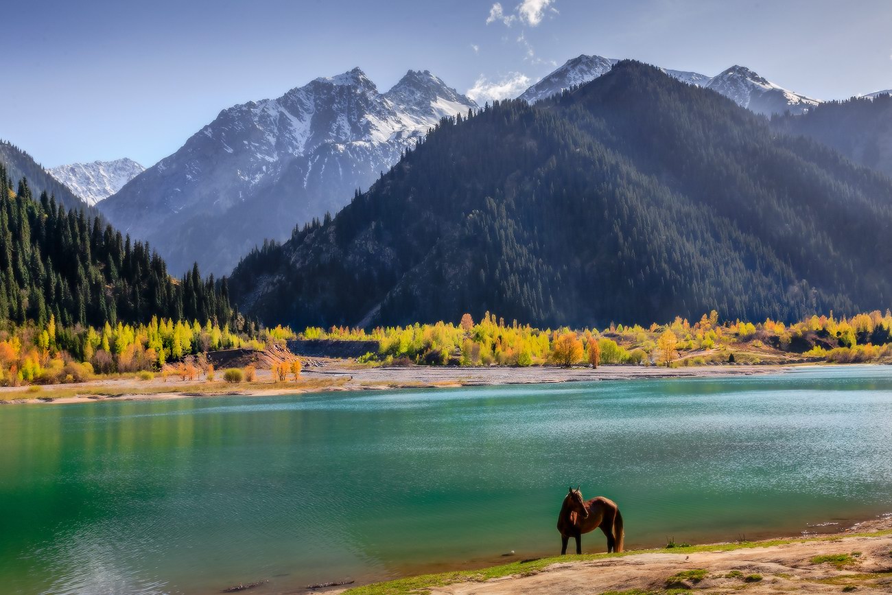
Tags: Almaty oblast
24
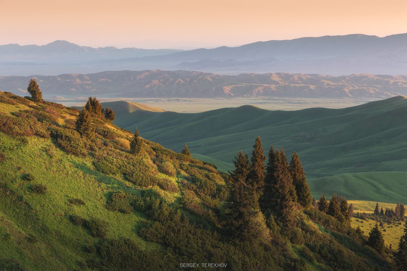
Amazing landscapes around Lake Tuzkol
No comments · Posted by Sergei Rzhevsky in Nature, Photos, Travel
Tuzkol is a salty mountain lake in Kazakhstan, located at an altitude of 1,959 m above sea level in Raiymbek District in the south-east of Almaty Oblast, about 310 km from Almaty. Translated from the Kazakh language, “tuzkol” means “salt lake”. The salinity of Lake Tuzkol varies with the seasons and is sometimes almost the same as in the Dead Sea in Israel or the Great Salt Lake in the US.
Raiymbek District is one of the most picturesque districts of Almaty Oblast. You can go there at any time of the year, but if you want to travel further into the mountains, the best time to go is from June to September. Lake Tuzkol on Google Maps. Photos by: Sergey Terekhov.
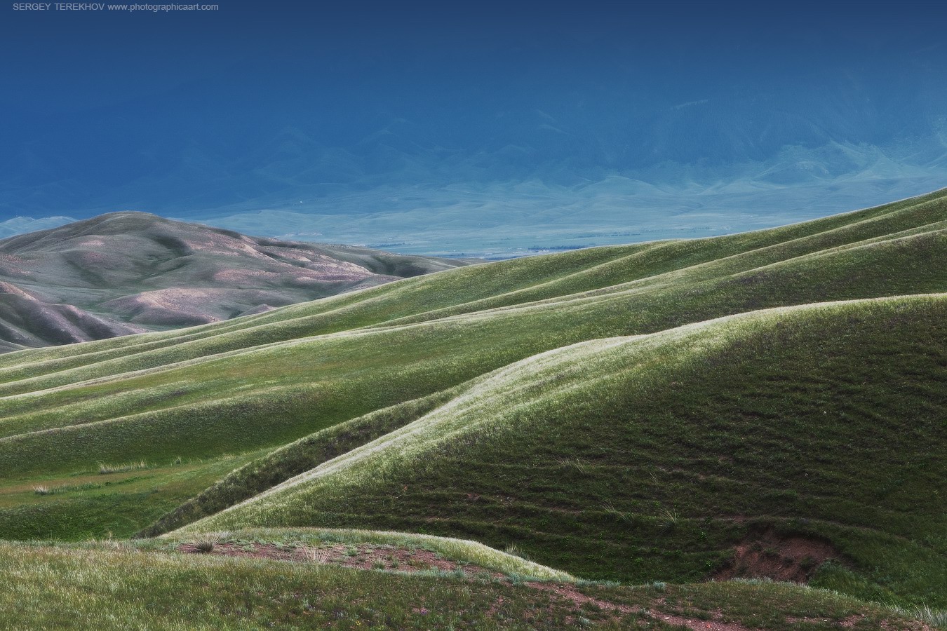
Tags: Almaty oblast · landscapes
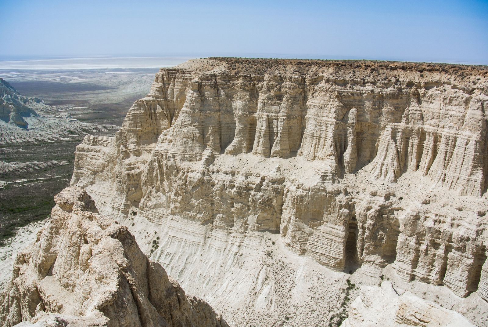
Aktau Mountains (translated as “white mountains”) are chalk mountains of different colors, mostly white, located in the territory of the national park of Altyn-Emel in the central part of Almaty Oblast. It will take you about 5-7 hours to get here from Almaty. Aktau Mountains on Google Maps. Photos by: Sergey Terekhov.
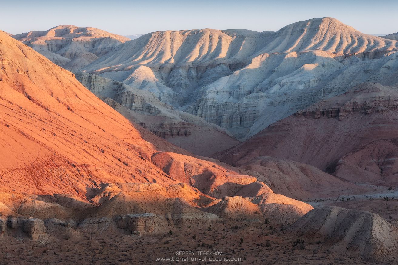
Tags: Almaty oblast
1
Landscapes of the Tekes River Valley
No comments · Posted by Sergei Rzhevsky in Nature, Photos, Regions
On the territory of Kazakhstan, the Tekes River flows mainly in a wide intermountain valley in Raiymbek District – one of the most beautiful places in Almaty Oblast located in its southeastern part. This area is rarely visited by tourists, which contributed to the preservation of its pristine nature. Photos by: Sergey Terekhov.
Tags: Almaty oblast
27
Picturesque Scenery of Aktolagay
No comments · Posted by Sergei Rzhevsky in Nature, Photos, Regions
Aktolagay, a snow-white mountain range almost 50 km long and about 10 km wide, is located in the southwest of the Aktobe region. The unusual, almost unparalleled landscape of the plateau makes it unique and attracts people interested in geotourism and auto-travelers.
In the distant past, it was the seabed. Here you can find fossilized remains of mollusks, bones and teeth of sharks and other living creatures that once inhabited the ancient sea. Aktolagay on Google Maps. Photos by: Natalya Kozlovskaya.
Tags: Aktobe oblast
6
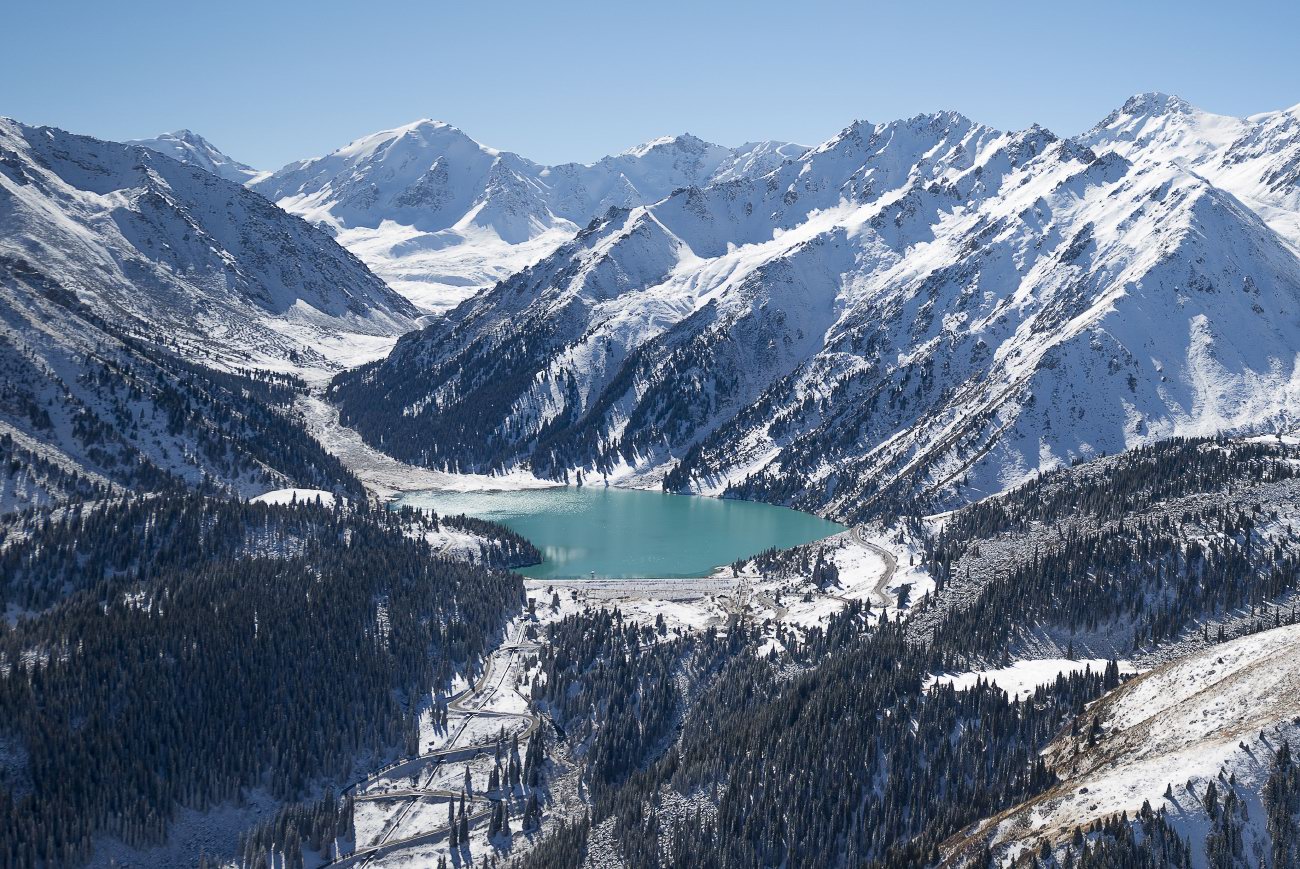
Landscapes of the Northern Tian Shan
No comments · Posted by Sergei Rzhevsky in Nature, Photos, Regions
The Tian Shan is a mountain system located in Central Asia in the territory of five countries: Kyrgyzstan, Kazakhstan, China (Xinjiang Uygur Autonomous Region), Tajikistan, and Uzbekistan. It is one of the highest mountain systems in the world with more than thirty peaks over 6,000 meters high.
Let’s look at the landscapes of the northern part of the Tien Shan located in Kazakhstan, near Almaty. The mountains of the Northern Tian Shan are the most visited in Kazakhstan. Photos by: Grigory Bedenko.
Big Almaty Lake located at an altitude of 2,511 meters above sea level.
fly over the Northern Tian Shan
Tags: Almaty oblast
17
Summer in the Dzungarian Alatau
No comments · Posted by Sergei Rzhevsky in Nature, Photos, Regions
The Dzungarian Alatau is a mountain range located on the border of the Almaty Region of Kazakhstan and the Xinjiang Uygur Autonomous Region of China, between the Ili River and Lake Alakol.
The mountains are named for the nearby desert. The length of this picturesque range is about 450 km, the width varies from 50 to 90 km, the height – up to 4,622 m (Semenov-Tian-Shansky Peak). The Dzungarian Alatau on Google Maps. Photos by: Grigory Bedenko.

Tags: Almaty oblast
1
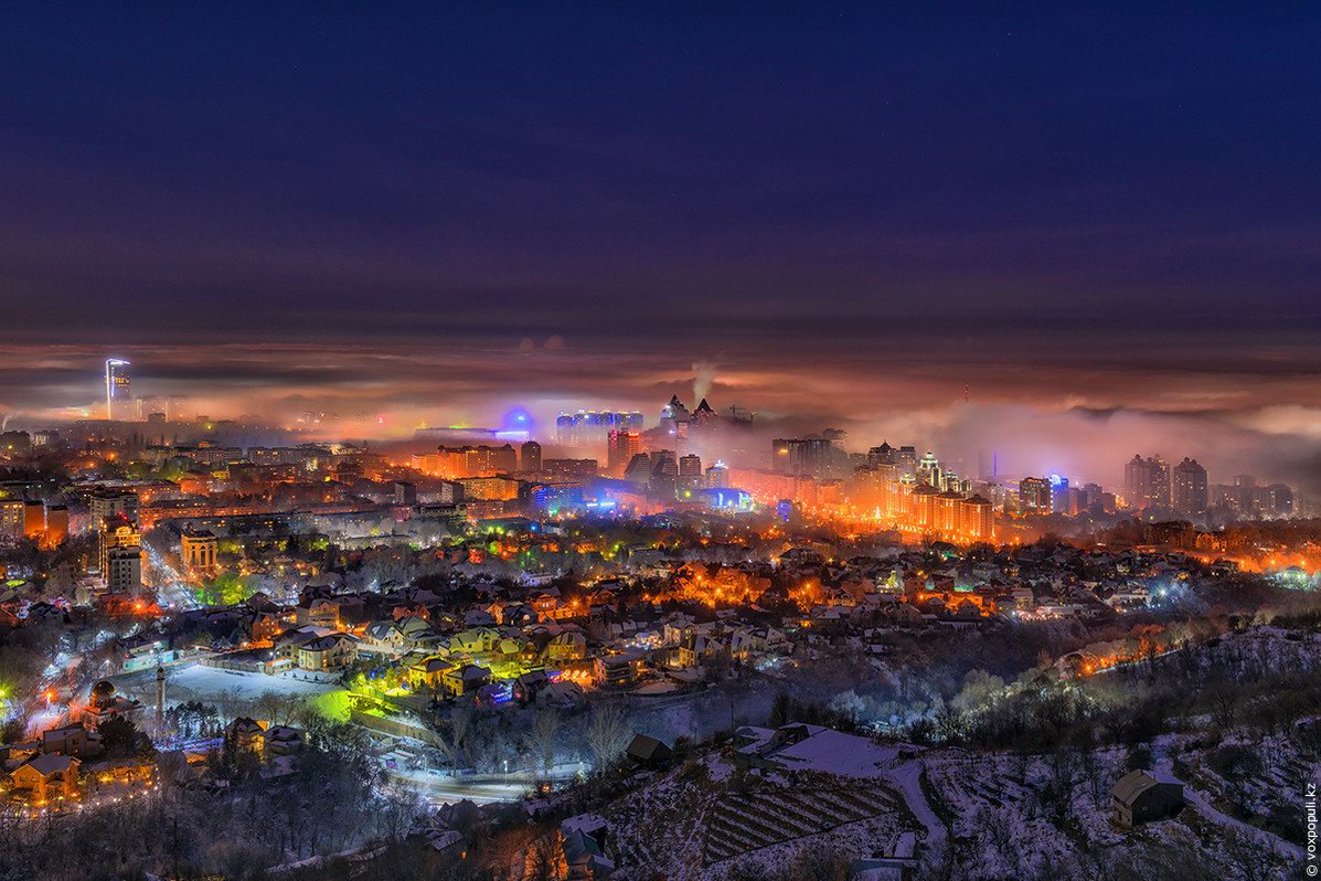
Almaty – the view from above
No comments · Posted by Sergei Rzhevsky in Cities, Photos, Travel
Almaty is the largest city in Kazakhstan with a population of about 1.8 million people. From 1991 to 1997, it was the capital of the country. The city is located in an intermountain depression at the foot of the mountains of Zailiysky Alatau in the extreme south-east of the republic.
The following photos of Almaty were taken at different times of the day and the year from the foothills surrounding the city and Almaty skyscrapers. The author of the photos published on voxpopuli.kz is the famous Kazakhstan photographer Maxim Zolotukhin.
Tags: Almaty city
16
Pristine Beauty of the Dzungarian Alatau
No comments · Posted by Sergei Rzhevsky in Nature, Photos, Travel
The Dzungarian Alatau is a mountain range located in the northeast of the Almaty region of Kazakhstan, between the Ili River and Lake Alakol. The range extends from the west-southwest to east-northeast along the state border of Kazakhstan and China.
The length of the range is about 450 km, the width – 50-90 km. The main peaks of the Dzungarian Alatau rise above 4,000 m. The Dzungarian Alatau on Google Maps. Photos by: Grigory Bedenko.
Tags: Almaty oblast
