CAT | Photos
2
Golden Autumn on Kolsai Lakes
No comments · Posted by Sergei Rzhevsky in Nature, Photos, Regions
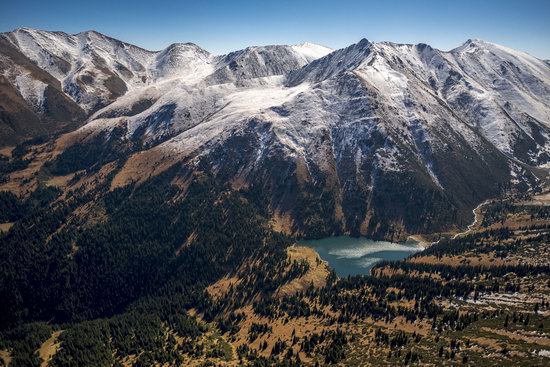
In the south-eastern part of the mountain system Ile Alatau (the most northern ridge of Tien Shan), near Almaty, you can find three beautiful tectonic lakes. They are called Kolsai lakes.
All three lakes are surrounded by pine forests and have rich underwater flora and fauna. The water in the lakes is crystal clear. Kolsai Lakes National Park on Google Maps. Photos by: Gregory Bedenko.
Upper Kolsai Lake (2,850 meters above sea level) is the smallest of the three lakes.
Tags: Almaty oblast
24
Boszhira tract at sunset and at night
No comments · Posted by Sergei Rzhevsky in Nature, Photos, Regions
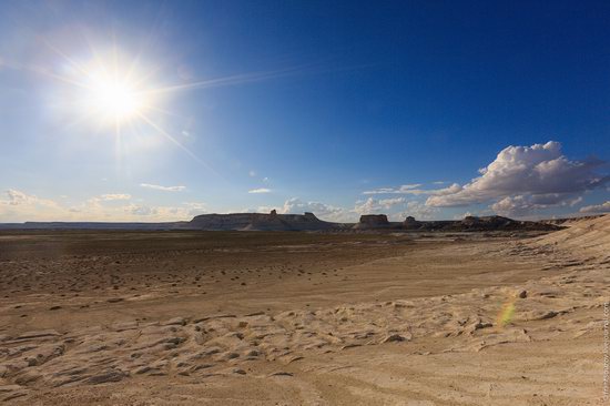
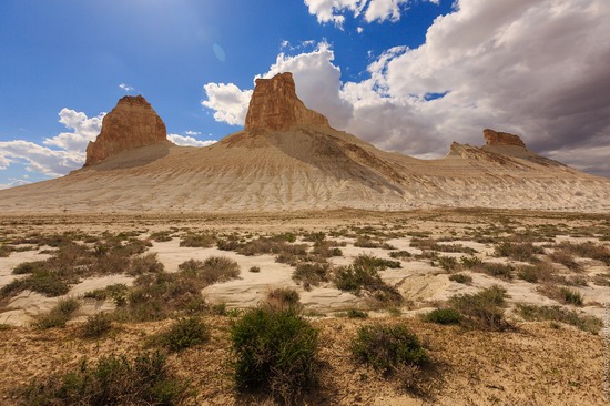
Boszhira tract is located in the western part of the Ustyurt Plateau, on Mangyshlak Peninsula in the Mangistau region. The highway Necropolis Becket-Ata – Zhanaozen passes about 20 km from the tract.
As the tract covers a huge area, it will take more than one day to explore it. This place is little known and inaccessible to tourists. Everything is white here – canyons, peaks, mountains-towers, mountains-castles, mountains-yurts, etc.
Tags: Mangystau oblast
8
Let’s take a walk through the streets of Taldykorgan
No comments · Posted by Sergei Rzhevsky in Cities, Photos, Travel
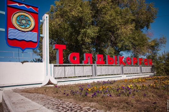
Taldykorgan is a city located in the Almaty region having the status of the regional center. It is the center of Semirechye (“seven rivers”) area. The distance from Taldykorgan to Almaty is 271 km.
The city stands on the Karatal River, at the foothills of the Jungar Alatau, at an altitude of 602 meters above sea level. “Taldykorgan” means “a hill surrounded by willows.” The city’s population is about 138,000 people. Photos by: Rinna Lee for voxpopuli.kz
Tags: Taldykorgan city
31
The beauty of the lakes Alakol and Balkhash
No comments · Posted by Sergei Rzhevsky in Nature, Photos, Regions
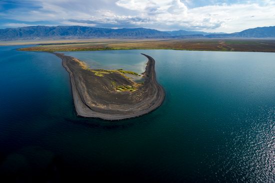
Alakol in Kazakh means “multi-colored lake.” It is situated on the border of the east and southeast of Kazakhstan. In the south-western part its water is clean and very clear, in the north-east – the water is muddy.
The lake water is strongly mineralized and is considered therapeutic. The length of the lake is 104 kilometers, the maximum width – 52 kilometers, the depth – 54 meters. Lake Alakol on Google Maps. Photos by: Grigoriy Bedenko.
Tags: Almaty oblast · East Kazakhstan oblast
23
Beautiful scenery around Lake Tuzkol
No comments · Posted by Sergei Rzhevsky in Nature, Photos, Regions
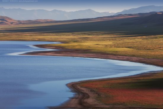
Tuzkol is the saltiest mountain lake in Kazakhstan, located in the south-east of the Almaty region, in Raiymbeksky district, about 310 km from Almaty.
The lake is quite large – the length is 5 km and the width in some places reaches 1 km. The water is very salty, but the level of salinity changes with the seasons. The maximum value is up to 300 g per liter. For comparison: in the Dead Sea, the concentration of salt is about 340-350 g per liter.
Tags: Almaty oblast · landscapes
6
Trans-Ili Alatau – mountains, glaciers, lakes
No comments · Posted by Sergei Rzhevsky in Nature, Photos, Travel
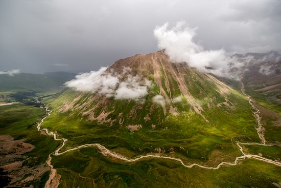
Trans-Ili Alatau or Ile Alatau is a mountain system located in the northwest of the Tien Shan (on the border of Kazakhstan and Kyrgyzstan). It is the most northern mountain range of the Tien Shan.
These mountains are rich with numerous glaciers and lakes that increase the risk of mudflows creating a hazard to the settlements located at the foot of the mountains, including the city of Almaty. That’s why regular monitoring of Trans-Ili Alatau is conducted from the air. Photos by: Grigoriy Bedenko.
Tags: Almaty oblast
4
Paradise lakes of Semirechye
No comments · Posted by Sergei Rzhevsky in Nature, Photos, Regions
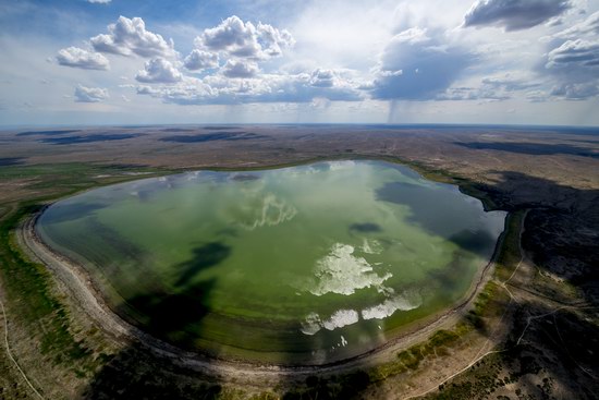
Semirechye (Seven Rivers), or Zhetysu is a vast area located in the south-east of Kazakhstan (Almaty region).
It is situated between Lake Balkhash in the north, Sasykol and Alakol in the northeast, the mountain range of Jungar Alatau in the south-east, and the ridges of the Northern Tien Shan in the south. Photos by: Grigoriy Bedenko.
Tags: Almaty oblast
27
The second lake of the Kolsai lake cascade
No comments · Posted by Sergei Rzhevsky in Nature, Photos, Regions
The Kolsai lake cascade is a system of three lakes located in the northern Tien Shan, in the Almaty region.
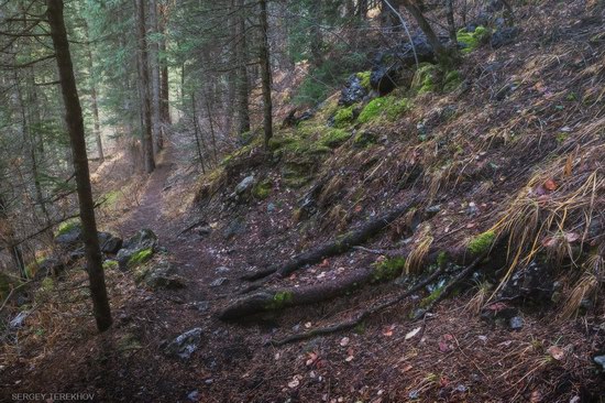
Let’s walk through the forest trail leading to the second Kolsai lake. Kolsai lakes on Google Maps. Photos by: Sergey Terekhov.
scenic forest trail and the lake
Tags: Almaty oblast
13
White cliffs of Aktolagay mountain ridge
No comments · Posted by Sergei Rzhevsky in Nature, Photos, Travel
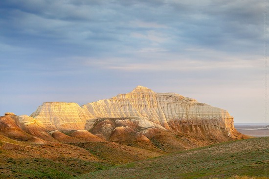
Aktolagay is a mountain ridge composed of limestone. The length of the ridge is 90 km, the width – 5-10 km. It is located on the territory of Bayganinsky district of the Aktobe region.
The unique landscape of Aktolagay, formed in the Jurassic period, is fascinating. Aktolagay mountain range on Google Maps. Photos by: Ilia Afanasieff.
Tags: Aktobe oblast
11
One day on the tract of Boszhira
No comments · Posted by Sergei Rzhevsky in Nature, Photos, Travel
Boszhira Tract is located in the western part of the Ustyurt Plateau, on the Mangyshlak Peninsula in the Mangistau region. Nature has given full freedom to its imagination here. You can see a unique landscape of unearthly white chalk colors.
The tract covers a huge area. In order to explore it, you will need more than one day. This place is little known and difficult to access for tourists.
Tags: landscapes · Mangystau oblast
