
CAT | Nature
13
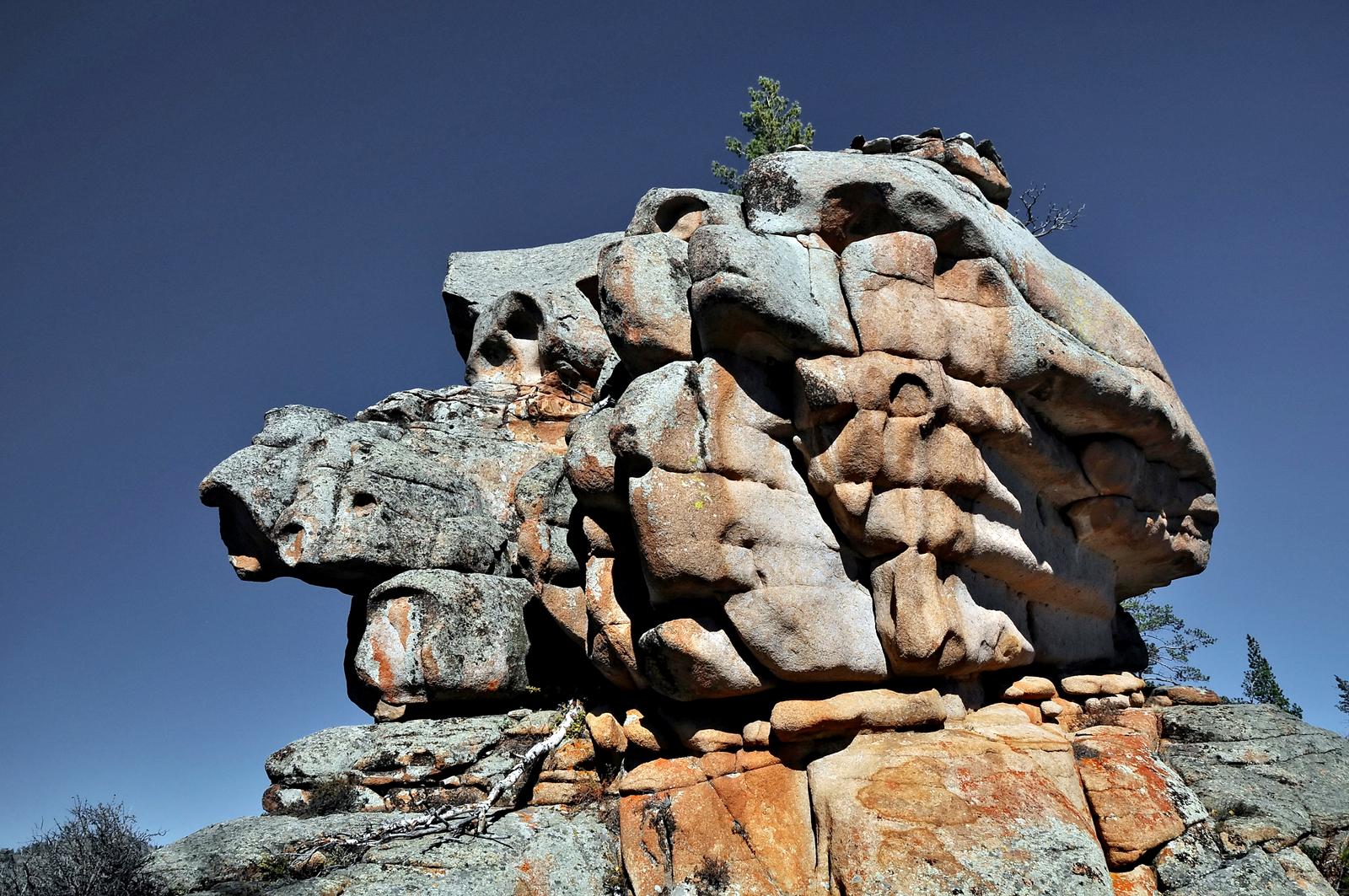
Bizarre Rocks of the Kent Mountains
No comments · Posted by Sergei Rzhevsky in Nature, Regions, Travel
The Kent Mountains, one of the oldest mountain ranges on Earth, is a very picturesque and unique natural and historical area. It is located in the Karkaraly district of Karaganda Oblast in central Kazakhstan and is part of Karkaraly National Park.
These mountains (the highest point is Mount Tursun, 1,469 meters high) is an island massif that rises like an impregnable granite wall above the surrounding steppe. A lot of mountain rivers and streams flow down from the mountains; through their valleys you can get inside this huge granite island and enjoy majestic views of pristine nature with bizarre rocks, boulders and ridges. The Kent Mountains on Google Maps. Photos by: Zekkadrb.
trekking in the ancient mountains

Tags: Karaganda oblast
26
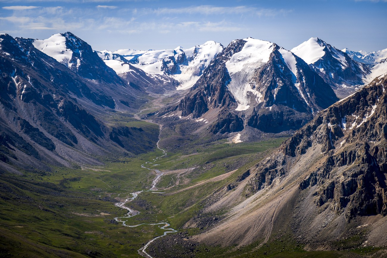
Glaciers and Lakes of the Dzungarian Alatau
No comments · Posted by Sergei Rzhevsky in Nature, Photos, Regions
The Dzungarian or Semirechensky Alatau is a mountain system located in the north-east of the Almaty region, between the Ili River and Lake Alakol.
This region is a place with pristine nature because it is located in the border zone with China. There are no roads and settlements here. Some areas can be reached only on horseback or by helicopter. Photos by: Grigory Bedenko.
Tags: Almaty oblast
25
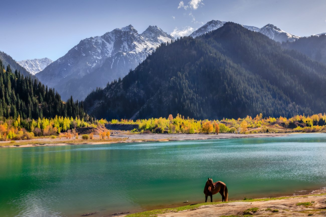
The pristine beauty of Lake Issyk
No comments · Posted by Sergei Rzhevsky in Nature, Photos, Travel
Issyk is a picturesque lake located in the Issyk gorge of the Trans-Ili Alatau mountain range, about 40 km east of Almaty, in the southern part of Almaty Oblast.
It was formed about 8-10 thousand years ago in a landslide that created a natural dam about 300 meters high. Initially, the length of Issyk was 1,850 m, width 500 m, depth 50-79 m. The water is green-blue. The height above sea level is about 1,700 m. Lake Issyk on Google Maps. Photos by: Leonid Dyachenko.
Tags: Almaty oblast
24
Amazing landscapes around Lake Tuzkol
No comments · Posted by Sergei Rzhevsky in Nature, Photos, Travel
Tuzkol is a salty mountain lake in Kazakhstan, located at an altitude of 1,959 m above sea level in Raiymbek District in the south-east of Almaty Oblast, about 310 km from Almaty. Translated from the Kazakh language, “tuzkol” means “salt lake”. The salinity of Lake Tuzkol varies with the seasons and is sometimes almost the same as in the Dead Sea in Israel or the Great Salt Lake in the US.
Raiymbek District is one of the most picturesque districts of Almaty Oblast. You can go there at any time of the year, but if you want to travel further into the mountains, the best time to go is from June to September. Lake Tuzkol on Google Maps. Photos by: Sergey Terekhov.
Tags: Almaty oblast · landscapes
20
The field of spherical concretions Torysh in Mangistau
No comments · Posted by Sergei Rzhevsky in Nature, Regions, Travel
According to one local legend, once, the Mangistau region, located in the west of present Kazakhstan, was invaded by the hordes of enemies who covered the land like locusts.
Locals put forth their hands to heaven in prayer for help and they were heard. The heavens opened downpours, thunder and lightning. In an instant, all enemies turned to stone.
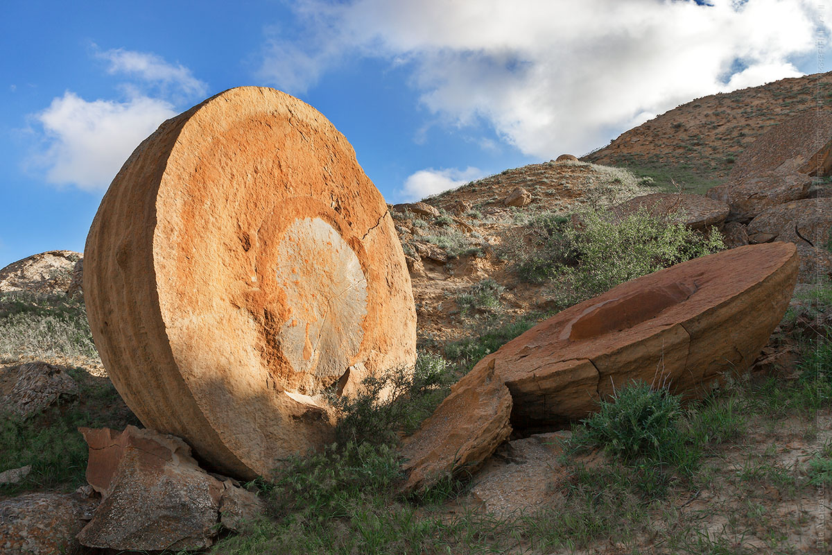
Tags: Mangystau oblast
29
Boszhira – the bottom of the dried up sea
No comments · Posted by Sergei Rzhevsky in Nature, Regions, Travel
Urochishche Boszhira is one of the most beautiful places in Kazakhstan. It is a whole range of rock formations of various sizes and shapes located at the bottom of a huge canyon in the western part of the Ustyurt plateau on the Mangyshlak peninsula in Mangystau Oblast of southwestern Kazakhstan.
Boszhira is huge. It will take more than one day to explore it. The weather in Mangyshlak is harsh and unpredictable. The best time to travel to Boszhira is summer. From autumn to mid-spring it often rains here washing out already bad roads. Boszhira on Google Maps. Photos by: Alexey Zhirukhin.

Tags: Aktau city · Mangystau oblast
27
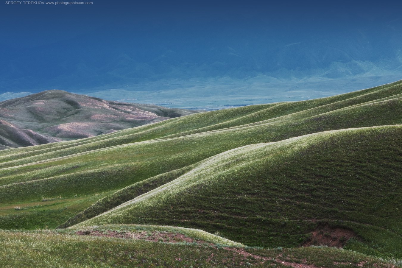
Breathtaking Landscapes of the Asy Plateau
No comments · Posted by Sergei Rzhevsky in Nature, Regions
The Asy Plateau is located in the south of Almaty Oblast at an altitude of about 2,200-2,750 meters above sea level. In the distant past, it was a place through which the routes of caravans from Europe and Central Asia to China and India ran.
The Asy-Turgen observatory can be found at the western end of the plateau. Today, this place is used as a summer pasture and attracts tourists. The Asy Plateau on Google Maps. Photos by: Sergey Terekhov.

Tags: Almaty oblast
17
Winter in Bayanaul National Park
No comments · Posted by Sergei Rzhevsky in Nature, Regions, Travel
Bayanaul State National Natural Park is located in the south of Pavlodar Oblast of Kazakhstan, about 100 km from the city of Ekibastuz. It is one of the specially protected natural areas of the country.
The park was founded in 1985 and became the first national park in Kazakhstan. It was done to preserve and restore the flora and fauna of the Bayanaul mountain range. The total area of the park is 684 square km. Bayanaul National Park on Google Maps. Photos by: Vasily Kosivtsov.

Tags: Pavlodar oblast
18
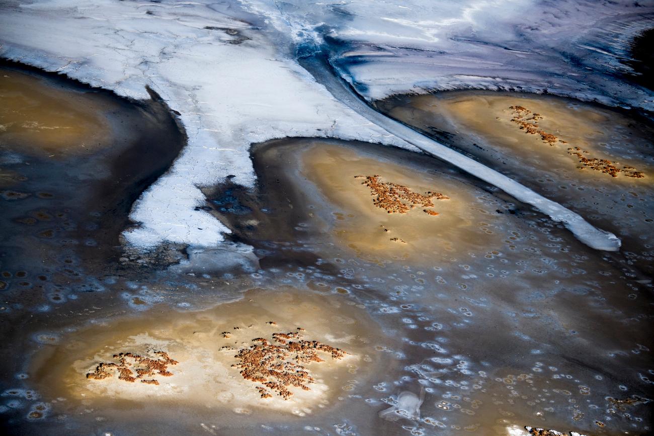
Bizarre saline lakes south of Lake Balkhash
No comments · Posted by Sergei Rzhevsky in Nature, Regions
The vast territory south of Lake Balkhash is called Semirechye (“the region of seven rivers”) because of seven large rivers that flow into Balkhash, one of the largest lakes in Central Asia.
The soils in this region are mostly desert and rich in various minerals. In spring, numerous lakes are formed on the salt marshes, which are of a seasonal nature; by the end of summer they dry up. As a result, minerals form very bizarre patterns on the surface of these formations. Photos by: Grigory Bedenko.
Tags: Almaty oblast
25
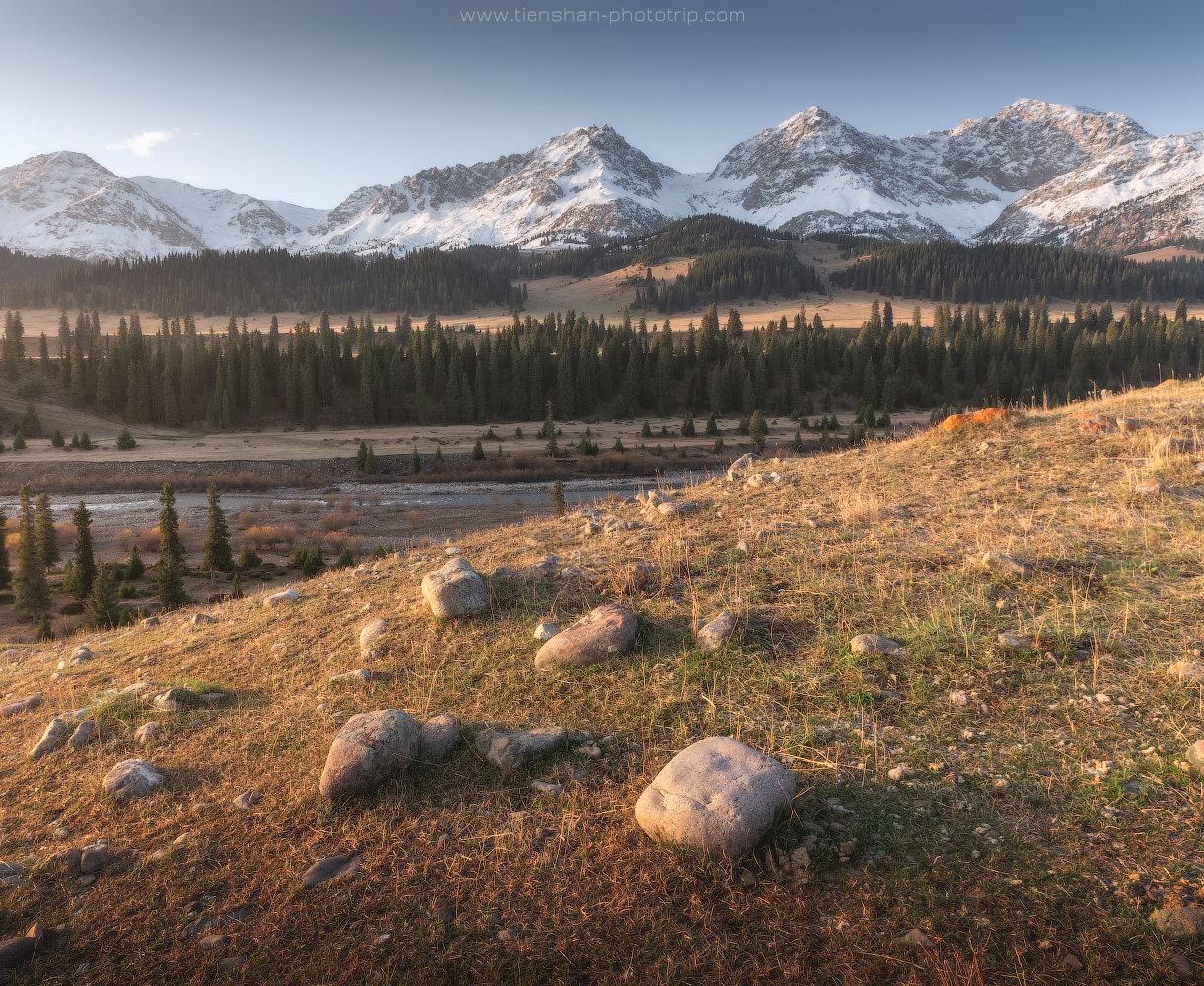
Autumn in the valley of the Tekes River
No comments · Posted by Sergei Rzhevsky in Nature, Regions
The Tekes is a 438 km long river, of which about 100 km flows through the territory of Kazakhstan, including 40 km inside the territory of Kazakhstan and about 60 km along the border of Kazakhstan and China.
The river originates on the northern slope of the Terskey Alatau Range. In Kazakhstan, the river flows mainly in a picturesque wide intermountain valley, which separates the Eastern Tien Shan from the Ketmen Ridge. This is one of the most beautiful places in Almaty Oblast, which, however, is little known to tourists. The Tekes River on Google Maps. Photos by: Sergey Terekhov.
Tags: Almaty oblast
